International Defense Security & Technology Your trusted Source for News, Research and Analysis
Related Articles
The constant growth of interest in high-speed wireless communications causes the search for new solutions and new types of radio access networks. Although more than half of the global population is already connected to the Internet, there is still a need for higher broadband connectivity and telecommunication services in suburban, rural, and isolated areas that remain underserved.
In the future, 5G networks will represent the global telecommunication infrastructure of the digital economy, which should cover the whole world including inaccessible areas not covered by 5G terrestrial networks. In addition, ground networks are susceptible to failures and degraded performance in many situations, such as natural disasters, severe weather conditions, and changing environments. For these reasons, several types of aerial networks are being considered as a means to provide both stable broadband connectivity to end-users and communication links between the mobile and core networks for backhauling purposes.
There are several use cases where standard terrestrial coverage is either not present or possible, making satellite systems uniquely positioned to provide a solution to bridge this gap. Satellite communication will play a significant role in 5G and beyond as a complementary solution for ubiquitous coverage, broadcast/multicast provision, aeronautical & maritime communications, emergency/disaster recovery, and remote rural area coverage. Furthermore from a deployment point-of-view, the cost can be largely decreased by using 5G chipsets/systems and tapping into economies of a larger scale.
Non-Terrestrial Networks (NTN) is a term coined under 5G standardization to designate communication systems that include satellites, Unmanned Aerial Systems (UAVs) or High Altitude Platforms (HAPs). The main objective of this initiative is to seamlessly integrate these assets into the 5G systems by studying their peculiarities in terms of architecture and air interface.
High Altitude Platforms (HAPs)
High-altitude platforms (HAPs) are aircraft positioned above 20 km altitude, in the stratosphere, in order to compose a telecommunications network or perform remote sensing, for civilian or military applications. These aircraft may be airplanes, airships or balloons, manned or unmanned.
Aerospace companies have been trying for years to create a solar-powered plane that can fly at high altitudes for years at a time, and can provide broadband communication services. They can provide a whole host of commercial applications, including communications to remote areas, environmental surveillance, disaster relief, humanitarian support, border protection and maritime surveillance.
These drones fly at an altitude of over 19,000 meters (65,000 feet) where there is little air traffic and above most weather that could impede its travels. Flying at that height will also give them unobstructed access to the sun’s power, which is harnessed by solar cells covering their wings. The solar cells also charge lithium ion batteries stored inside the wing so they can fly at night, which means that these drone can fly uninterrupted for many years all while producing zero emissions.
In addition, the HAPS node will be equipped with a flight control system that enables the ground center to control its mobility and direct it toward a certain location whenever needed. Note that a HAPS node does not need a takeoff vehicle, i.e., it can move using its own power, and it can be fetched back to Earth, upgraded, and redeployed.
Military is also turning to solar powered stratospheric drones for communications and persistent, wide area, real time Intelligence, Surveillance, and Reconnaissance (ISR). Military has been employing various platforms like Balloons, Aerostats, Airships, Satellites, and UAVs for satisfying the requirement for persistent, real time and wide area coverage of battle space. The helium powered Airships have safety issues, while satellites have been expensive to launch. For remote sensing, HAPs have as an important advantage over satellites, mainly the low orbit ones, the ability to remain continuously over an area for very long periods (persistence). Another advantage is to permit better resolution images, because they are closer to the covered areas .
Broadband Mobile Communications
These two types of applications could open the way to wireless broadband deployment in distant locations, such as mountains, seaside, and desert areas. The HAPS is expected to be among the major networks that will assist the ground infrastructure in future telecommunication systems. With its wide footprint (500 km radius per node) and reduced round-trip delay (0.13–0.33 milliseconds (ms)), HAPS is ideal for low-latency and mobile applications that require continuous connectivity, as it relieves such applications from the burden of frequent handoffs that occur in ground networks.
The following list highlights the main advantages of the use of HAPs in communication networks:
• Geographical coverage: HAPs provide an intermediate coverage range between terrestrial and satellite systems.
• Fast deployment: aerial base-stations can be deployed for operation within hours. They can be a supplement or complement to the existing terrestrial and satellite communications networks when they are overloaded or in case of failure.
• Reconfiguration: HAPs can be operated for long periods, but they can also return to the ground for reconfiguration.
• Propagation delay: the propagation delay (∼50-85 µs) is significantly lower compared to the GEO (∼120 ms), MEO (∼15-85 ms) and even LEO satellites (∼1.5-3 ms), offering important advantages for delay-sensitive applications.
• Less infrastructure: a simple aerial platform can serve a large number of terrestrial cells, limited by its antenna technology.
Moreover, due to its large volume, a HAPS node is appropriate for multiple-input multiple-output (MIMO) and massive-MIMO antenna arrangements. When assisted with multi-antenna arrays, the HAPS node can produce highly directional 3D beams with narrow beamwidths that increase the signal-to-interference-plus-noise ratio (SINR) for all users.
Cloud Computing
Cloud computing (CC) is the process of supplying computing resources over the Internet. Instead of maintaining their own computing infrastructure or data centers, businesses can rent access to various services offered by cloud providers, such as digital applications, storage, databases, networks, and analytics tools. By utilizing these resources, companies can make use of any computational assets they require, and during the period they need them, without the need to acquire and sustain a physical, on-site infrastructure and framework. This new computing paradigm provides several advantages to customers, such as reduced costs, flexibility and efficiency, scalability, and information sharing.
Another major advantage of HAPS is its ability to connect users in disconnected or weakly connected areas, and to provide to these users the various applications and services that are offered by public and private ground networks. One of the domains that will benefit from a strong HAPS constellation network is cloud computing. This is particularly the case since the HAPS would allow the cloud to reach a wider range of users, enhance the quality of service (QoS) of traditional cloud applications, and establish new cloud services that benefit from the unique characteristics of the HAPS, as we illustrate in this paper.
Complementing Satellites
HAPs have the potential to complement conventional satellite networks. Indeed, they are also known as High Altitude Pseudo-Satellites.
Due to their working altitude, HAPs have the potential to provide communications services at a regional scale.
There are two main ways of cooperation between satellites and HAPs:
• Backhauling: HAPs can be an intermediate element between the satellite and the ground receiver. This two-step downlink communication will have a first-hop between satellite and HAPs, and a second hop between HAPS and ground. The former is prone to the use of high bandwidth optical links, as it suffers little atmospheric effects, whereas the latter has a much shorter path than the satellite height, which improves the link budget enabling smaller antennae (cost-saving) or wider bandwidth (revenue increase).
• Trunking: HAPs have a good balance between regional coverage and reduced signal degradation. This triggers their use as low-cost deployment solution for broadcast or multicast services, allowing the users to directly connect within its coverage area and going to the satellite for inter-coverage communications.
Despite their promising applications, HAPs are still facing some major challenges for their deployment at a global scale, although they have been successfully deployed in emergency scenarios.
Challenges of Near Space Stratospheric Drones
The term “near space” refers to the region of the Earth’s atmosphere between 20 and 100 kilometers above sea level, encompassing the stratosphere, mesosphere and the lower thermosphere. It is located at altitudes above where commercial airliners fly, but below orbiting satellites. According to USAF Chief of Staff; Peter Teets, defined near space as the altitudes between 20 and 300 km. The region of near-space starts where controlled airspace ends. Near-space extends up to the lowest altitude that a vehicle can maintain low earth orbit, defined as 490,000 ft or about 150 km. Near space, until now been regarded a “death zone” for drones – thin air at this altitude makes it hard to generate lift, while extremely low temperatures mean electronic components like batteries are prone to fail.
The stratosphere is the layer of the atmosphere where the temperature starts to increase with altitude. Immediately after the tropopause, which has a constant temperature of about −60 °C, the stratosphere starts at an altitude of 7 km at the poles and 18 km at the Equator,
extending to around 50 km
One of the main challenges is the limited autonomy, especially in higher latitudes due to the reduced amount of daylight hours. Another is the weather conditions since high wind speeds may drag HAPs away from their operating area and low temperatures reduce the lifetime of
the batteries. The altitude range adopted for HAP operation, around 20 km, is motivated by the facts that in these altitudes the wind speed is less intense and, as a consequence, the HAP requires less power to maintain position.
“The problem is very, very difficult,” said Morgan, who worked earlier in Simi Valley-based AeroVironment. “It’s more difficult than it seems when you first start testing it.” An atmosat needs to be strong enough to climb through the troposphere, where weather happens, but light enough to cruise in the thinner air of the stratosphere. The biggest challenges are battery life and the efficiency of the solar array, Morgan said. The planes are also hard to operate outside the tropics, where their solar cells benefit from sustained sunlight near the equator.
High-altitude communications platforms “such as Aquila and Titan Aerospace show tremendous promise,” Richard Whitt, director of Google’s strategic initiatives, and Yael Maguire, head of Facebook’s Connectivity Lab, wrote in a joint blog post. “Over 30 percent of the world lives beyond the range of mobile broadband. In rural areas, in which approximately half the world lives, that number is over 70 percent,” Whitt and Maguire wrote. “Recent improvements in composite materials, low-power computing, battery technology and solar panels have made (platforms such as Titan and Aquila) a new way to spur the growth of rural wireless networks.”
Several technological challenges still need to be overcome, such as: lightweight structures, energy storage with RFC, airships thermal management, operation at low altitude, and increase in system reliability.
Operation at Low Altitude
The HAP projects, both airplanes and airships, are optimized for the stratosphere conditions, at altitudes close to 20 km, where the thin air is relatively calm and the wind speed is low (Jamison et al. 2005). As result, HAPs have low power propulsion systems and light and fragile structures, when compared to aircraft designed to operate at lower altitudes. The strong winds and turbulence found in the troposphere can lead to loss of the HAP, such as the accidents of Helios in 2003 and Solara 50 in 2015.
Therefore, an important point in the HAPs operation at low altitude, especially in phases of launch and recovery, is the choice of weather windows where the weather conditions are appropriate (Brooke 2005). An example of these limitations is that, for the operation of Zephyr, it is chosen calm weather conditions, such as those found in desert regions (Rapinett 2009). The domain of technologies for weather forecasting in the operations area and for simulation of the aircraft trajectory at the conditions found at low altitude is essential to the successful operation of HAPs.
Another important aspect to be considered in HAP operations is the coordination with the airspace control organizations. Most of the time of flight of a HAP is above the air control altitude limit, usually defined at 20 km (65,000 ft). The launch and recovery phases, which occur at lower altitudes, should be planned in conjunction with the airspace control agency, with the definition of specific segregated areas for that operation. The integration of unmanned aircraft in not segregated airspace is a subject not yet regulated, mainly due to the issue of avoiding air collisions (“sense and avoid”). Aspects in the field of international law related to the overflight of other countries also need to be analyzed.
Enabling Technologies
Designing aircraft to operate in the stratosphere as HAP imposes major technological challenges, with the main ones being: lightweight structures, energy generation and storage, thermal management, operation at low altitude and reliability.
Lightweight Structures
At an altitude of 20 km, typical of HAPs operation, the air is rarefied, with a density of about 7% of the sea level. As the lift, both aerodynamic and aerostatic, which counteracts the weight of the aircraft, is directly proportional to the air density, the wing area in the case of airplanes and the volume in the case of airships and balloons, designed to operate as HAP, have to be about 14 times larger than if the aircraft were dimensioned to sea-level conditions, considering the same design features, such as total weight, aerodynamic shape and operation speed.
These large dimensions lead to very severe optimization requirements of HAPs structural weight. In the case of airships and balloons, the envelope material must have low weight characteristics, high strength, high ability to withstand damage (tear, pin holes), low permeability to lifting gas, maintain flexibility at low temperature and low degradation with UV radiation and ozone (Zhai and Euler 2005).
It is typically used laminated with an outer layer, for environmental protection and retention of gas, and internal fibers, for structural strength, joined by an adhesive layer. A typical HAP laminate has thickness of 0.16 mm and density per area of 130 g/m2 (Liu et al., 2015). As an example of the importance of the use of advanced materials for the envelope of high-altitude airships, it can be mentioned that the Japan
SPF Project estimated that the mass of the structure corresponds to 52% of the total airship mass (Eguchi and Yokomaku 2000).
Also for HAPs of the airplane category, lightweight structures are essential. A typical wing structure of a HAP airplane, as the Helios , from AeroVironment, consists of tubular spar and ribs using composite material (carbon fiber), rigid foam leading edge and plastic film skin. The weight of various components of a HAP airplane is distributed along the wingspan to reduce the structural stress on the wing. As an example, on the Zephyr, the batteries are installed in the wing spar (Rapinett 2009).
One of the technologies required for the design of these large and very flexible wings is analysis of aeroelastic phenomena, such as flutter, and its influence on the stability and control of the airplane. These optimized structures for high-altitude flights have the disadvantage of fragility at gust conditions found at lower altitudes. Examples of this weakness are the accidents of Helios in 2003 and Solara 50 in 2015.
Energy Generation and Storage
Like any aircraft, HAPs require a source of energy for the propulsion system and the electricity supply to their systems and payload. HAP projects with the objective of achieving very long endurance, on the order of months and even years, prevent the use of energy sources based on traditional aviation fuel, as avgas (aviation gasoline) or jet fuel (aviation kerosene), and other less common fuels, such as diesel or hydrogen.
Nuclear power is a technically feasible solution, but politically not acceptable by society, because of the associated risks. The potential for power transmition to the aircraft from ground stations, via microwave or laser, has been studied, but it is still far from being operationally viable. Currently, the main source of energy generation considered for HAPs is the Sun. Following the developments in solar panel systems, HAPS nodes can utilize solar power that can be combined with storage batteries as the primary methods for energy supply; HAPS stations possess large surfaces that can house solar panel films.
The most commonly adopted solution for very long endurance HAP is, during the day, the solar energy converted into electricity by means of photovoltaic cells (solar cells), and part of this electricity is used to charge a storage system, usually rechargeable batteries or RFC for later use at night (Nickol and Guynn 2007).
The use of RFC on HAP, although with promising advantages, has been one of the major technological challenges. In Japan, research for the SPF airship defined as a target for the RFC system achieving a specific energy of 450 Wh/kg. The current systems have 350 Wh/kg of specific energy (Okaya and Shinozaki 2011).
Plane Phoenix, designed by academics in Scotland, is lighter than air and can stay airborne indefinitely
An innovative balloon-like aircraft capable of fast transitioning between two states -being lighter than air and heavier than air – has been flown for the first time. The Phoenix, designed by academics in Scotland, is powered by the thrust created when such cycling happens at high speeds. According to its creators, the engine-less craft can sustain forward motion for long periods and could be a cheaper alternative to satellites. The Phoenix was tested over a distance of 394 feet (120 metres) in laps at an indoor storage facility in Portsmouth.
It is powered by technology known as variable-buoyancy propulsion that drives it forward like a plane. The terms refers to the transition of an object between two states: being lighter than air (causing the object to lift) and being heavier than air (causing the object to fall). The difference to a hot air balloon is that the transition is so fast that it creates thrust which allows the craft to travel like a plane, moving forward in a horizontal plane rather than up and down.
When the Phoenix is filled with helium gas, it becomes lighter than air and moves upwards. A separate bag inside the balloon draws in air from outside and compresses it, making the Phoenix temporarily heavier than air and move downwards. This cycling between the two happens so quickly that no up and down motion is observed; instead the craft is propelled forward and glides like a plane. The variable-buoyancy propulsion is used for crafts underwater but this is the first time it has powered a large craft in air.
Thermal Management
The lighter-than-air (LTA) aircraft are directly influenced by the temperature difference between the lifting gas and the external atmosphere. This effect is called superheating, when the temperature of the internal gas is higher than that of external air, or supercooling, in the opposite case (Harada et al. 2003). This difference of temperature may be caused by several factors, such as direct solar radiation, solar radiation reflection on Earth’s surface or clouds (albedo), expansion of the lifting gas during climbing or compression in descent, changes in atmospheric temperature (day/night) and warming caused by operation of photovoltaic cells (Yao et al. 2014).
The influence can be in aerostatic lifting force or internal pressure, in the case of superpressure airships. The thermal management of HAP airships, including the mathematical modeling of the thermal balance and the use of insulating materials, is a technology that needs to be intensified (Wu et al. 2015).
Millimeter Wave Transmission
In a secretive project codenamed SkyBender, the technology giant built several prototype transceivers at the isolated spaceport last summer, and is testing them with multiple drones, according to documents obtained under public records laws. Project SkyBender is using drones to experiment with millimetre-wave radio transmissions, one of the technologies that could underpin next generation 5G wireless internet access. High frequency millimetre waves can theoretically transmit gigabits of data every second, up to 40 times more than today’s 4G LTE systems. Google ultimately envisages thousands of high altitude “self-flying aircraft” delivering internet access around the world.
The huge advantage of millimetre wave is access to new spectrum because the existing cellphone spectrum is overcrowded. It’s packed and there’s nowhere else to go,” says Jacques Rudell, a professor of electrical engineering at the University of Washington in Seattle and specialist in this technology.
However, millimetre wave transmissions have a much shorter range than mobile phone signals. A broadcast at 28GHz, the frequency Google is testing at Spaceport America, would fade out in around a tenth the distance of a 4G phone signal. To get millimetre wave working from a high-flying drone, Google needs to experiment with focused transmissions from a so-called phased array. “This is very difficult, very complex and burns a lot of power,” Rudell says.
Google is not the first organisation to work with drones and millimetre wave technology. In 2014, Darpa, the research arm of the US military, announced a program called Mobile Hotspots to make a fleet of drones that could provide one gigabit per second communications for troops operating in remote areas.
Launching and Landing
The Aquila drones will be taken to the stratosphere by a helium balloon. They lack the standard landing gear that aircraft typically have as part of an effort to reduce weight. Instead, they are intended to land on specially designed kevlar pads.
Software Optimization
Google’s Project Loon balloons travel approximately 20 km above the Earth’s surface in the stratosphere. Each balloon is of the superpressure type with 15 m diameter. Winds in the stratosphere are stratified, and each layer of wind varies in speed and direction. Project Loon uses software algorithms to determine where its balloons need to go, then moves each one into a layer of wind blowing in the right direction. The altitude control is performed by adding or removing air inside the balloon, with the use of a fan. With this, it is possible to select altitudes where the wind is in a convenient direction. By moving with the wind, the balloons can be arranged to form one large communications network.
Reliability
HAP operation by long flight periods, for months or even years, will require equipments with a high level of reliability (Bolkcom 2004). In the definition of HAP equipment, it should be considered that the environment in the stratosphere has aspects similar to the space, such as very low temperatures, marked temperature cycles (day/night) and intense solar radiation and UV (Keck Institute for Space Studies 2014).
Another important point is that the low pressure at high altitudes can cause arcing problems in electrical components (Ferguson and Hillard 2004). For an operational HAP, it is likely that space equipments and components are adopted, usually of very high cost. The high-reliability issues must be applied even to the HAP system as a whole, including ground stations and data link. The methods used to perform reliability analysis, as Failure Mode, Effects and Criticality Analysis (FMECA), should be adapted to the specific case of HAP systems.
Technology Trends
Based on the evolution of HAP projects and the current state-of-the-art of its technologies, it is possible to perform an analysis of technology trends in this area. Most of the current projects are of UAVs, due to the goal of achieving very-long-duration flights. This trend should be increasingly strengthened. For these long flights, it is expected to increase the use of solar cell panels (photovoltaic cells) as the primary energy source of HAPs.
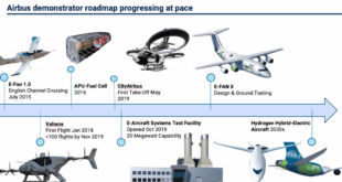
Solar-powered, efficient technologies are massively promoted by government bodies across the world owing to the rising pollution and depletion of natural fuel sources. Vendors operating in the global high altitude platform market are integrating photo-voltaic cell modules across the wingspan to decrease the reliance on fuel cells to generate power. For instance, in May 2017, SolarStratos completed the testing of the prototype of the first commercial two-seater solar plane, Elektra-2. Following this, various other companies in the HAP market such as Airbus SE and AeroVironment, Inc. have increased their investment in the development of these technologies and developed and launched unmanned HAPs for various applications.
For nighttime, it is unclear whether there will be a preference for advanced rechargeable batteries, such as lithium-sulfur, or RFC. These two technologies are expected to have significant advances in the coming years due to the evolution of electric car industry. In the military market, the decline of US involvement in the conflicts in Iraq and Afghanistan motivated the stop of HAP projects managed by the DoD, as in HAA, ISIS and Vulture Programs. Among the HAP developments underway with better prospects for continuity allocation of financial resources, there are three airplane projects (Google’s Solara 50, Facebook’s Aquila and Airbus’ Zephyr), only one airship (Thales’ Stratobus) and one balloon (Google’s Loon). This predominance of airplane projects does not seem to be a confirmed trend for medium and long term.
The number of technical publications in China on HAP airships may be an indication that airships will still be a significant segment of future HAP projects. Analyzing the information on the 12 major HAP projects, presented in this paper, it is noticed that 7 were closed without achieving results that would ensure continuity and 5 are in progress (Airbus Zephyr, Thales Stratobus, Google Loon, Google Solara 50 and Facebook Aquila). This finding indicates that the technological maturity (Technology Readiness Level — TRL) for the development of HAP aircraft has not reached a level sufficiently high to ensure their certification, serial production and commercial operation.
At present, the technological risks involved in developing HAP are very high.
Despite the numerous growth prospects, high costs of systems and numerous operational difficulties are limiting its adoption across other countries, which in turn are restraining growth of the global high altitude platforms market, says TMR. Additionally, extremely slow deployment, restriction on payload weight, and difficult handling are some of the other challenges for the growth of the global high altitude platforms market.
References and Resources also include:
https://www.frontiersin.org/articles/10.3389/frcmn.2021.716265/full