 International Defense Security & Technology Your trusted Source for News, Research and Analysis
Related Articles
Flight MH370 left Kuala Lumpur was bound for Beijing in March 2014 when it disappeared, with 239 people on board. Even after the largest and most expensive search in aviation history, to date, neither any confirmed debris from the aircraft nor any survivors have been found. A four-year deep sea hunt in the southern Indian Ocean off western Australia costing $200million was conducted but the full aircraft has never been found. The search for Malaysia Airlines Flight 370 ended in January after a deep-sea sonar scan of 120,000 square kilometers (46,000 square miles) of ocean floor southwest of Australia failed to find any trace of the Boeing 777 . But research has continued in an effort to refine a possible new search.
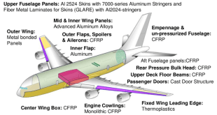
So far there have been 32 pieces of the plane found and one of the last discovered pieces was found to be from the internal fin of the vortex generator. If it is from the fin it could determine that the engine of the aircraft shattered on impact, which means it was not in a controlled glide when it went down. This supports the theory the plane crashed violently, but testing of the final two pieces found was delayed for two years and have not yet been made public.
A new mission to find the missing wreckage of Malaysia Airlines flight MH370 could be launched in a matter of months, according to reports. Families of victims and the Malaysian government are currently looking to send seabed searchers, Ocean Infinity, on a new quest to find the missing flight. Officials are hoping new debris and analysis will provide investigators with a clearer priority search, News Corp reported. Former Australian investigators are welcoming the renewed search after they felt they were rushed into looking for the plane in the wrong area.
‘The Transport Minister is open to review a proposal. We are trying to make sure that the proposal is something that is airtight and doesn’t get rejected for some vague reason so we have been working quietly with parties involved to try and bring that to fruition.’ She hopes data from the military radar that was tracking the plane was no longer seen as national security so they can investigate the findings. Ocean Infinity CEO Oliver Plunkett said the Malaysian Government is only committing to the search on a ‘no find no fee’ basis.
Why technology was unsuccessful in finding MH370
The area of the Indian Ocean where MH370 is thought to have disappeared reaches depths of about 13,000 feet. The current there is the worst in the world, the weather there is the worst in the world and the sea floor there is less well-known than the surface of the Moon. In a report published in Notices of the American Mathematical Society, a team of researchers led by applied mathematician Goong Chen from the Texas A&M University at Qatar used computer simulations to compare five scenarios of water entry. Based on their calculations, they conclude the plane took a vertical nosedive into the Southern Indian Ocean. The team of interdisciplinary specialists – engineers, mathematicians and computational scientists – reached this conclusion after comparing data on five simulated water entry scenarios for a Boeing 777 aircraft.
According to aviation experts, if the plane entered the water at a 90-degree angle (head first), the wings and tail of the plane would have been torn away, and the fuselage could sink within less than a minute, without ever resurfacing. Such a ‘clean’ entry would therefore explain the lack of debris or oil on the surface of the ocean near the assumed crash site of MH370 and why the search effort for MH370 focusing on scanning the surface of the water was a failure. Neither the crew nor the aircraft’s communication systems relayed a distress signal, or indications of bad weather before the aircraft vanished. Suddenly its transponder stopped transmitting and it became invisible to secondary radar, the passengers and crews of airliners were virtually on their own after that.
Military radars show the aircraft turning sharply to the west, then north. Because of the sensitive nature of revealing military radar capabilities, countries in the region where Flight 370 disappeared were reluctant to release information they may have collected from military radar. None of the four Emergency Locator Transmitters carried by it transmitted SOS signal, a 406MHz frequency signal that is used by the International Cospas-Sarsat search and rescue constellation to locate and assist vehicles or individuals in distress.
Records of signals sent between the aircraft and a communications satellite over the Indian Ocean revealed that the aircraft had continued flying for almost six hours after its final sighting on Malaysian military radar. Radar data suggest that the flight path of MH370 was very erratic during the first 2-3 hours with sharp turns, and large changes in speed and elevation. After last radar contact, the Inmarsat 3-F1 satellite “pinged” the aircraft 7 times over a 6 hour period. At each ping time, the engineers could determine an arc of possible locations of the aircraft, and the burst frequency offset [BFO] which is a quantity related to the aircraft-satellite Doppler shift. Initial analysis determined that Flight 370 was along one of two arcs—equidistant from the satellite—when its last signal was sent. On March 25th, the AAIB released the results of a sophisticated analysis of Doppler shift data due to the relative motion of MH370 and the satellite, which provides strong confirmation that the aircraft took the southerly route.
As things stand, the world’s airlines and air traffic controllers have no system in place to track planes as they cross the world’s vast ocean regions. Thus, there’s no sensible theory to where it is, the most likely theory is that it is down there in the southern Indian Ocean. The search area itself was changed five times from March to October. High resolution Satellite imagery of the region identified several objects of interest and two possible debris fields. At least 40 ships and 34 aircraft took part in the search, with teams from Australia, China, Thailand, Indonesia, Singapore, Vietnam, Philippines, New Zealand and the USA, However, none of these possible objects were found by aircraft or ships and the rest were false alarms. US Navy surveillance planes equipped with radar, cameras and electro-optical sensors, searched for objects on open water, with sailors at every window looking with binoculars and the plane diving to identify targets visually, without any success. Australia’s JORN over-the-horizon radar system was believed to be looking north to detect illegal migrants and not west over the Indian Ocean where Flight 370 is presumed to have flown.
Australia’s national science body CSIRO said in April that MH370 was “most likely” lying north of the former search zone . It supported the December review’s findings by a team of international and Australian experts who re-examined all the data used to define the original search zone that the wreckage was most likely within a 25,000-square kilometer (9,700-square mile) area on the northern boundary of the last search zone. Malaysia, China and Australia have agreed that the search will remain suspended unless new evidence emerges that would pinpoint the plane’s exact location. The resting place of missing flight MH370 will eventually be found but it will require advances in science and technology, including artificial intelligence, Malaysia Airlines’ chief said.
Technologies for Aircraft Accidents and Search and Rescue
Airplane accidents may be detected by the IMS infrasound system if that explosion occurred near the station at a range less than 100 Km, however, according to ctbto report, the closest certified infrasound station IS06 in the Cocos Islands, that could have recorded signals from the plane was found to be located 1700 km away from the southern part of the predicted flight path. Ships equipped with towed pinger locators (TPLs) and submarine equipped with a hull-mounted acoustic system, began searching for pings along a 240-kilometre (150 mi) seabed line believed to be the Flight 370 impact area.
Under favorable sea conditions, the pingers can be heard 2 nautical miles away, but high seas, background noise, wreckage or silt can all make pingers harder to detect. In addition the pinger’s batteries are designed to last only 30 days. Operators considered it a shot in the dark, when comparing the vast search area with the fact that a TPL could only search up to 130 sq km (50 sq mi) per day. Between 4–8 April several acoustic detections were made that were close to the frequency and rhythm of the sound emitted by the flight recorders’ ULBs; The ping signal was also detected by Australian Air Force Orion P-3 aircraft, through its dropping sonar buoys. The analysis of the acoustic detections determined that, although unlikely, the detections could have come from a damaged ULB.
Submarines are not suitable for conducting sea-bed searches for static debris objects and options like sonars fitted on hydrographic vessels, submarine rescue vessels, specialised rescue vessels and minehunters are better options. The robotic submarine Bluefin-21’s used its side sonar to create high-resolution 3-D images of the seafloor, however it completed its mission without success. Ships have been surveying tens of thousands of square kilometers of the bottom of the southern Indian Ocean, The mapping is necessary because the area of ocean, far off the Western Australian coast, is so remote that its depth and seafloor terrain were largely unknown.
Mapping has led to the discovery of previously unknown undersea features such as mountains, volcanoes, chasms and a rough, uneven sea floor, highlighting the challenges. The priority search, with area of 60,000 square kilometers (23,166 square miles) which began in early October, has completed searching 50,000 square kilometres without any trace of the aircraft being found.
The underwater phase of the search is used three vessels equipped with towed deep water vehicles, which use side-scan sonar, multi-beam echo sounders, and video cameras to locate and identify aircraft debris. The underwater probe took place in treacherous surface conditions with waves as high as 12 metres (39 feet). Authorities believe the plane may be sitting on the ocean floor at depths of 4,000 metres. “It’s a huge search area, it’s in very deep water, it’s a long way from the coast, but we’re still optimistic that we’re searching in the right place and we’ve got good enough equipment to be able to identify this wreck,” said acting Prime Minister Warren Truss to ABC Radio. The April meeting of Ministers, agreed to double the search zone to 120,000 square kilometres. Ministers also decided the search would not be extended beyond that area “in the absence of credible new information that leads to the identification of a specific location of the aircraft”.