International Defense Security & Technology Your trusted Source for News, Research and Analysis
Related Articles
Quantum sensors are measuring device that takes advantage of quantum correlations, such as states in a quantum superposition or entanglement, for better sensitivity and resolution than can be obtained by classical systems. QP will boost the capabilities of all sorts of sensory devices, such as gravimeters, which are used to measure the strength of a gravitational field. Quantum effects disappear when exposed to any outside interference or noise, so any quantum system or device must be carefully shielded and cooled to very low temperatures. This has limited their use in many real-world applications.
Geophysical surveying is widely used for the location of subsurface features. Commonly used geophysical techniques such as ground-penetrating radar (GPR), electromagnetic (EM) conductivity, electrical resistivity and seismic methods have been successfully used to locate underground features in the near-surface.
Current technology is limited in terms of its resolution (thus size of features it can detect) and penetration depth. An alternative is to use “passive” technologies such as magnetic or gravity surveying which rely only on being able to measure the potential field generated by the target of interest and to distinguish it from the regional field and signals from other features above or below the ground.
Our mobile phones currently contain a gravity sensor which is accurate to 0.015 m/s2, good enough to tell you which way is up. New high sensitivity gravity measurement devices, such as gravity MEMS and quantum gravity sensors are being developed. The University of Glasgow’s Quantum enhanced imaging hub ‘QuantIC’ are investigating MEMS devices that can measure the acceleration due to gravity to 10-8 m/s2, good enough to detect a 10m3 cavity, such as a sinkhole, located 10m under the ground.
Quantum technology (QT) gravity sensors potentially offer a step-change in technology for locating features which lie outside of the currently detectable range in terms of size and depth, However, Quantum sensors are just becoming commercially available.
The Gravity Pioneer project, which has been awarded £6 million in research funding from UK Research and Innovation, was announced in Nov at the 2018 National Quantum Technologies Showcase in London. The Gravity Pioneer project will be led by leading environmental and engineering services company RSK and consist of 12 project partners from prominent organisations currently engaged in quantum technologies in the UK: Teledyne e2v, Fraunhofer UK, Altran, Geomatrix Earth Science, Magnetic Shields, UniKLasers, Silicon Microgravity, Optocap, QinetiQ, the University of Birmingham and the University of Southampton. The project aims to build and test a new gravity instrument that will have demonstrable benefits over existing technologies on the market.
Quantum gravimetry will bring a range of economic, social and environmental benefits in the coming years,” Graeme Malcolm, CEO and co-founder of M Squared said. “Applications can be envisaged in many sectors, from the detection of new oil and gas deposits, surveying unknown underground infrastructures such as pipes and cables, even monitoring the water table. If we can transfer the technology into accurate seismic mapping, it could be used to predict natural disasters ranging from avalanches and volcanic eruptions to tsunamis.”
laser cooling
Many quantum sensors, for example those detecting gravity, need to slow down atoms so that they are nearly completely still. At room temperature atoms move about really fast. So fast, in fact, that their high kinetic energy makes it really hard to exploit their quantum properties for something useful. At very low temperatures the quantum properties of atoms can be observed and harnessed to detect very small changes that would be missed out otherwise, like passing over a sinkhole where the gravitational field is slightly weaker than the surrounding area.
Laser cooling can be used, for example, in an atom interferometer that works by dropping a cloud of ‘cooled’ atoms. To measure gravity, three pulses of light are shone onto the atoms, transferring momentum to the cloud and placing the atoms into a quantum superposition of two momentum states. The first pulse causes one half of the atoms to travel more quickly through space, splitting the cloud in two. After a time T has passed, a second pulse is used to invert the momentum
difference of the two clouds, causing them to begin to move towards each other once again.
Finally, after further time T a third pulse is used to close the interferometer. During the sequence
the atoms accumulate a phase difference due to gravity, allowing the instrument to detect local
changes in density. Laser cooling is essential in this technology to ‘cool’ atoms to form the cloud needed to study their properties and take measurements.
Quantum Gravity Sensors
Conventional imaging relies on radio frequency electromagnetic sensors such as Ground Penetrating Radar (GPR), but soil attenuates the signal and can stop it reaching more than a few centimetres into the ground, but buried assets like pipes, electric and telecoms cables can be up to just over a metre deep. Quantum technology gravity sensors, in contrast, can detect much further – and theoretically, all the way to centre of the earth as they are measuring a passive field and are not sending an active signal through the ground. By dropping charged atom clouds which, because of the principle of superposition, can be in two different states at once, it is possible to measure density variations by comparing differences in the ways that atom clouds fall and thus deduce underground conditions.
Researchers at the University of Birmingham’s quantum sensors and metrology hub are proposing to measure gravity using the quantum effects of laser cooled clouds of Rubidium atoms. These devices can measure down to 10-10 m/s2, good enough to detect a 1m3 cavity, such as a forgotten sewer pipe, located 30m under the ground.
For over 30 years, academics have been exploring the strange effects of quantum superposition – the principle that 2 or more quantum states can be added together to result in another valid quantum state – to measure gravity. This is done by comparing wave-particle duality – the concept that quantum entities can be described both as particles and waves – in atoms of the element rubidium. By comparing wave-particle duality with a laser beam, the instrument will be able to detect very small changes in the way atoms fall freely in a vacuum, determining the local strength of gravity. If the measurement is sensitive enough, it will be able to detect if there are voids, pipes, tunnels and oil and gas reserves in the ground beneath your feet.
These devices consist of clouds of cold rubidium atoms in basketball-sized vacuum chamber and cooled down to 80 microkelvin – barely above absolute zero. Then the atom clouds are dropped, and while in freefall, their position is measured very precisely using lasers at many points before the clouds come back together to make what’s called an interference pattern. the difference in speed of two atom clouds fall indicate a change in the density of the ground below. This could be due to the presence of oil or certain minerals, for example.
“In general, a Quantum Technology makes use of the counter intuitive consequences of quantum mechanics – the principal theory explaining our world on a microscopic scale. One of these consequences is that a single object can be in several different places (or in several different ‘states’) at the same time. In the quantum world, a person could pass a tree simultaneously on the right and the left side, or be wearing business clothes and beach attire simultaneously,” says Professor Kai Bongs, Professor of Ultracold Atomic Physics, School of Physics and Astronomy, University of Birmimingham
“For example, in our everyday experience the force we feel due to gravity appears to be the same anywhere on Earth. A precision quantum gravity sensor picks up variations, by letting single atoms explore different paths in the gravitational field of the Earth. From those differences one can infer what lies beneath the Earth’s surface,” he further explains
“A quantum gravimeter can detect and measure atomic interference, a manifestation of wave-particle duality that matter can display when it is in a quantum state at temperatures just above absolute zero,” said Graeme Malcolm, CEO and co-founder of M Squared. “It uses quantum technology to bring unprecedented levels of precision to gravitational measurements and the detection of gravitational fields of hidden objects.”
Quantum laser developer M Squared has demonstrated the U.K.’s first industrial quantum gravity technology — a quantum gravimeter. The device, which can measure gravity, is crucial for such applications as the detection of new oil and gas deposits, surveying unknown underground infrastructures such as pipes and cables, monitoring the water table and preventing flooding and geological surveying.
Quantum Gravity Sensor Applications
Gravity sensors have remarkably diverse applications. Helping determine the spatial extent of aquifers that have run dry – by the change in gravity due to the water being pumped out, or the equivalent processes in oil and gas recovery (where unrecovered pockets of oil and gas can represent the considerable residual value) are other big applications. More academically, climate change science (snow cover of mountains and magnitude of ocean currents) and archeology (‘seeing’ without digging) will benefit greatly.
Lack of Knowledge of below-ground infrastructure mere few metres below our ground surface in some urban areas pose geotechnical risks for infrastructure and brownfield developments. This includes utility infrastructure (such as pipes, cables, sewers), transport infrastructure (tunnels) and deeper down, mine-shafts, old foundations, and emerging sinkholes. Millions of pounds are spent on site investigations for projects like HS2 rail, and huge delays and additional costs are incurred in excavation and during additional roadworks that result from now knowing what lies beneath our feet. The utility industry undertakes 1.5 million street works annually to repair, maintain and upgrade its vast network of buried infrastructure.
The implications go beyond infrastructure – quantum gravity sensors could also guide environmental work like carbon sequestration, spot threats like magma flows, and uncover new minerals and water resources. They could also, by tracing gravitational dynamics of the earth, support navigation in autonomous ships, and underwater vessels with limited access to satellite navigation and radio.
The University of Birmingham led EU iSENSE and EPSRC GG-TOP projects are leading the way in providing the means to enhance oil and mineral exploration, find water resources, drive climate research and to map urban infrastructure and archaeology. A new Quantum Gravimeter has been developed by University of Birmingham that could allow to survey underground structures in minutes rather than weeks. This portable gravity sensing system uses cold atom quantum technology and two gravimeters coupled together for the first time to allow for higher sensitivity and reliability when carrying out surveys, enhanced robustness to external noise sources and drastically reduced measurement time. Applications for our Armed Forces range from spotting enemy tunnels to supporting disaster relief.
The technique of gravity mapping is already used by civil engineers for carrying out surveys – such as on brownfield sites – and detecting underground features. The Gravity Imager is intended to provide higher sensitivity and reliability for such applications, while also drastically reducing measurement time through enhancing the robustness to external noise sources.
The full resolution brain
The brain’s functional complexity – it is a rapidly communicating, evolving network, rather than an engine made of discrete parts – combined with its encasement in bone, make it extraordinarily hard to image non-invasively. Intracranial fluid, because it is electricity-conductive, washes out the signal of electroencephalograms (EEG), a common imaging technology. This is a particular problem when diagnosing and understanding disorders like dementia, which involve deep-brain structures.
Quantum sensors are supporting the development of magnetoencephalography – the measurement of magnetic fields generated by the flow of current through neuronal assemblies in the brain – revealing how the brain forms and dissolves networks of neurons, on a millisecond timescale, as part of the processes supporting cognition. With quantum sensors, this can even be done while the subject is moving, unlike current tools.
These quantum gravity sensors in the future may be integrated with the mobile phones which can measure the mass, shape and size of our brains that might allow our phone to diagnose a variety of medical problems, from tumours through to headaches.
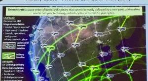
Quantum gravity sensors have also many military and security applications like through wall imaging, finding deeply buried structures and even detection of stealth aircraft. Firstly, accurate gravity sensing will enable attacking forces to detect underground and undersea movements, which will be a boon to detecting submarine movements from afar, diminishing their deterrent effect.
Teledyne e2v’s Quantum Group is putting Quantum Gravity Sensing in Satellites
Under a project called Cold Atom Space Payload (CASPA), Teledyne e2v is leading the development of a nanosatellite (30 x 20 x 10 cm) which aims to demonstrate cold atom technology in space. In addition to leading the programme, Teledyne e2v are developing a space flight ready variant of a cold atom chamber subsystem that will begin space qualification as part of the satellite, later this year.
New developments in quantum technology have resulted in the ability to cool atoms close to absolute zero by using lasers. At these temperatures laboratory, experiments have shown that these cold atoms can be used as ultra-sensitive sensors for measuring gravity. This technology has applications both on the ground and in Space. There is currently a technology readiness barrier preventing this technology from being adopted in Space, this has been identified by the European Space Agency (ESA) who have this technology on their development roadmap. Teledyne e2v is addressing the technology readiness level barrier through the CASPA programme, which will be the first demonstration of cold atoms on a free-flying satellite.
Current development streams at Chelmsford include gravity sensing, precision timing, and space hardware development for Earth Observation (EO) with potential applications in detecting and monitoring underground resources from Earth or Space, as well as navigation, synchronization of distributed resources and networks, and Global Navigation Satellite System (GNSS resilience). The extreme sensitivity brought by cold atom sensors could provide the ability to finely monitor the movement of mass within Earth systems bringing benefits to multiple applications, including polar ice mass monitoring, ocean currents, and sea level monitoring along with water table monitoring for flood and drought prediction.
Quantum technology to ensure resilient maritime navigation
Dr Simon Calcutt from Oxford’s Department of Physics along with Professor Tom Pike from Imperial College London are leading on a new research project to improve the precision of maritime navigation. The project aims to develop the MEMS component of a hybrid cold atoms MEMS gravity gradiometer and is funded by the UK Quantum Technology Hub Sensors and Timing, led by the University of Birmingham. It will extend the Hub’s map-matching navigation technology to applications in maritime environments.
The light and compact hybrid instrument will combine highly sensitive sensors and a gravity gradiometer to allow navigation that will not only rely on satellite signals, but will measure the localised gravity field produced by underground conditions which can be matched to gravity maps to establish a vessel’s precise location.
The team will exploit gravity gradiometer technology developed by Quantum Technology Hub academics, to ensure its effectiveness on a moving platform. Hub academics are already working closely with industry partners, such as Network Rail and the Lighthouse Authority, to implement map-matching navigation, and this project aims to add electronics that are able to compensate for the dynamics of the deployment platform to offer higher frequency capabilities required for resilient maritime navigation. The sensor instrument is based on the MEMS seismometers previously developed by Professor Pike for the NASA InSight mission, which is currently operating on the surface of Mars, and has a world-leading 0.3 ng/rtHz performance. These seismometers are helping to study the interior of the planet by listening to ‘marsquakes’.
Creating an instrument which can detect a gravity signal from a mobile deployment is an incredible challenge. Gravity sensors require extreme sensitivity to be able to detect signals, and a typical maritime, or airborne deployment experiences acceleration of 0.1g or more. The instrument aims to uniquely detect signals at the nano-g level. Professor Simon Calcutt comments: ‘We are looking forward to modifying the 3-axis seismometer system we now have operating on Mars to control the much more complex multi-axis feedback system needed to detect gravitational changes from a moving ship.’
Professor Kai Bongs, Principal Investigator at the UK Quantum Technology Hub Sensors and Timing, said: ‘We are delighted with this opportunity to extend our cold atom quantum technology in map-matching navigation to maritime environments, using MEMS enhanced technology developed by leading electronics expert Dr Simon Calcutt in a project led by Professor Tom Pike. At the Quantum Technology Hub, we are working closely with industry to build quantum technology for map matching navigation in both the maritime and railway sectors.’
Quantum Gravity Sensor Development
The University of Birmingham teams of the UK National Quantum Technology Hub in Sensors and Metrology have secured seven projects within the recent Innovate UK call ‘Exploring the commercial application of Quantum Technologies CRD’. This success underpins the strength in depth at the University of Birmingham to accelerate the development of quantum technology sensors and metrology, transfer our knowledge into industry and translate prototypes from academia into industry. They will create new links into industry, and deepen existing ties with key partners
Qvision, led by OXEMS, is exploring the combination of highly sensitive gravity data together with asset tags attached to buried pipes and cables to improve the management of buried assets, reduce accidental damage due to poor location of assets and enhance the market offerings of OXEMS’ tags. This completely new application has the potential to open up the market for QT gravity sensors.
CASPA, led by e2v, brings together a UK consortium to develop a QT sensing payload for a CubeSat, to push towards operation of quantum sensing in space. Achieving this challenging goal will push forward the operation of quantum sensors in applications such as gravity mapping and time generation in space. These will enable huge benefits across fields such as flooding and disaster resilience, and monitoring of water resources.
The new company, such as Muquans in France, offers commercial devices based on new ideas around quantum sensing. It has launched new generation of ultra-high performance measurement instruments based on a unique and patented technology, which relies on the utilization of laser cooling, trapping and manipulation of neutral atoms. It offers an absolute quantum gravimeter capable of measuring gravity with a relative accuracy of 10 exp (-9), dedicated to various geophysics applications.
Muquans, on the outskirts of Bordeaux, France. Set up by colleagues of Pereira Dos Santos at SYRTE, Muquans focuses on gravimeters made from atom interferometers, which exploit the quantum-mechanical property of wave-particle duality (see sidebar, below, and “Then and Now,” OPN, June 2019). Gravimeters allow scientists to map variations in density below the ground by recording gravitational fluctuations in both time and space. Geoscientists, for example, use these sensors to monitor volcanic hazard by measuring density changes caused by rising magma, or to gauge water resources by measuring the extent of aquifers. Energy companies, meanwhile, supplement seismic surveys by measuring variations in gravity over wide areas to look for oil and gas.
Most field-based gravity measurements currently use relative gravimeters, which monitor tiny changes in position of a mass suspended from a spring. These devices can be as sensitive as absolute gravimeters, but their output drifts over time and must be calibrated by absolute devices. As Pereira Dos Santos explains, that implies returning periodically to a reference station when carrying out a survey. “And in those surveys, time is money,” he says.
A new absolute quantum gravimeter unveiled by Muquans last year is designed to overcome these problems. Unlike its classical equivalent, it needs little or no maintenance and so can be run continuously like a relative gravimeter, while experiencing no drift. Consisting of a 70-cm-high cylinder and a slightly bigger box for the lasers and electronics, it is smaller than previous quantum devices and can be operated by non-experts. According to Muquans CEO Bruno Desruelle, the company expects to deliver two units of a more rugged version of the device to geophysicists by the end of year.
Bongs and colleagues at Birmingham are building a slightly different kind of gravity sensor to target one specific market: civil engineering. Construction companies carry out underground surveys to identify old mineshafts, sewers, sinkholes or other dangerous structures; utilities dig millions of holes in roads to locate pipes and cables. Ground-penetrating radar, while helpful, can’t see down beyond a few meters, and conventional spring-based gravimeters need several minutes to make a measurement, to average out ground vibrations that would otherwise swamp the tiny signals.
The solution, says Bongs, is a gravity gradiometer. This uses two atom clouds subject to the same external vibrations, but falling at different heights. Subtracting the signal of one cloud from the other removes the noise while revealing the gravity gradient. Although the device won’t necessarily be more sensitive to gravity than masses on a spring, it should operate much faster—cutting survey times by as much as 99%, Bongs estimates, and thereby slashing operational costs. “Our approach is not to make the best instrument,” he says, “but the most practical instrument.”
Bongs reckons that speedier measurements could transform the global market for gravity surveys in civil engineering from its current, modest US$10‒$20 million to “several hundred million” a year. He estimates that another three to five years will be needed to simplify and miniaturize the group’s existing instrument (which is currently about two meters high), and perhaps an additional five to ten years to make it cheaper than a standard gravimeter (cost: about US$100,000), although the exact timings, he says, will depend on investment by industrial partner Teledyne e2v.
Gravity Power: Industry leaders enter partnership to develop new industry of quantum gravity sensors
The University of Birmingham, lead of the Quantum Technology Hub for Sensors and Metrology, is academic lead for the project – building on strong collaboration between the School of Physics and Astronomy and the Department of Civil Engineering to provide expertise in the development and use of quantum technology based gravity gradient sensors for practical applications.
Principle Investigator Dr Michael Holynski, lead of the Atom Interferometry team at Birmingham and scientific lead of the project, with Co-Investigators Prof Nicole Metje, Head of the Power and Infrastructure Group, Prof Kai Bongs, Director of the Quantum Technology hub, Dr Jamie Vovrosh, Dr Dan Boddice and the team will work closely with the project partners to deliver step changes in our ability to detect objects beneath the ground.
“Despite our increasing ability to detect and monitor objects that exist on land, in the sea, around buildings or in space, our ability to detect objects beneath the ground has not improved significantly,” explains George Tuckwell, project lead and divisional director for geosciences and engineering at RSK.
“When it comes to attempting to locate a forgotten mineshaft, determine the extent of a sinkhole or assess the quality of infrastructure, we still often resort to digging or drilling holes. This presents huge economic and societal costs as road networks are dug up, oil wells are dry or brownfield land is left undeveloped.”
Existing techniques for ground investigation include classical microgravity, ground penetrating radar and seismic technologies, but these can be limited in sensitivity, penetration or cost. Gravity Pioneer aims to develop a tested blueprint for a commercially relevant device that will overcome these challenges. Working with leading UK universities, it aims to demonstrate a 2× sensitivity improvement and a 10× measurement speed improvement over the industry standard gravity sensor.
The large project has received £6 million in research funding from UK Research and Innovation, the national funding agency investing in science and research in the UK. The consortium submitted a bid in response to the £20 million Quantum Technologies Pioneer Fund, which aims to develop prototypes in two years that could be used in future sensors, consumer electronics and digital services. The fund, which is part of the Industrial Strategy Challenge Fund, implements the policies set out in the UK government’s white paper Industrial Strategy: Building a Britain Future for the Future, which was published in 2017.
Speaking on receiving the research funding, Dr Richard Murray, business development manager at Teledyne e2v said, “The project was proposed by a UK consortium of the best scientific and engineering companies the UK has to offer, from component manufacturers to instrument developers and end-users.
A large factor in the bid’s success was the prominent role of end-users in the project structure and the full supply chain of service, instrument and component partners involved. Together, we are working to build a gravity instrument that works, that the marketplace wants and that provides value to users such as RSK and client organisations such as BP, Network Rail, HS2 and Airbus.
“The UK is world leading in quantum technology and the project brings together the best the UK has to offer in this field. Once we can demonstrate the advanced performance of quantum cold-atom sensors, the economic and societal benefits of this new quantum industry in the UK will be significant.”
Roadmap of Quantum Gravity sensors
“Over the next 10 years, quantum gravity field and gradient sensors will be developed. They can be used to build a 3D map of the density of material around them and will have a significant impact on the world’s construction and oil and gas sectors,” predicts UK Quantum roadmap. “The trend towards urban dwelling means more building on brownfield sites or in areas of existing infrastructure. Legacy infrastructure hidden below the ground and forgotten imposes a substantial cost: 60% of holes dug to access existing infrastructure are in the wrong place.”
Gravity sensors will also significantly impact the £318 million market for for the discovery of new reserves, and for the efficient extraction from existing reservremote sensing technologies for oil, gas and mineral explorationes. For example, quantum technologies may allow companies to monitor the movement of oil and water underground during extraction. This may make it easier to use novel techniques to more efficiently extract oil from difficult environments. There is already competition in this field and evidence that testing of quantum gravity mapping devices is already underway in the US.
References and Resources also include:
https://www.birmingham.ac.uk/research/quest/emerging-frontiers/quantum-sensors.aspx