International Defense Security & Technology Your trusted Source for News, Research and Analysis
Related Articles

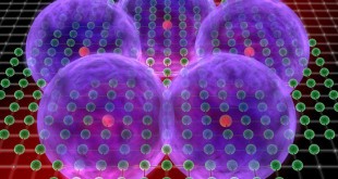
We are in midst of the second quantum revolution moving from merely computing quantum properties of systems to exploiting them. Quantum technology (QT) applies quantum mechanical properties such as quantum entanglement, quantum superposition, and No-cloning theorem to quantum systems such as atoms, ions, electrons, photons, or molecules.
Quantum bit is the basic unit of quantum information. Whereas in a classical system, a bit is either in one state or the another. However, quantum qubits can exist in large number of states simultaneously, property called Superposition. Quantum entanglement is a phenomenon where entangled particles can stay connected in the sense that the actions performed on one of the particles affects the other no matter what’s the distance between them. No-cloning theorem tells us that quantum information (qubit) cannot be copied.
Quantum technology has many Quantum applications. Researchers are developing new capabilities in secure communication, ultra-sensitive and high signal to noise physical sensing of the environment and Quantum Information Science (QIS).
Quantum Sensing exploit high sensitivity of quantum systems to external disturbances to develop highly sensitive sensors. Quantum sensors are measuring device that takes advantage of quantum correlations, such as states in a quantum superposition or entanglement, for better sensitivity and resolution than can be obtained by classical systems. They can measure Quantities such as time, magnetic and electrical fields, inertial forces, temperature, and many others. They employ quantum systems such as NV centers, atomic vapors, Rydberg atoms, and trapped ions.
Current atomic clocks based on Cesium or Rubidium loses just a second in 100 million years. These next generation Quantum clocks based on single atoms will lose only a second in a billion years. Quantum navigation could be far more accurate than using current accelerometers and gyroscopes and will provide backup to GPS, if GPS fails or navigation in places where GPS is not available. Quantum imaging exploits quantum entanglement of the electromagnetic field to image objects with a high resolution under low light levels, or in the presence of strong background illumination. It has applications in 3D cameras, behind the corner cameras, quantum radar and lidar.
Quantum Gravimeters can measure gravity with greater sensitivity and reliability while more robust against external noise sources.
Civil engineers are often faced with the challenge of scouting out underground locations to lay cable, pipe, or conduits to supply necessary utilities like electricity, water, gas, and telecommunication services. While many technologies exist for underground sensing, such as ground-penetrating radar, scientists have only recently turned to quantum technology for a better idea of what’s going on beneath the surface.
Quantum sensors are just becoming commercially available. Quantum effects disappear when exposed to any outside interference or noise, so any quantum system or device must be carefully shielded and cooled to very low temperatures. This has limited their use in many real-world applications.
QP will boost the capabilities of all sorts of sensory devices, such as gravimeters, which are used to measure the strength of a gravitational field. Gravity sensors have remarkably diverse applications. Helping determine the spatial extent of aquifers that have run dry – by the change in gravity due to the water being pumped out, or the equivalent processes in oil and gas recovery (where unrecovered pockets of oil and gas can represent the considerable residual value) are other big applications. More academically, climate change science (snow cover of mountains and magnitude of ocean currents) and archeology (‘seeing’ without digging) will benefit greatly.
Quantum gravimetry will bring a range of economic, social and environmental benefits in the coming years,” Graeme Malcolm, CEO and co-founder of M Squared said. “Applications can be envisaged in many sectors, from the detection of new oil and gas deposits, surveying unknown underground infrastructures such as pipes and cables, even monitoring the water table. If we can transfer the technology into accurate seismic mapping, it could be used to predict natural disasters ranging from avalanches and volcanic eruptions to tsunamis.”
These quantum gravity sensors in the future may be integrated with the mobile phones which can measure the mass, shape and size of our brains that might allow our phone to diagnose a variety of medical problems, from tumours through to headaches.
Quantum Gravity Sensors
According to researchers at the University of Birmingham, a new method known as quantum gravity sensing works by applying a technique called atom interferometry. This technique uses cold atoms “as ideal test-masses to create a gravity sensor which can measure a gravity gradient rather than an absolute value.” Researchers claim this method bypasses noise sources that may interfere with sensing. A BBC article explains that quantum sensing uses lasers to cool rubidium atoms to slightly above zero (-273°C). These atoms are first shot upward in a vacuum and measured as gravity pulls them back down.

While quantum sensors are already used in the oil and gas sectors with much success, quantum cold-atom sensors—which are designed to operate on the surface—are expected to be better at detecting and monitoring objects beneath the ground. To date, however, not much attention has been paid to the potential benefits of quantum gravity sensors deployed in boreholes.
The Gravity Delve Project (GDP) brings together academics from the UK Quantum Technology Hub Sensors and Timing (led by the University of Birmingham) and Nemein Ltd, a down-hole technology specialist, to explore quantum gravity sensors based on atom interferometry. Nemein Ltd is currently developing equipment that can be deployed in boreholes for energy harvesting and environmental sensing. According to the company, this technology will enable the University of Birmingham’s quantum sensor, developed as part of the GDP, to be deployed into the harsh conditions of the downhole environment.
Dr. Jamie Vovrosh, the University of Birmingham-based researcher who is also the technical lead for the project, said that the project provides an opportunity to use the “extraordinary performance” of quantum cold-atom sensors in new applications, potentially opening up “a pathway towards realizing future economic and societal benefits.”
Building on work already undertaken by the University of Birmingham in cold-atom gravity sensors, the project will investigate borehole applications such as carbon capture and storage (CCS) and hydrocarbon and geothermal reservoirs. It will also investigate how a commercially-viable quantum device could replace or enhance current technology to optimize CCS reservoirs and minimize the impact that hydrocarbon extraction has on the environment.
The researchers also state that the project will enhance the transition from fossil fuels to renewable energy. As part of the project, a design will be developed for an innovative borehole quantum cold-atom sensor, which could lead to the first deep borehole quantum sensor that is both cost-effective and efficient. Once developed, atom interferometer-based technologies are expected to be significantly smaller, lighter, and more power-efficient with improved sensitivity and faster measurement times. Nemein’s technical director, Lawrence Till, comments, “Gravity Delve is not just a project which will optimize CCS and borehole energy extraction. It is very significant as a relatable project to show quantum technology can be deployed in some of the harshest environments in the real world and demonstrate tangible benefits to the environment.”
Quantum tech breakthrough for subsurface mapping, reported in March 2022
In a world first, a quantum gravity sensor has been used to detect a buried structure outside of laboratory conditions, offering “a new lens into the underground”. The quantum gravity gradiometer was used to find a tunnel buried outdoors in real-world conditions one metre below the ground surface at the Birmingham University campus.
The sensor was developed by University of Birmingham researchers from the UK National Quantum Technology Hub in Sensors and Timing as part of the Gravity Pioneer project. The research results were recently published in the journal Nature. The sensor works by detecting variations in microgravity using the principles of quantum physics, which is based on manipulating nature at the submolecular level.
“In addition, an underground map of what is currently invisible is now a significant step closer, ending a situation where we know more about Antarctica than what lies a few feet below our streets.” Current gravity sensors are limited by a range of environmental factors. A particular challenge is vibration, which limits the measurement time of all gravity sensors for survey applications. If these limitations can be addressed, surveys can become faster, more comprehensive and lower cost. The new sensor can overcome vibration and a variety of other environmental challenges in order to apply quantum technology in the field.
Quantum technology to ensure resilient maritime navigation
Dr Simon Calcutt from Oxford’s Department of Physics along with Professor Tom Pike from Imperial College London are leading on a new research project to improve the precision of maritime navigation. The project aims to develop the MEMS component of a hybrid cold atoms MEMS gravity gradiometer and is funded by the UK Quantum Technology Hub Sensors and Timing, led by the University of Birmingham. It will extend the Hub’s map-matching navigation technology to applications in maritime environments.
The light and compact hybrid instrument will combine highly sensitive sensors and a gravity gradiometer to allow navigation that will not only rely on satellite signals, but will measure the localised gravity field produced by underground conditions which can be matched to gravity maps to establish a vessel’s precise location.
Receiving stable and accurate location data while at sea is vital, and this has not yet to date been achieved due to satellite vulnerabilities. This crucial need has been underlined in the Maritime 2050 report, compiled by the UK Government’s Department of Transport in 2019, which states: ‘A key problem which must be addressed in navigation safety terms is the overwhelming reliance on Global Navigation Satellite Systems (GNSS) with its inherent vulnerabilities to man-made interference and space weather. There are numerous examples of accidents and incidents associated with navigation error.’
Gravity gradiometers military and security applications
Quantum gravity sensors have also many military and security applications like through wall imaging, finding deeply buried structures and even detection of stealth aircraft. Firstly, accurate gravity sensing will enable attacking forces to detect underground and undersea movements, which will be a boon to detecting submarine movements from afar, diminishing their deterrent effect.
Gravity gradiometers can detect anything with a mass that distorts gravitational fields specific to any location on Earth. Taking several minutes to filter out local vibrations, existing tools make surveys extremely slow and expensive. However, future quantum gravity gradiometers have the potential to “cut down the impact of vibration, enabling quicker measurements – potentially in no more than a second.” This would allow stability under dynamic conditions and enable scanning the ground from a moving vehicle, a very limited capability by existing technology standards.
Quantum gravity sensors have also many military and security applications like resilient maritime navigation, through wall imaging, finding deeply buried structures and even detection of stealth aircraft.
Researchers at DSTL develop quantum gravity sensor that can see through walls, prevent terrorist incidences
A team of scientists including experts at the MoD’s Porton Down labs have developed a device which can detect even the most minuscule fluctuations in gravity. Neil Stansfield, of the Defence Science and Technology Laboratory, said the new quantum gravity detector works by using lasers to freeze atoms in position and then measuring how the tiny particles are affected by the gravitational pull of nearby objects. By studying how the particles are influenced by the mass of nearby objects, scientists can then draw a 3D map highlighting how density changes nearby.
Stansfield, told the Telegraph: “One potential use would be to allow people to see underground. From a national security perspective, the potential is obvious if you can see caves and tunnels.” “There is also huge potential for civilian applications.” He said currently half of road works are in the wrong place because workers have no idea where pipes are buried. The new sensor would be able to accurately map what was underground.
The device could also detect changes through objects, such as walls, effectively allowing operators to see through walls. He said the detector could not be jammed or spoofed like many current technologies. He said: “We are not sending out a wave of any form, we are detecting the gravitational influence on an object. There’s nothing that we are sending out that can be interfered with.”
Detection of stealth Aircraft
Emmanuel David Tannenbaum in his paper: “Gravimetric Radar: Gravity-Based Detection of a Point-Mass Moving in a Static Background,” discussed a novel approach for detecting stealth aircraft, UAVs, cruise, and ballistic missiles. This method exploits the fact that all massive objects generate a gravitational field, and that a moving object will lead to a time-varying gravitational field that can be measured at various points. By measuring this time-varying field at a sufficient number of points, it is possible to obtain the mass, position, and velocity of the object by solving a system of nonlinear algebraic equations. This approach has an advantage over other detection methods, in that, because it is impossible to hide or shield a gravitational field, this method should be much more difficult, if not impossible, to counter, than other methods.
The main drawback is that it requires the ability to detect gravitational fields that are four to five orders of magnitude weaker than what is possible with current gravimetric devices. In order for gravity-based detection to emerge as a practical method for detecting moving objects, it will be necessary to develop devices that can detect gravitational fields several orders of magnitude weaker than what is possible with current instruments.
One possible approach for the development of a gravimetric device with the required sensitivity relies on a quantum-mechanical effect known as gravity-induced quantum interference. Gravity-induced quantum interference is an interference phenomenon that occurs when a particle interferes with itself after traveling along two paths with differing potential energies in a gravitational field.
Finding deeply buried structures a critical military requirement.
One of the easiest ways for nations to protect weapons of mass destruction, command posts, and other critical structures is to bury them deeply, perhaps enlarging natural caves or disused mines. Deep burial is not only a means of protection against physical attack, as even without the use of nuclear weapons, there are deeply penetrating precision guided bombs that can attack them.
Deep burial, with appropriate concealment during construction, is a way to avoid the opponent’s knowing the buried facility’s position well enough to direct precision guided weapons against it. Finding deeply buried structures, therefore, is a critical military requirement.
The usual first step in finding a deep structure is IMINT, especially using hyperspectral IMINT sensors to help eliminate concealment. “Hyperspectral images can help reveal information not obtainable through other forms of imagery intelligence such as the moisture content of soil. This data can also help distinguish camouflage netting from natural foliage.” Still, a facility dug under a busy city would be extremely hard to find during construction. When the opponent knows that it is suspected that a deeply buried facility exists, there can be a variety of decoys and lures, such as buried heat sources to confuse infrared sensors, or simply digging holes and covering them, with nothing inside.
MASINT using acoustic, seismic, and magnetic sensors would appear to have promise, but these sensors must be fairly close to the target. Once these sensors (as well as HUMINT and other sources) have failed, there is promise for surveying large areas and deeply concealed facilities using gravitimetric sensors. Gravity sensors are a new field, but military requirements are making it important while the technology to do it is becoming possible.
Secondly, in urban battlefields such as those in Gaza, insurgents and their military supplies often travel through underground tunnels, where they also maintain covert shelters. Here, gravity sensors will enable surveillance units to continue tracking suspected insurgents who disappear into a tunnel; and to obviate the risk of confusing the suspect with other ‘background noise’, powerful computers will separate and reconstruct the sensed movements of the person of interest. By the same token, gravity sensors will also provide valuable intelligence to both air and ground attack units, enabling them to intercept underground insurgents at the precise point of a tunnel’s exit; or to attack en route, to pre-empt both the insurgents and the underground movement of supplies. Of course, a measure of precaution is needed as some tunnels may be accessible to civilians (which also form part of the ‘background noise’), rendering the battlefield status of underground movements less certain.
Thirdly, quantum gravimeters can precisely map geological features from the gravitational force they induce, thereby enabling military units to navigate in areas where satellite signals are weak (or in ‘GPS-denied’ environments). To illustrate the level of sensitivity, even the weight force of a human hair is measurable, thus facilitating precise mapping as a result of even minor variations across terrain. The article cites a British MoD scientist who aptly refers to this as “a kind of Google maps for gravitation”. This will be enormously important for the viability of lethal autonomous weapon systems (LAWS), which may at times have to operate in denied environments, or may have to shut off their own communication links to avoid enemy hacking.
Quantum gravimeters based on atom interferometry could enable airborne detection and localization of underground structures, nuclear stockpiles, and nuclear submarines.
In 2009, DARPA launched Gravity Anomaly for Tunnel Exposure (GATE) program
DARPA studied an airborne surveillance system designed to detect underground targets by spoting gravity-based effects from tunnels and underground facilities from the air. DARPA’s Gravity Anomaly for Tunnel Exposure (GATE) program will demonstrate the capability to map tunnel networks generated by aerial surveillance of gravity anomalies measured by ‘gravity gradiometer’ to detect, classify and characterize subterranean threats. The sensor will be designed to detect underground voides typical of tunnels, bunkers and caches, which can be traced by their characteristic gravity effects. The sensor will be designed to measure minute spatial variations in the pull of gravity caused by the voids. Installed on a low-flying aircraft or UAV, the GATE sensor will try to detect those variations and process the signals on-board, in near real-time, to discriminate the positive signal from the variable natural and man-made topography and geology.
The Defense Advanced Research Projects Agency (DARPA) awarded Lockheed Martina $4.8 million contract to design a sensor system that can locate and identify underground targets by spotting gravity-based effects from an airborne platform.
Under DARPA’s Gravity Anomaly for Tunnel Exposure (GATE) program, Lockheed Martin will develop a prototype sensor and system that can detect, classify, and characterize subterranean threats such as tunnels, bunkers, and caches. The sensor system incorporates a gravity gradiometer, an instrument which measures the tiny variations in the pull of gravity. The GATE sensor will detect those variations to discriminate a man-made void from naturally-occurring features such as topography and geology, yielding a near real-time map of what is underground.
“Our expertise in gravity gradiometers will help increase the capability to detect and characterize subterranean tactical threats by its anomalous gravity signature,” said Dr. James Archibald, General Manager of Lockheed Martin’s Niagara Operation. “This capability will help prevent both underground infiltration of secure perimeters and tactical underground operations, keeping our assets and troops protected.”
Gravity gradiometer systems have historically been used for a variety of applications, including natural resource exploration, navigation, and underground detection. The gravity gradiometer technology measures small differences in the earth’s density. These variations in density yield information on geologic structures, which are indicative hosts of ore bodies or oil and gas deposits, and even voids
For more than three decades, the Gravity Systems team in Niagara Falls has provided the world’s only moving-base gravity gradiometer capabilities. Applications range from defense to commercial markets for hydrocarbon and natural resource exploration.
However a recent report of the Air Force Scientific Advisory Board (SAB) found, “while some systems may be near-ready, that doesn’t mean they fit into the Air Force concept of operations. As an example, Dahm said that the oil and gas industry is using quantum gravity gradiometers to search for areas with reservoirs of oil. That’s off-the-shelf technology available now —– but it requires the plane to fly low to the ground, which is likely at odds with Air Force operations.”
An object hidden below ground has been located using quantum technology, reported in Feb 2022
University of Birmingham researchers from the UK National Quantum Technology Hub in Sensors and Timing have reported their achievement in Nature. It is the first in the world for a quantum gravity gradiometer outside of laboratory conditions.
The quantum gravity gradiometer, which was developed under a contract for the Ministry of Defence and in the UKRI-funded Gravity Pioneer project, was used to find a tunnel buried outdoors in real-world conditions one metre below the ground surface. It wins an international race to take the technology outside.
The sensor works by detecting variations in microgravity using the principles of quantum physics, which is based on manipulating nature at the sub-molecular level.
The success opens a commercial path to significantly improved mapping of what exists below ground level.
This will mean:
- Reduced costs and delays to construction, rail and road projects.
- Improved prediction of natural phenomena such as volcanic eruptions.
- Discovery of hidden natural resources and built structures.
- Understanding archaeological mysteries without damaging excavation.
Current gravity sensors are limited by a range of environmental factors. A particular challenge is vibration, which limits the measurement time of all gravity sensors for survey applications. If these limitations can be addressed, surveys can become faster, more comprehensive and lower cost.
The sensor developed by Dr Michael Holynski, Head of Atom Interferometry at Birmingham and lead author of the study, and his team at Birmingham is a gravity gradiometer. Their system overcomes vibration and a variety of other environmental challenges in order to successfully apply quantum technology in the field.
Professor George Tuckwell, Director for Geoscience and Engineering at RSK, said: “Detection of ground conditions such as mine workings, tunnels and unstable ground is fundamental to our ability to design, construct and maintain housing, industry and infrastructure. The improved capability that this new technology represents could transform how we map the ground and deliver these projects”
Dr Gareth Brown, joint Project Technical Authority for Quantum Sensing and Senior Principal Scientist at Dstl, said: “For national Defence and Security, accurate and rapid measurements of variations in microgravity open up new opportunities to detect the otherwise undetectable and navigate more safely in challenging environments. As gravity sensing technology matures, applications for underwater navigation and revealing the subterranean will become possible.”
Submarine detection
Several quantum technology applications could aid detection of submarines. These include magnetometers, gravity gradiometers and quantum clocks. Simultaneously, quantum navigation could aid the submarine to hide better.
Quantum gravity gradiometers will be very sensitive. That creates two problems. First, although putting them in space would solve the issue of their subsequent sensitivity to ground noise, space-based quantum gravity sensing or mapping is unlikely to detect submarines. Due to a combination of instrument sensitivity and satellite altitude, satellite gravity sensing will have a limited spatial resolution on the ground. Even if the currently estimated achievable resolution of around 100 km could be reduced up to 10 km, it would still be a few orders of magnitude the size of a submarine. Whether further improvements will be possible remains to be seen after the first quantum gravity gradiometers are put into space Second, even if the spatial resolution would improve, gravity gradiometers would see a lot from space as a lot is happening in and above waters – think, for instance, of commercial underwater infrastructure, surface ships, planes etc. Even if a gravity gradiometer would be able to detect and distinguish a submarine, further intelligence will need to determine whose and what type of submarine it sees.
Yet classification is tough. Like with birdwatching, one needs to know very well what to look for. Next to SSBNs waters are crowded with commercial, research and conventional military submarines. In 2019, militaries of 40 states operated 491 conventional and nuclear subs. That number excludes those owned privately or by research institutions. Distinguishing a strategic nuclear submarine would thus most likely make only sense through continuous tracking, so tracing nuclear submarines down from their known ports/bastions.
While submarines can shield themselves from magnetic or acoustic detection, there are no methods to shield from gravity gradiometers. Simply because such methods have not been necessary so far. Should this change, however, in the first instance decision-makers
will likely do all possible to hide their submarines better. One could design ways to decrease the detectable gravity signature by improving mass distribution on a submarines’ hull. That would need to happen at the already overly complex design stage of a submarine. Correcting mass distribution in hindsight could turn out very tricky.
Moving masses in a significant way on a vessel is not easy in itself and might upset other optimisation efforts. States building new SSBNs today would need to consider this in advance. Like magnetometers, quantum gravity gradiometers will most likely first be mounted on moving platforms like planes, ships or drones. While potentially enhancing submarine detection, they will not make oceans fully transparent
or seriously endanger submarine near invulnerability.
Chinese researchers say their gravity detector can help submarines avoid accidents
Chinese researchers have developed a highly sensitive and portable gravity detector for military use, including underwater navigation. The scientists described their atomic gravimeter in Acta Physica Sinica, a peer-reviewed journal of the Chinese Physical Society, in April 2020.
The device’s portability and ease of use make it an ideal candidate for military applications such as mobile launch of intercontinental ballistic missiles and submarine navigation, according to the research team from Zhejiang University of Technology in the eastern city of Hangzhou. The gravimeter could allow a submarine to detect the presence of an underwater mountain or another submarine without using sonar, helping to avoid accidents like the one that befell the nuclear submarine USS Connecticut, which crashed into a seamount in the South China Sea last year.
The car-mounted device’s measurements are an order of magnitude more precise than those of previous gravimeters. With improved accuracy, future atomic gravimeters could help an aircraft detect a submarine hidden in deep water, according to an estimate by Chinese researchers.
The device requires only a couple of minutes to set up and calibrate – previous instruments took hours – and performs well despite noise, vibration and other disturbances. Most gravity detectors use a sophisticated mechanism to keep the atomic fountain stable by isolating it from the external environment. Lin and his colleagues used an active stabiliser instead. The device can cancel out environmental disturbances by generating counter forces. The technology, known as proactive compensation, insulates the device from tiny vibrations on the ground. The device requires only a couple of minutes for set-up and testing, and it can be used for long missions without needing frequent calibration.
According to the researchers, the gravimeter could also have civilian applications in geological exploration, earthquake detection and groundwater monitoring.
China’s military scientists have used airborne gravity detectors to survey locations such as Antarctica, the Gobi Desert and Mount Everest, according to Chinese media reports.
References and Resources also include:
https://www.photonics.com/Article.aspx?AID=62373
https://www.sciencedaily.com/releases/2022/02/220223111238.htm