International Defense Security & Technology Your trusted Source for News, Research and Analysis
Related Articles
Th e world is entering a new era of industrial development and societal change driven by advances in digital technologies such as big data analytics, artifi cial intelligence (AI), and robotics, and also by the expanding reach of the Internet of Things (IoT) that is connecting many different types of things to the internet.
Realizing the “super smart society” requires a high-level fusion of cyberspace and physical space. Of particular importance to achieving this is the sensing of the “what, where, and when” of events in physical space with high precision. If imprecise sensing information is used, the accuracy of analysis and prediction by big data analytics and AI in cyberspace are also impaired. Imprecise analysis and prediction in turn mean that the data provided back to the physical world also become inaccurate, impeding the appropriate control of people, goods, and things in physical
space.
Satellite positioning, as exemplified by the US Global Positioning System (GPS), is expected as a
means to provide sensing of “where” and “when” in outdoor physical spaces with high precision. As the satellites used for satellite positioning are equipped with atomic clocks, the information they provide includes highly precise time information. Another feature of satellite positioning is that it provides an absolute position on the Earth.
High-precision absolute position information has potential uses in a variety of applications. Possibilities in the automotive and transportation sectors, for example, include the use of autonomous driving in vehicles such as private cars, taxis, buses, and trucks to resolve labor shortages, reduce traffic accidents, and provide on-demand transportation, or the use
of lane recognition to reduce congestion by operating navigation on a lane-by-lane basis.
Highly precise absolute position information is vital for controlling mobility services. In the case of autonomous driving, for example, control systems have been developed that combine precise satellite positioning with relative positioning technologies such as cameras or light detection and ranging (LiDAR).
In marine transportation, possibilities include automatic navigation and collision avoidance in shallow or inshore waters or in locations through which large numbers of vessels pass, or cost and energy savings achieved by selecting optimal courses.
Potential agricultural applications include automated tractors to overcome labor shortages, to keep operating through the night during busy times of year, or to avoid the effect of coming natural disasters, and labor savings from the use of drones capable of highly precise land sensing
to monitor for crop growth or for pests or weeds. In construction, the opportunities are for labor savings, accident reduction, and faster completion of work through the autonomous operation of construction machinery. Potential applications also exist in many other areas such as logistics, infrastructure inspection, and civil defense.
Requirements for High-precision Satellite Positioning
Key requirements for high-precision satellite positioning in the above-mentioned applications are as follows.
(1) Global operation: The ability to work anywhere on land or sea, however remote, and regardless of the nation or region.
(2) Absolute positioning: The ability to provide absolute values for positions on the Earth (latitude, longitude, and altitude) with high precision (to within a few centimeters).
(3) Uniformity: The ability to provide a position using the same method and the same standards regardless of location.
(4) Broad applicability: The ability to be used by anyone and to work with other sensors or systems.
(5) Ease of deployment: The ability to start systems or services and running quickly and at low cost using existing systems and software
High-precision Satellite Positioning Techniques
Based on the assumption that the satellite orbits (current locations) are known, satellite positioning works on the principle of triangulation to identify the position of a receiver (code positioning), with a ground station receiving signals (“codes”) from each satellite and calculating the distance in between based on the diff erences in code arrival time. The GNSS receivers in car navigation systems and smartphones work according to this principle and have error deviations
between several meters and several tens of meters.
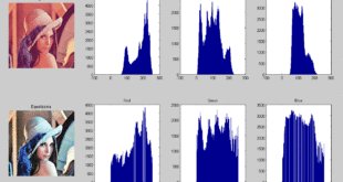
In surveying, however, where precision of a few centimeters is required, the receivers instead use carrier phase positioning whereby the phases of the carrier waves are used rather than the code arrival time diff erences to calculate the distance to the satellites, thereby achieving much higher precision. Unfortunately, satellite positioning is subject to errors in the satellite’s orbit and clock, the influence of the troposphere and ionosphere, and the error in the receiver’s clock. In order to reduce these errors, a reference station (receiver) is located in a place with an accurate location that is known near a mobile station (receiver), and the measurement data of the reference station is provided to the mobile station so as to lower the errors to within a few centimeters. Th is technique is typically called real-time kinematic (RTK) positioning.
However, since the use of RTK or network RTK in broad areas requires a number of reference points to be installed, precision with error deviations of a few centimeters become available only
within 20 to 30 km around these points. Furthermore, to improve their positioning precision, receivers that use RTK are larger than those used in devices such as car navigation systems, and very costly. Due to these circumstances, there are issues to be solved for the use to control mobility.
Global Correction Message Distribution Service
A new high-precision positioning technique that has attracted interest in recent years is precise point positioning (PPP). Whereas satellite positioning is subject to errors in the satellite’s orbit and clock, as explained above, PPP works by estimating precise orbits and clock errors and providing this information to mobile stations, thereby allowing a mobile station’s receiver to achieve precise positioning on its own without installing reference stations.
Recognizing that satellite orbit tracking can be used for the precise orbit and clock estimation needed in PPP, the Japan Aerospace Exploration Agency ( JAXA) developed the Multi-GNSS Advanced Demonstration Tool for Orbit and Clock Analysis (MADOCA). MADOCA generates correction messages (which include precise satellite orbits and clock error corrections) based on observational data from about 100 satellite tracking stations around the world and passes these to mobile stations via satellite or the Internet.
MADOCA can provide highly precise absolute positioning with an error deviation of a few centimeters anywhere in the world, including at sea or in remote locations with very fewer stations than RTK. Also, it can be easily incorporated into existing systems and applications thanks to its affinity with existing carrier positioning.
Th e Hitachi Group has undertaken automated tractors and high-precision agricultural land sensing with drones in Australia in order to demonstrate how high precision satellite positioning can be used for mobility control, etc.
China Claims Success With ‘Laser Test’ That Can Dramatically Boost High-Precision Satellite Navigation
China has completed a laser test that could pave the way for developing high-precision ground-to-satellite communications, as per reports. The experiment could also lead to fundamental physics discoveries and redefine the second as a unit of time.
The experiment was carried out by Chinese scientists at Urumqi, the capital of the Xinjiang Uygur autonomous region in western China. However, the time and date of the test are not mentioned in the SCMP report.
The report outlined the process and stated that the Chinese researchers set up two terminals in laboratories that were 113 kilometers (70 km) away. Each terminal had a laser, a telescope, and two optical frequency combs for precisely measuring light frequencies.
They determined and validated the time by sending information-carrying laser pulses between the two telescopes. According to the research team led by quantum physicist Pan Jianwei at the University of Science and Technology of China (USTC), previous attempts to transmit signals through the open air have been confined to a few dozen kilometers.
Chinese researchers said optical fibers had been used to relay signals beyond 1,000 kilometers with remarkable precision. However, because it is impossible to stretch wires between specific places, researchers have attempted to convey signals over the open air. Their findings were published on Wednesday in the peer-reviewed journal Nature. The latest test is significant in improving satellite navigation.
For instance, building a global network of optical clocks, which are incredibly precise timekeeping instruments that can help boost the precision of satellite navigation services, requires scientists to be able to transfer signals over large distances.
Optical technologies can advance the next generation of global navigation satellite systems (GNSS). Optical clocks, in particular, have the potential to support or even replace microwave-based clocks, with the possibility to improve GNSS position determination due to their lower frequency instabilities.
David Gozzard, a fellow at the International Center for Radio Astronomy Research in Australia who was not involved in the study, told the SCMP that links through the open air were required in any situation where installing a fiber-optic cable would be prohibitively expensive or impractical, such as when connecting a spacecraft to the ground.
Gozzard, a researcher on laser systems for high-precision measurement, also noted that this technology has drawbacks, including power loss and atmospheric turbulence that can cause frequent signal failures.
“Whenever a time signal is transmitted from one location to the other, turbulence causes the light to randomly speed up or slow down, so the time signal arrives after different amounts of flight time, ruining the timing synchronization,” he said.
He explained that the Chinese team had proven the technology across 100 kilometers on the ground. This demonstrates the technology’s ability to withstand the tremendous power loss and a significant amount of turbulence encountered on a link from the ground to a spacecraft.
USA’s Efforts To Build Laser-Based Clocks
The United States is also looking to develop laser-based clocks. These optical clocks would be 100 times more accurate than today’s most precise models while remaining tiny and durable enough to be carried on army vehicles and fighter jets.
Today, precision timing is crucial for many commercial and government applications, including financial networks and communication systems. Precision timing is also necessary for vital military activities, including sensor fusion and precise navigation.
US military authorities, particularly those in the Army, have been increasingly focused on finding alternatives to GPS. The rationale for seeking alternatives to GPS is to ensure positioning, timing, and navigation in contested areas, which is prone to jamming and spoofing via false signals.
Instead of the microwaves that are employed by today’s atomic clocks, optical clocks use specialized lasers. However, current models are huge and fussy, although they have been demonstrated to work in lab settings.
References and Resources also include:
https://www.hitachi.com/rev/archive/2019/r2019_01/pdf/P070-077_R1a07.pdf
https://eurasiantimes.com/china-success-with-laser-test-that-can-satellite-navigation/