From Sky to Soil: Integrating Tech and Intuition to Rescue Disaster Survivors
Discover how satellites, drones, GPR, AI, and even canine teams work together to detect survivors buried beneath disaster debris, saving lives when every second counts.
The devastating 2024 landslides in Kerala’s Wayanad district claimed over 420 lives and left countless others trapped beneath layers of debris. While satellite imagery helped map the vast scope of surface damage, it quickly became clear that even the most advanced space technologies could not detect signs of life buried beneath rubble. This tragic event underscored a critical truth about disaster response: orbital sensors have limits when it comes to life-saving operations deep underground.
Although India’s Earth-observation satellites such as RISAT and Cartosat-3 provided invaluable macro-scale assessments of terrain shifts and infrastructure collapse, they remained silent on the one question that mattered most—where survivors might be entombed below.
Why Space Technology Hits a Wall Underground
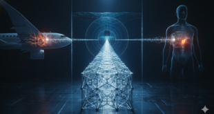
Space-based radar systems are powerful tools for assessing surface-level destruction, but they falter when asked to peer into the ground. This limitation stems from the fundamental behavior of radar waves, which weaken and scatter when encountering dense materials like concrete, metal, or compacted soil. Just as a flashlight can’t illuminate objects deep within fog, satellite radar loses clarity with depth, especially when resolution requirements tighten to the scale of individual human bodies.
Satellite-borne Synthetic Aperture Radar (SAR) systems are adept at mapping land deformations, identifying flood plains, or tracking glacier shifts. However, their resolution is typically measured in meters, making them ill-suited for locating objects as small and organic as humans under debris. Moreover, their limited penetration depth renders them ineffective in distinguishing features buried even a few meters below the surface. These constraints mean that while satellites offer a bird’s-eye view of disaster zones, they are not equipped to guide search-and-rescue teams to individual survivors beneath collapsed buildings or landslides.
The Real Heroes: Ground-Level Technologies in Action
In Wayanad, rescue efforts hinged on terrestrial and aerial technologies designed specifically for close-range detection. Ground-penetrating radar (GPR) and seismic sensors were deployed by military and emergency teams to scan the rubble directly. These systems work by sending electromagnetic or vibrational signals into debris piles and interpreting the echoes that bounce back. In some instances, radar pulses indicated the presence of voids or organic matter—raising initial hopes that survivors might be found, though many of these detections were ultimately linked to animals.
Aerial drones equipped with thermal imaging cameras played a key role in detecting heat signatures that were invisible to the naked eye. These drones hovered over unstable terrain, helping identify areas where trapped bodies might be generating warmth. Others carried LiDAR scanners to produce high-resolution 3D maps of the landscape, allowing operators to pinpoint hazardous zones and plan safer excavation routes.
Equally important were more traditional methods. Cadaver dogs trained to detect human scent worked tirelessly alongside technical teams, often locating bodies buried beneath thick layers of soil and concrete. Sensitive acoustic sensors, capable of picking up faint cries, breathing, or tapping, were also deployed to listen for any human activity in the silence of collapsed structures.
When cellular networks failed, amateur radio operators stepped in to restore vital communication links. Operating from improvised control centers, they enabled coordination between field teams and headquarters, proving that maintaining communication is just as critical as physical detection in emergency response scenarios.
Technology in Context: Complementary Strengths
Each technology brought into Wayanad had distinct strengths and limitations, underscoring the need for a hybrid approach. Satellite-based SAR excelled in broad, strategic overviews, offering insights into where roads were blocked or terrain had shifted. Ground radar systems provided more granular insights into subsurface anomalies but were constrained by depth and surface conditions. Thermal drones were effective at spotting heat sources in open areas, though their readings could be disrupted by thick layers of rubble or insulation. Cadaver dogs performed well in pinpoint detection but were limited by fatigue and environmental conditions. Even ham radio networks—though analog—became irreplaceable once digital infrastructure collapsed.
Table: Tech Strengths in Disaster Response
| Technology | Best For | Depth/Limitation | Kerala Application |
|---|---|---|---|
| Satellite SAR | Surface deformation, large cracks | Limited to surface/subsurface | Mapped 86,000 m² landslide area 15 |
| Ground Radar | Detecting voids, bodies under debris | Up to 20m in ideal conditions | Breathing detection in rubble 9 |
| Thermal Drones | Live heat signatures, night ops | Blocked by thick cover | Scanned unstable debris piles 5 |
| Canine Teams | Scent-based location | Weather-dependent | Located buried victims 9 |
Conclusion: Clarity Saves Lives
This layered approach demonstrated the importance of integrating multiple sensing modalities to build a complete operational picture. Instead of expecting a single “silver bullet” technology, the most effective rescue efforts combined airborne, terrestrial, and human elements to maximize coverage and accuracy.
Looking Beyond: Emerging Technologies with Future Promise
While current technologies have their merits, researchers are exploring even more advanced systems that might someday revolutionize disaster response.
Optimizing What We Have: The Hybrid Path Forward
In the near term, the most practical improvements lie in refining and integrating existing technologies. Drone swarms carrying multi-modal sensors—thermal, LiDAR, magnetic—can be deployed rapidly over affected areas, providing broad initial scans. Sensor fusion algorithms powered by artificial intelligence can cross-reference data from seismic, radar, acoustic, and magnetic sources to reduce false positives and highlight credible targets.
Deploying distributed networks of low-cost sensors across debris fields is another promising avenue. These networks, akin to projects funded by defense and disaster tech agencies, can continuously monitor environmental changes and detect patterns indicative of life or structural shifts. Meanwhile, scaling up the number of trained canine teams and standardizing drone deployment protocols can ensure that rescue teams are consistently equipped with the most effective tools.
Conclusion: Tech Must Match the Mission
The Wayanad landslide disaster underscored a critical lesson: disaster response technologies must be chosen not for their sophistication, but for their suitability to the challenge at hand. While satellite systems provide unmatched reach and speed in mapping large-scale devastation, they must be complemented by targeted, ground-based tools capable of detecting individual lives beneath debris.
As space and quantum technologies continue to evolve, their role in disaster management will expand. But for now, the key to saving lives lies in a coordinated, multi-tiered response that blends innovation with intuition, and machines with human skill. The final meters to a survivor are not traversed from orbit—they are crossed in the mud, with tools that listen, smell, scan, and hope.
 International Defense Security & Technology Your trusted Source for News, Research and Analysis


