International Defense Security & Technology Your trusted Source for News, Research and Analysis
Introduction:
The field of remote sensing plays a vital role in acquiring information about the Earth’s surface from a distance. Synthetic Aperture Radar (SAR) satellites, in particular, provide valuable insights by bouncing radar signals off the ground and creating images based on the reflections. DARPA’s DRIFT program aims to leverage SAR satellite constellations and develop innovative analysis algorithms to unlock new capabilities in remote sensing. This article explores the significance of SAR satellites, the challenges they address, and the objectives of the DRIFT program.
Remote sensing is the science of acquiring information about the Earth’s surface without actually being in contact with it. This is done by sensing and recording reflected or emitted energy and processing, analyzing, and applying that information. Unlike optical satellites that capture reflected sunlight to produce detailed photos of Earth, synthetic aperture radar (SAR) satellites bounce radar signals off the ground and record the reflections to create images. This allows radar satellites to collect high-resolution imagery day or night, regardless of cloud cover. This unique imaging capability makes SAR particularly useful for time-critical applications including change detection after natural disasters and identifying illegal fishing operations. Investments by the commercial and government sectors are leading to rapid growth in earth observation satellites and remote-sensing data.
For in-depth understanding on SAR technology and applications please visit: Introduction to Synthetic Aperture Radar (SAR)
During Russia’s invasion of Ukraine, space imagery, remote sensing and communications satellites have been informing the public and helping keep Ukrainian forces and civilians connected. An unprecedented release of commercial satellite imagery of Russia’s invasion of Ukraine – and the rapid sharing of that intelligence – was facilitated by U.S. intelligence agencies that already were familiar with the capabilities of the private sector and how they could be applied, a U.S. intelligence official said April 6.
“We partner with over 100 companies, we’re currently using imagery from at least 200 commercial satellites and we have about 20 or so different analytic services in our pipeline,” David Gauthier, director of commercial and business operations at the National Geospatial-Intelligence Agency (NGA), said during a panel discussion at the 37th Space Symposium.
The bad weather and heavy cloud coverage over Ukraine became a problem for optical imaging satellites that use visible, near-infrared and short-wave infrared sensors to produce photographic images. Those satellites can’t see through clouds so NGA turned to commercial operators of synthetic aperture radar (SAR) sensor satellites that can penetrate cloud cover and shoot pictures at night.
“We took commercial SAR, which was in our testing and evaluation pipeline, and we brought it directly to operations,” said Gauthier. “And we increased our purchasing power fivefold and started buying SAR capabilities all over the battlefield because of weather, quite honestly.”
Radar satellites have traditionally been big, expensive beasts, but technology developments are shrinking the size and cost of these platforms. A new trend in SAR technology arrived in 2018, however, with multiple launches of inexpensive small satellites (under 500 kg) carrying fully functional SAR sensors. Micro- and nano-satellites are attractive due to the low development and launching costs. Carried by micro- and nano-satellites, synthetic aperture radars (SARs) have great potential for urban, oceanography, land use, and agriculture usages.
However, the observation opportunities offered by current SAR satellite systems are insufficient from the perspective of rapid flood monitoring in the context of disaster management. In the context of flood monitoring, the disaster management community requires flood extent information with little latency and frequent updating, but inadequate satellite revisit time is one issue preventing the collection of this information. The dynamic flood process, which may both expand and shrink, is difficult to track within the limited time available.
Constellations of small satellites equipped with synthetic aperture radar (SAR) payloads can realize observations in short time intervals independently from daylight and weather conditions and this technology is now in the early stages of development.
Recent developments in small SAR satellites led by the commercial industry offer new opportunities to experiment with novel SAR-related concepts. DARPA launched the DRIFT program in Feb 2022 with goal to demonstrate advanced capabilities enabled by a cluster of SAR satellites flown in formation.
The Defense Advanced Research Projects Agency (DARPA) is soliciting innovative proposals to
develop novel algorithms that process data from clusters of synthetic aperture radar (SAR)
satellites to enable new capabilities. The program, Distributed Radar Image Formation Technology (DRIFT), is a vital part of the Mosaic Warfare end-state vision.
Program
The DRIFT program seeks to demonstrate novel processing algorithms on data from a cluster of
at least two SAR satellites flown in formation. The program consists of two Technical Areas
(TAs), but only abstracts and proposals for TA 2 are sought in response to this BAA.
Technical Area 1 (TA 1): Formation Flying and Data Collection
Under TA 1 (not solicited by this BAA), performers will create an approach to formation flying
small SAR satellites and joint collection. This will include the maneuver strategy, the tasking
algorithms, and the means to collect synchronized monostatic and bistatic data. It will also
involve non-recurring engineering (NRE) to tailor satellites to operate in this manner and to
produce monostatic and bistatic phase history data in the Government’s desired format. This
NRE will be limited to modifications to an existing satellite design, such as upgrading thrusters
or oscillators.
This program will not develop a new satellite or sensor. The DRIFT program
may then make a data purchase for on-orbit collection from a cluster of at least two satellites.
The satellites will be owned, launched, and operated by the performer. The output from the
TA 1 on-orbit collection will be radar data in Compensated Phase History Data (CPHD) format.
Technical Area 2 (TA 2): Algorithms
Under TA 2 (solicited by this BAA), performers will develop processing algorithms that operate
on the CPHD data from TA 1. The Government seeks to separately acquire data and algorithms,
using CPHD as a sensor-independent standard to enable interoperability. DRIFT TA 2 will be executed over three phases.
In Phase 1 (12 months, base period), TA 2 performers will develop algorithms and
software to process multi-satellite radar data to achieve objectives specified in the
Classified Addendum. The TA 2 performers will also generate simulated radar data and
use that data to test their algorithms and software to measure how their approach
performs relative to the TA 2 metrics for Phase 1. In parallel with TA 2 Phase 1,
performers under TA 1 will be preparing to collect on-orbit data.
In Phase 2 (12 months, option period), it is anticipated that a TA 1 performer will conduct
an on-orbit data collection campaign, and the collected data will be provided to the TA 2
performers to test and demonstrate their algorithms. TA 2 performers will process that
data and measure how their software performs relative to the TA 2 metrics for Phase 2.
In Phase 3 (12 months, option period), TA 2 performers will optimize their algorithms
and software to run on tactically relevant timescales.
DARPA envisions the on-orbit data collection campaign portion of Phase 2 to be an
approximately 3-month period during which the SAR cluster is maintained in passively safe
formation flight and collects approximately 1000 data sets. The TA 1 performer will downlink
and process the on-orbit data to CPHD, which will be provided to the Government and the TA 2
algorithm developers. The TA 1 and TA 2 performers and the Government will collaboratively
determine experimental objectives for the data collection campaign and will interact to ensure
data quality and share results.
For in-depth understanding on Advanced SAR technology and applications please visit: Advanced Techniques in Synthetic Aperture Radar (SAR) and their Applications
DRIFT Awards
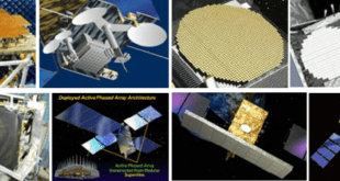
The Defense Advanced Research Projects Agency (DARPA) has awarded four companies contracts to provide data about formation flying of synthetic aperture radar satellites and algorithms for imagery processing, as part of an overarching effort to develop capabilities for what it calls “Mosaic Warfare” — a future version of multi-domain operations on steroids.
Under the new program, Digital Radar Image Formation Technology (DRIFT), SAR-sat operators Umbra and Terran Orbital’s PredaSAR will demonstrate at least two sats, each, flying formation to better see a target area to allow fusion of imagery via advanced processing. Umbra’s award is worth up to $4.5 million; PredaSAR’s, $500,000. Northrop Grumman and Jacobs were granted contracts worth $3.9 million and $4 million respectively to process the data gathered from those satellites.
Umbra will provide DARPA with data from “at least two” SAR satellites, according to a May 22 press release from the company. Likewise, Terran Orbital said in a May 18 press release PredaSAR will also “provide data products from at least two SAR satellites flying in formation and demonstrate novel data processing algorithms. The conceptual design work is expected to take several months and may lead to follow-on opportunities for prototyping and demonstrations.”
Master said key to DRIFT will be data gathered by the bistatic radar, meaning its transmitter and receiver are separated in different locations, because it “provides some really unique collection phenomenology that offers more information” that using a single, monostatic system.
“At the most basic level, you can picture that radar imagery is measurement of reflections of things in the scene. If you’re looking from one angle, there are things that will be angled and make a bright reflection back to you, but something that’s angled away may not because of your viewing geometry,” he said. “Now imagine you’re illuminating the scene from one source and receiving that reflection at a different location. You’ll see a unique set of reflections, giving you better insights than you’d get from one alone.”
Conclusion:
DARPA’s DRIFT program showcases the potential of SAR satellite constellations and analysis algorithms in advancing remote sensing capabilities. By leveraging small SAR satellites and innovative processing techniques, the program aims to revolutionize disaster management, environmental monitoring, and other critical applications. The ongoing collaboration between government agencies, performers, and the commercial sector paves the way for groundbreaking advancements in the field of remote sensing.
References and resources also include:
https://breakingdefense.com/2023/05/darpa-contracts-4-firms-for-drift-radar-imagery-experiments/