International Defense Security & Technology Your trusted Source for News, Research and Analysis
Related Articles

The warning bells has ringed in US, as Kim has finally succeeded in developing an ICBM operational capability through which it can deliver a nuclear weapon anywhere in the United States, according to analysis based on Images released by North Korea. North Korea released dozens of photos and a video after 29 Nov launch of the new Hwasong-15 missile, and leader Kim Jong Un declared the country had “finally realized the great historic cause of completing the state nuclear force”.
North Korea said the missile soared to an altitude of about 4,475 km (2,780 miles), more than 10 times the height of the International Space Station, and flew 950 km (590 miles) during its 53-minute flight before landing in the sea near Japan. In response, US is strengthening its Ballistic Missile Defence capabilities including the Redesigned Kill Vehicle, the Multi-Object Kill Vehicle, the Configuration-3 booster, a space-based sensor layer, boost phase sensor and kill technologies and additional ground-based interceptors.”
In its 2019 Missile Defense Review, the Department of Defense calls for “space-basing,” or putting sensors and interceptors in orbit to detect and defeat attacks as early as possible. The National Defence Authorisation Act, a year-end policy bill also hinted that US will seek to use advanced technology to defeat both small-scale and large-scale nuclear attacks through “research, development, test and evaluation” of space-based systems for missile defence. The US exchanges missile detection and warning information with its multinational partners.
Critical to space and missile defence is capability of well-organized missile warning system structure that allows commanders to maximize detection and warning of inbound ballistic missiles, thereby ensuring effective passive defense, active defense, and attack operations. Missile warning systems process raw sensor data into missile warning reports and disseminate the information to users globally. Missile warning consists of multiple ground and space-based systems located worldwide.
The Pentagon’s new Missile Defense Review highlights new space capabilities that could become the next layer of missile defense to deal with the threat of ballistic missile threats posed by North Korea and Iran. But while the earlier review focused exclusively on the ballistic-missile threat, the new review broadens the scope to include cruise missile and hypersonic threats being developed by Russia and China. A key point of emphasis in the review will be space-based capabilities that could help the U.S. stay ahead of the threat, according to the official.
The American missile warning mission uses a mix of space-based and terrestrial sensors. US’s Space-based Infrared System (SBIRS) is a constellation of integrated satellites in geosynchronous orbit (GEO) and high elliptical orbit (HEO) and ground-based data processing and command and control centers.This system is designed to provide early missile warning, cue missile defenses, deliver technical intelligence (TECHINT), and support battlespace awareness. These satellites are equipped with IR sensors that track the hot plumes of the launches.
Lockheed Martin has been awarded nearly $163.9 million for support of the space-based infrared system (SBIRS). The US Air Force’s (USAF) fourth Space-Based Infrared System (SBIRS) Geosynchronous Earth Orbit (GEO) satellite sent its first set of images back to Earth in May 2018. Known as ‘first light’, the event occurred when the SBIRS GEO Flight-4 missile-warning satellite turned on its powerful sensors for the first time during space vehicle checkout. Developed by Lockheed Martin, the SBIRS GEO Flight-4 is the latest satellite to join the USAF’s orbiting missile warning constellation.
The SBIRS will eventually be replaced by the Pentagon’s Next Gen Overhead Persistent Infrared satellites, which will include large GEO satellites and cheaper, smaller satellite operating in low earth orbit, the Air Force’s Space and Missile System Center confirmed.
ABC News has learned that another space technology that might be explored is the development of a space-based interceptor that could fire rockets into space, directed at an incoming missile. The Missile Defense Review also calls for the study of whether to use “directed energy” against incoming missiles, possibly through laser technology, according to the official. However, 2003 study by the American Physical Society concluded that a system of space-based interceptors designed to defeat boosting enemy missiles “would require a fleet of a thousand or more orbiting satellites just to intercept a single missile.”
Russia and China are also pursuing space based missile defence solutions. Russian President Vladimir Putin says Moscow is helping China build a system warning about ballistic missile launches. Since Cold War times, only the United States and Russia have had such systems, which involve an array of ground-based radars and space satellites. The system is essential for early spotting of intercontinental ballistic missiles. Speaking at an international affairs conference Thursday, Putin said that Russia has been helping China develop such a system. He added that “this is a very serious thing that will radically enhance China’s defense capability.”
Boost-phase defense
Intercepting missiles while their rockets are still burning would not be an effective approach for defending the U.S. against attacks by an important type of enemy missile. This conclusion comes from an independent study by the American Physical Society into the scientific and technical feasibility of boost-phase defense, focusing on potential missile threats from North Korea and Iran.
Boost-phase defense (disabling ballistic missiles while they are still under power) has recently received much attention as one possible element of a National Missile Defense system. However, the report shows that issues of timing severely limit the feasibility of this approach. The effectiveness of interceptor rockets would be limited by the short time window for intercept, which requires interceptors to be based within 400 to 1,000 kilometers of the possible boost-phase flight paths of attacking missiles. In some cases this is closer than political geography allows. Even interceptors that were very large and fast and that pushed the state of the art would in most cases be unable to intercept solid-propellant ICBMs before they released their warheads.
The study found that defending the United States against solid-propellant ICBMs would be impractical in many cases, because of their short burn times. According to the U.S. intelligence community, countries of concern could deploy such ICBMs within 10 to 15 years, about the same time the study judged would be required for the United States to field a boost-phase defense against ICBMs. Even against the longer burning liquid-propellant ICBMs that North Korea or Iran might initially deploy, a boost-phase defense would have limited use due to the requirement that interceptors be based close to potential missile flight paths. “According to U.S. intelligence estimates, North Korea and Iran could develop or acquire solid-propellant ICBMs within the next 10 to 15 years.
“Only two to three minutes would be available to achieve a boost-phase intercept, even assuming substantial improvements in systems for detecting and tracking missiles,” said Study Group co-chair Frederick Lamb. “Consequently, even fast interceptors could have difficulty catching liquid-propellant ICBMs and would be unable to catch solid-propellant ICBMs in time. In the most optimistic scenarios, the defense would have only seconds to decide whether to fire interceptors and could be required to make this decision before knowing whether a rocket launch were a space mission or a missile attack.” However, boost-phase defense against short- or medium-range missiles launched from ships off U.S. coasts appears technically possible, provided ships carrying interceptors could stay within about 40 kilometers of the threatening ships.
A system of space-based interceptors, also constrained by the short time window for intercept, would require a fleet of a thousand or more orbiting satellites just to intercept a single missile. Deploying such a fleet would require a five- to tenfold increase in the United States’ annual space-launch capabilities. The Airborne Laser currently in development has the potential to intercept liquid-propellant ICBMs, but its range would be limited and it would therefore be vulnerable to counterattack. The Airborne Laser would not be able to disable solid-propellant ICBMs at ranges useful for defending the United States.
However, with arrival of Hypersonic missiles and interceptors, the time available to achieve a boost-phase intercept is going to increase and poised to become little more feasible. ABC News has learned that one concept being explored for countering the North Korean missile threat in the future is using a new solid state powered laser on a high-altitude drone. The long-range laser would be able to destroy a North Korean missile while in the initial boost phase of its launch.
Russia and China are also pursuing space based ballistic missile warning system
Russia is pursuing unified space-based ballistic missile warning system, as was announced by Russian Defense Minister Sergei Shoigu. The system will help Russia detect moving targets at medium and high altitudes. Russia is fast tracking the deployment of such ballistic missile systems in response to the U.S.’ aggressive rearmament program of its cruise missile.
The new generation satellites will ensure much quicker identification of ballistic missile launches by detecting their engines’ exhaust plume in infrared light. The EKS-1 – the first such satellite of the unified space-based ballistic missile warning system was launched late 2015 by the Russian Aerospace Defense Forces.
China’s super-secretive Communications Engineering Test Satellite -1 (TXJSSY-1) that was launched by from the Xichang Satellite Launch Center on 12 September 2015 was speculated for early warning of ballistic missiles. Rumors initially suggested that this launch involved the first Great Wall (Changcheng) satellite – a new series of Chinese satellites dedicated to early warning similar to the American Space Based Infra-Red Sensor satellites.
China Shijian 11 satellites, the first of them was launched in 2009 followed by three launches in 2011. Expert analysis of the pattern of coverage suggested a possible near continuous monitoring of Northern Canada and Alaska. A large field of view sensor (or a combination of smaller field of view overlapping sensors) may provide the desired large area coverage for detecting missile launches.
In December 2015 China also launched the Gaofen 4 satellite into GSO (106 E) officially a civilian satellite used for the detection of hot spots in tropical storms. However given its reported stop and stare optical and IR sensors it could be the precursor for China’s GSO based “Early Warning” satellite.
Japan’s Kyodo News reported that China was building a missile defense system to detect a ballistic missile attack. The Kyodo News report was based on Chinese military documents that referred the development of an experimental early warning satellite program. Additionally the report pointed out that China had started the development of an X-band radar system as part of a ground-based interceptor system.
Russia planning unified space-based ballistic missile warning system for strategic deterrence by 2020
Russia has started to develop a line of defense systems similar to the United States’ Terminal High Altitude Area Defense (THAAD) and Ground-based Midcourse Defense (GMD) systems, local media reports announced. It is also planning to put in place an improved early warning system in space for detecting ballistic missile launches by 2020, a chief engineer from the Russian defense corporation Almaz Antey said recently.
Russia had lost its last Oko-1 geostationary satellite of its missile attack warning system (MAWS) last year, which had impacted the capability of the country’s strategic defense system, of which outer space segment was a critical part. To be fully operational, Oko-1 system needs four 73D6 satellites in placed in a highly elliptical orbit, dubbed ‘Molnya’ (lightning) orbit, to provide full-time coverage of the area of interest, and an additional backup satellite in a 71X6 geosynchronous orbit.
“MAWS are still fully operational, despite the fact that the geostationary satellites have been lost, as the Cosmos-2422 and Cosmos-2446 satellites, which operate in high orbits, are still running”, according to Igor Lisov of trade magazine Cosmonautics News. According to Lisov, geostationary satellites and high-orbit satellites can typically compensate for one another.
The current early warning system can detect any launches from any direction from south or north or any other. It is impossible to commit any act of aggression without us finding out,” Chief of Staff of the Main Centre for Missile Warning of the Russian Aerospace Forces, Colonel Viktor Tymoshenko said in an interview with radio RSN. According to him, the early warning system is constructed in such a way that it is ‘multi-channeled’ and can function on mass launches of dozens of ballistic missiles.
The first generation MAWS system was launched in 1982, when the first of four generations of 74D6 (US-K or Oko) satellites for high orbits was placed on alert. Experts believed that Russia’s early warning system, unlike that of the United States, did not provide global coverage. Russian early warning satellites have traditionally monitored only U.S. territory.The second second-generation system, placed in 1991 of the Oko-1 (US-KMO) and 71X6 geostationary satellites was also able to record sea-based missile launches and determine their flight trajectory. According to Soviet officials its early warning satellites could detect missile launches within 20 seconds of lift-off.
The first satellite of it’s new warning system, Known as ‘product 14F142’ is to be launched by a Soyuz-2.1b rocket and a Fregat third stage to a Tundra orbit – a highly elliptical orbit similar to Molnya, but with twice its period.
According to an RBTH source close to the Ministry of Defense, the lack of geostationary satellites is being compensated for by new horizon radar systems known as Voronezh-M and Voronezh-DM. Located in the Kaliningrad, Leningrad, Irkutsk, and Krasnodar regions, these stations operate in two frequency ranges: the meter range (Voronezh-M) and the decimeter range (Voronezh-DM). They create a radar field, which makes it possible to easily detect space objects and effectively prevent missile attacks.
The first early warning ground-based station for the new network has been built in the Altay region and it has passed state trial.The Russian Aerospace Forces are engaged in the centralized management of the air forces, air defense and missile defense, operation and supervision of spacecraft of the Russian orbital grouping. It is also responsible for the space control and early warning of missile attacks. The Russian Defence Ministry considers the continuous and stable functioning of missile attack warning systems to be a crucial element of strategic deterrence.
US Space based missile warning
The Missile Defense Agency (MDA) has chosen four companies to design space sensors that can track hypersonic and ballistic missiles. Northrop Grumman, Raytheon, Leidos, and L3Harris each received a $20 million contract to design a prototype sensor payload by the deadline of October 31, 2020.
The contract awards come nearly a year after the U.S. government’s Missile Defense Review, which called for deployment of space sensors to monitor, detect, and track advanced, maneuvering hypersonic glide vehicles from anywhere on the globe. According to wording in this review, space sensors “enjoy a measure of flexibility of movement that is unimpeded by the constraints that geographic limitations impose on terrestrial sensors, and can provide ‘birth to death’ tracking that is extremely advantageous.”
U.S. Missile Defense Agency must have a space-based sensor layer as part of its long-term plans to track ballistic missiles that could threaten the United States using a sensor in medium earth orbit, said Navy Vice Adm. James Syring, the head of the MDA, said the organization. “From a missile defense perspective, we have to develop a future operational space layer,” Syring said. “Given where the threat is going with hypersonics and more ICBMs and so forth this persistent tracking and discrimination capability from space is a must.”
Traditionally Ballistic Missile launches were detected by GSO . More recent US responses to ballistic missile threats, involve creating capabilities to intercept and deal with the threat during the boost and mid-course phases of the missile trajectory. To perform these functions US is looking at a constellation of satellites in LEO and maybe in MEO to perform the mid-course and boost phase detection as early as possible after the missile is launched.
Space-sensors increase the lethality and effectiveness of Ground Based Interceptors (GBIs), “but also adds to the lethality and effectiveness of every other element of the BMDS” such as the Patriot missile defense system, the Terminal High Altitude Area Defense system and the Aegis system, Tom Karako, a missile defense analyst at the Center for Strategic and International Studies, said.
In 2013, an Aegis Standard Missile-3 Block IIB fired on the basis of tracking from space, using a satellite, “and as a result dramatically increased its defended area because the defended area is a function of the radars and where we are right now is the radars, the missile basically has longer legs than the radars do,” Karako said. “Our defended area is held back not by the missile but by the sensors.
One sensor has been laying the groundwork for futuristic space-based missile defense for years: the Space Tracking and Surveillance System, or STSS, developed by Raytheon for Northrop Grumman. It watches for ballistic missiles, monitors space objects and relays intelligence data, all from low Earth orbit.“Space-based early warning gives our country an edge,” said Wallis Laughrey, vice president of Raytheon Space Systems. “The ability to track a missile from the time it’s launched is the key to effectively eliminating the threat.”
The system uses what is known as ‘boost-to-intercept’ tracking – meaning it can see a ballistic missile from the moment it launches to the moment a defensive strike destroys it. The system was the first of its kind to detect and track multiple targets from space at the same time.And it’s a survivor. Originally built to last two years on-orbit, STSS marked its tenth year of space operations in September 2019. On average, Raytheon’s space-based sensors outperform their design life by two and a half times.
“STSS proved that we can do this mission on low-Earth orbit during real operations with real threats flying,” said Mark Davis, director at Raytheon Space Systems. “Our next goal is to do it at a cost point that we can build dozens or maybe hundreds of satellites to do this mission across the whole globe in low Earth orbit.”
However space base missile defence face many challenges including discrimination of the warhead from the decoys and their continued tracking is a crucial requirement. Clouds, the sunlight and the moon are other sources of radiation that could corrupt the signal. The US Mid-Course Space Experiment collected signatures of various Re-entry Vehicles to build a data bank for the designing of suitable algorithms that help identify the RV from clutter, backgrounds and chaff.
The appropriations measure states that the US Missile Defence Agency would have the job of producing “a highly reliable and cost-effective” sensor architecture capable of “precision tracking of threat missiles,” “discrimination of warheads” and “effective kill assessments”.
American space-based sensors, such as Defense Support Program and space-based infrared system, usually provide the first level of immediate missile detection. Some satellite sensors also accomplish nuclear detonation detection. Ground-based radars provide follow-on information on launches and confirmation of strategic attack. The majority of their day-to- day mission is space surveillance; however, the radars are always scanning the horizon for incoming missiles.
Once it detects significant activity, that information is transmitted to Air Force Space Command in Colorado and subsequently to North American Aerospace Defense Command (NORAD) and other relevant parts of the military who will decide whether the launch threatens the United States or its interests. Missile warning includes the notification to national leaders of a missile attack against North America, as well as attacks against multinational partners. It also includes notification to multinational partners and forward deployed personnel of missile attack
Defense Support Program satellites use an infrared sensor to detect heat from missile or booster plumes against the relatively cool background of the Earth’s surface. These geosynchronous satellites that were designed to detect strategic ballistic missiles in the early stage of launch of their flights, have provided uninterrupted warning since the early 1970s.
USA SBIRS space sensor system
On 19 January, the SBIRS GEO Flight-4 was successfully launched on-board a United Launch Alliance (ULA) Atlas V rocket from Space Launch Complex 41 at Cape Canaveral Air Force Station, Florida, US. Only 37 minutes after its launch, the satellite began responding to the USAF’s 460th Space Wing’s commands. Completing the baseline SBIRS constellation, the Flight-4 satellite joins SBIRS GEO Flights-1, 2 and 3, which were launched in 2011, 2013, and 2017 respectively. In 2014, the USAF awarded a $1.86bn contract to Lockheed Martin for the development of the SBIRS GEO-5 and 6 spacecraft.
“With the launch of this satellite, SBIRS can now provide global coverage, with better-than-specified sensor pointing accuracy and the ability to detect even more targets than anticipated.” The satellite, which is integrated with powerful scanning and staring infrared surveillance sensors, collects data to be used in the US military to detect missile launches, support ballistic missile defence, expand technical intelligence gathering, and strengthen situational awareness on the battlefield.
The SBIRS architecture includes a resilient mix of satellites in geosynchronous earth orbit (GEO), hosted payloads in HEO orbit, and ground hardware and software. The integrated system supports multiple missions simultaneously, while providing robust performance with global, persistent coverage.
The SBIRS program delivers timely, reliable and accurate missile warning and infrared surveillance information to key decision makers. The system enhances global missile launch detection capability, supports the nation’s ballistic missile defense system, expands the country’s technical intelligence gathering capacity and bolsters situational awareness for warfighters on the battlefield.
The constellation has a continuous view of all of the earth’s surface, which it images every 10 seconds while searching for infrared (IR) activity indicating heat signatures. SBIRS is able to detect missile launches faster than any other system and can identify the missile’s type, burnout velocity, trajectory, and point of impact. Though the system was designed primarily for missile defense purposes, its short- and mid-wave IR sensors can detect any significant infrared event on the globe, including explosions, fires, and plane crashes.
This system is intended to replace the aging DSP system of satellites.SBIRS satellites are able to scan large swaths of territory to detect missile activity and can also hone in on areas of interest for lower-scale activities, including launches of tactical ballistic missiles. These sensors are independently tasked, meaning the satellite can both scan a wide territory and fixate on a particular area of concern simultaneously.
The first satellite, SBIRS GEO-1, launched in May 2011 and was followed in March 2013 by the SBIRS GEO-2 satellite.2 In July 2015, the Air Force delivered its third satellite, though it plans to store it and launch the fourth satellite first, which is slated for an October 2016 launch.3 In addition to the dedicated satellites in GEO, the system also includes two missile warning sensors hosted on classified satellites in HEO that were launched in November 2006 and June 2008.
Spacebased Kill Assessment, which would use sensors hosted onboard nondedicated commercial vehicles
The Fiscal Year 2014 National Defense Authorization Act directed the Missile Defense Agency to address hit and kill assessment for the Ballistic Missile Defense System. An internal study on space highlighted strategies that could provide sensor capabilities at lower price points. The MDA is requesting $22 million next year for the Spacebased Kill Assessment experiment. The Spacebased Kill Assessment , the experimental network of space-based sensors that will fly into commercially hosted payloads that will verify whether incoming missiles have been destroyed by defensive interceptors and no longer pose a threat.
The Spacebased Kill Assessment consists of “a network of sensors, each mated to a different satellite; and the total number of sensors and where they are placed in the network are specifically tailored for the kill assessment mission,” the MDA budget documents said. The individual sensors house three infrared detectors used to collect the energy signature of the impact between a threat ballistic missile and an interceptor of the Ballistic Missile Defense System. The SKA experiment is currently in the satellite integration and testing phase and is expected to be on orbit in 2018. Each sensor would weigh about 10 kilograms. John Hopkins University’s Applied Physics Lab is developing the entire experiment.
The first experimental missile-warning sensor, known as the Commercially Hosted Infrared Payload, or CHIRP, was launched aboard the SES-2 telecommunications satellite owned by fleet operator SES of Luxembourg. The program is widely viewed among government and industry officials as validation of the hosted payload concept.
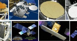
US Air Force Developing Next Generation Missile Warning Satellite
Following along the path of STSS, Raytheon is developing a new wave of space-based missile warning and defense systems that include a more responsive identification system to discriminate threats from space. Those new systems include Next Gen OPIR, which uses three GEO and two polar satellites to provide early warning of intercontinental ballistic missiles and theater ballistic missiles. The system, which the government has dubbed a “go-fast” program, is expected to be operational by 2029.
Another system, one the Pentagon’s Defense Advanced Research Project Agency has dubbed Blackjack, will provide an additional layer of persistent global coverage. The Blackjack system will work autonomously to network multiple sensors together from low-Earth orbit. The goal is to demonstrate sensors that are low in size, weight and power – and can be mass-produced to fit on commercial, low-Earth satellites. Both programs benefit from technology first developed on STSS.
Lockheed Martin Space Systems has secured a $2.935bn order for three next-generation overhead persistent infrared (OPIR) geosynchronous Earth orbit space vehicles. Awarded by the US Space and Missile Systems Center Los Angeles Air Force Base, the contract covers design and development of OPIR satellites, requirements analysis, and procurement of critical path flight hardware. The company will also provide early manufacturing and risk reduction efforts to support the system critical design review. The Air Force wants a new missile warning constellation that would be more survivable against counter space weapons being developed by China and Russia.
Lockheed Martin spokesman Chip Eschenfelder said the company will be “working closely with the Air Force on the rapid development of next gen OPIR’s more advanced, resilient missile warning capability. We understand the need to ‘go fast’ while improving our national security posture against emerging threats around the world.
On April 17, the U.S. Air Force announced procurement plans for its next generation of missile warning satellites. Canceling further satellites launches for the Space Based Infrared System (SBIRS) constellation, the Air Force is instead transferring to a new program dubbed the Next Generation Overhead Persistent Infrared.
Air Force Secretary Heather Wilson wants the new satellites to be more survivable and fielded more quickly. “We aren’t going to spend years on an analysis of alternatives. We will drive toward simplicity and use known sensor technology,” she said, according to prepared remarks of her speech.
Procurement is scheduled in five years, yet analysts are uncertain as to what the new constellation will look like. “We’re not ready to say what we think the right mix is,” said Dr. Will Roper, Assistant Secretary of the Air Force for Acquisition, Technology, and Logistics. “Part of moving to prototyping is acknowledging that you’ve got some experimentation and discovery to do. There are benefits to having things in LEO, there are benefits to having things in GEO, there are benefits to having things in highly elliptical orbits…We need things that work together to give us a resilient architecture.”
Chief of Staff Gen. Dave Goldfein added that the new satellites must also be part of a defendable architecture. That, Wilson said, could mean giving those satellites defensive capabilities, making them more maneuverable or putting more fuel onboard. Part of that survivability could also involve putting the missile warning satellites in a mix of different orbits.
Of the two agreements, the first contract will be awarded to Lockheed Martin Space, which, under the terms of the deal, will be responsible for defining requirements, creating the initial design, as well as identifying and procuring flight hardware for a satellite to operate in geosynchronous orbit. The second of the two contracts will be sole-sourced to Northrop Grumman Aerospace Systems in order to define polar system requirements. The Space and Missile Systems Center’s Remote Sensing Systems Directorate at Los Angeles Air Force Base, California, serves as the acquisition programme office.
GEO satellite program completes preliminary design reviews
The U.S. Space Force’s Space and Missile Systems Center (SMC), Next Generation Overhead Persistent Infrared (OPIR) Geosynchronous Earth Orbiting (GEO) satellite program, commonly referred to as NGG, completed its preliminary design reviews (PDR) for its two candidate mission payloads, May 2020. The NGG program is developing two infrared mission payloads in a competitive, parallel development effort to mitigate schedule risks for the first NGG satellite launch in 2025.
The two mission payload provider teams, Raytheon Space and Airborne Systems (RSAS) and Northrop Grumman Aerospace Systems (NGAS) with Ball Aerospace, will each design, manufacture, assemble, integrate, test, and deliver one mission payload to fly on the first two of three planned NGG satellites. As the Space Force pushes for rapid delivery of the first NGG satellite for launch by 2025, this key milestone demonstrates the program is on track. Completing the payload PDRs was important, as the payloads are the critical path for the first NGG satellite delivery.
“NGG is a critical piece of our missile warning architecture that will deliver a capable, resilient, and defensible missile warning system to counter determined adversaries,” said Col. Dennis Bythewood, program executive officer for Space Development. “This milestone demonstrates our ability to move with deliberate speed, while maintaining the technical and programmatic rigor needed to ensure success.” The NGG program is developing two infrared mission payloads in a competitive, parallel development effort to mitigate schedule risks for the first NGG satellite launch in 2025.
References and Resources also include:
http://www.spaceref.com/news/viewpr.html?pid=55740