 International Defense Security & Technology Your trusted Source for News, Research and Analysis
Introduction: Quantum teleportation has long been a staple of science fiction, capturing our imaginations with visions of instantaneous transportation across galaxies. While teleporting physical objects remains elusive, scientists have achieved a groundbreaking feat by teleporting images across a network using quantum mechanics principles. This revolutionary advancement opens doors to secure and …
Read More »Safeguarding Against Nuclear Threats: Leveraging Advanced Modeling and Simulation
The threat posed by nuclear weapons looms large in the landscape of global security. While some nations openly brandish their nuclear capabilities, the specter of clandestine proliferation and the potential for terrorist acquisition cast a shadow over international stability. Understanding the intricacies of nuclear weapons effects is paramount for devising …
Read More »Avalanche Photodiode (APD): From Theory to Practice in Optical Sensing
Introduction: In the world of optical sensing, Avalanche Photodiodes (APDs) have emerged as a crucial technology that enhances the sensitivity and efficiency of light detection. Building on the principles of traditional photodiodes, APDs utilize the avalanche effect to amplify the photocurrent, making them suitable for a wide range of applications …
Read More »Embracing CO2: A Natural Refrigerant Revolutionizing Heating, Cooling, and Power Generation
For decades, our refrigerators and air conditioners have relied on synthetic refrigerants, some of which have been linked to environmental damage. But what if the answer to sustainable climate control was hiding in plain sight – the very gas we’re trying to reduce: carbon dioxide (CO2)? Embracing CO2 as a …
Read More »Advancing Radar Technology: Chinese Naval Scientists Achieve Breakthrough in Radar Signal Analysis
Introduction: Recent research published in the journal Radio Science and Technology has unveiled a groundbreaking achievement in radar technology by Chinese naval scientists. Led by scientist Song Jie from the PLA Naval Aviation University, the team has developed a novel method for analyzing radar signals emitted by other countries’ military …
Read More »Advancing Camouflage: Military’s Response to Thermal Imaging Threats

Introduction: In the ever-evolving landscape of modern warfare, the development and deployment of advanced technologies have revolutionized military strategies and tactics. Among these technologies, thermal imaging cameras have emerged as a formidable tool, enabling enhanced visibility and detection capabilities on the battlefield. However, with this increased visibility comes a new …
Read More »Unveiling the Krasukha Electronic Warfare system: Russia’s Shield Against Airborne and Satellite Threats
Introduction: In an era marked by escalating tensions and evolving warfare techniques, the role of electronic warfare (EW) systems has become increasingly critical. Among these cutting-edge systems stands the Krasukha Electronic Warfare System, a formidable defense against both airborne and satellite threats. Developed by Concern Radio-Electronic Technologies (KRET), a subsidiary …
Read More »Pioneering the Final Frontier: Advancements in Space Microelectronics Propel Future Missions
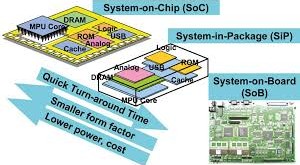
Introduction: In the realm of space exploration, the race to unlock the mysteries of the universe and expand humanity’s reach beyond Earth’s bounds is accelerating. With NASA’s ambitious plan to send humans to Mars by 2033 and China’s announcement of a manned moon base, the stakes have never been higher. Meanwhile, …
Read More »Breaking the Heat Barrier: Latest Breakthroughs in Cooling Quantum Computing Systems
Quantum computing is an emerging technology with the potential to revolutionize computing and solve some of the most complex problems that classical computers cannot solve. However, quantum computing systems are highly sensitive to external disturbances such as heat, which makes cooling them a crucial factor for their operation. In this …
Read More »Future of Battlefield Repair: The Rise of Telemaintenance
In the modern era of warfare, maintaining military equipment has become increasingly complex and challenging. Traditional maintenance methods often face obstacles such as logistical constraints, limited accessibility, and the need for specialized personnel. To overcome these challenges, military forces worldwide are turning to telemaintenance, a revolutionary approach that leverages remote …
Read More »