Home / Security & Threat Management / Eyes in the Sky: How Space Technology is Revolutionizing Disaster Management

Eyes in the Sky: How Space Technology is Revolutionizing Disaster Management

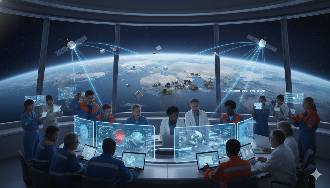
Eyes in the Sky: How Space Technology Is Transforming Global Disaster Management

A cinematic journey into how satellites, AI, and next-gen sensors form humanity’s new planetary shield against natural disasters.

The Unseen Guardians Orbiting Earth

When Hurricane Maria tore through Dominica in 2017, overhead satellites from both Russia and France were able to capture before-and-after images within mere hours. These images laid bare the devastation’s contours, enabling relief agencies to prioritize aid delivery and rescue operations. This rapid-response capability has since become emblematic of how space-based technologies now underpin every stage of disaster management: predicting hazards, preparing at-risk communities, coordinating emergency response, and guiding long-term recovery. As climate change intensifies the frequency and severity of weather-related disasters, these orbital sentinels have transformed from useful tools into essential guardians of global resilience.

Prevention and Early Warning: From Prediction to Preparedness

The first line of defense begins well before a disaster unfolds. Thanks to machine learning and next-generation satellite sensors, our capacity to forecast risks has dramatically improved. In wildfire-prone California, Lockheed Martin’s IRIS system now monitors ground temperature anomalies from orbit. With an infrared payload capable of detecting ignition signatures within 90 seconds—three times faster than most terrestrial systems—these satellites flagged over 80% of fire outbreaks during the 2023 season before local reports were filed.

Space-based technologies have revolutionized early warning systems, transforming disaster prediction from reactive guesswork into precise, life-saving foresight. Geostationary satellites like the GOES (Geostationary Operational Environmental Satellite) and Japan’s Himawari series continuously monitor atmospheric patterns over large regions, enabling forecasters to track storm development in real time. Their high-resolution imagery and frequent updates allow for accurate hurricane path predictions up to 72 hours in advance, buying critical time for evacuation planning and infrastructure protection. These tools are vital in regions prone to cyclones and extreme weather, where every hour of lead time can translate to thousands of lives saved.

Flood prediction has advanced equally rapidly. NASA’s Surface Water and Ocean Topography (SWOT) satellite, launched to map river levels globally, now works in tandem with AI algorithms that analyze rainfall, terrain, and soil saturation. In India’s 2024 monsoon season, this combined system achieved a 94% accuracy rate in predicting flood-prone areas five days in advance—empowering authorities to move vulnerable populations ahead of time.

Beyond atmospheric monitoring, space technologies are being used to detect geophysical signals that precede seismic events. Networks of GPS satellites and ground receivers measure infinitesimal ground shifts—sometimes just a few millimeters—enabling the identification of strain buildup along fault lines. These subtle movements can offer seconds to minutes of warning before an earthquake strikes, allowing automated shutdowns of gas lines and transportation systems. Additionally, satellites like NASA’s Surface Water and Ocean Topography (SWOT) mission deliver high-resolution data on river elevation and hydrological patterns, while the European Commission’s Global Human Settlement Layer (GHSL) maps urban sprawl in flood-prone areas. Together, these capabilities help urban planners and disaster managers preemptively identify high-risk zones and design smarter, more resilient cities before a disaster ever occurs.

Meanwhile, seismic forecasting is stepping into a new era with the upcoming NASA-ISRO Synthetic Aperture Radar (NISAR) mission. This satellite is designed to detect ground deformations smaller than a centimeter. Integrated with deep-learning models trained on historical seismic activity, such data provides crucial early warning windows in megacities like Tokyo and Los Angeles—giving infrastructure systems enough time to shut down rail lines, gas mains, and power grids seconds before an earthquake strikes.

Emergency Response: Faster, Smarter, Safer

When a disaster hits, speed saves lives. The “golden hour” of emergency response has been radically redefined by orbital intelligence. Satellites equipped with synthetic aperture radar (SAR) can now see through smoke, clouds, and night—enabling near-instant mapping of collapsed structures. During the 2024 Turkey earthquake, SAR-equipped satellites identified 89% of damaged zones within two hours, directing ground rescue teams with unprecedented precision.

In parallel, hyperspectral satellites are proving vital in industrial accident response. After the Texas freeze of 2023, sensors flagged three ammonia gas leaks invisible to the naked eye, allowing first responders to evacuate impacted zones quickly. Even more transformative is the rise of on-board artificial intelligence. Satellites like PhiSat-2 now analyze flood imagery directly in orbit, bypassing ground relays. This innovation cut data-to-decision time from three hours to just eight minutes during severe flooding in Mozambique.

The pace and precision of emergency response have been transformed by space-based technologies. In the wake of the devastating 2004 Indian Ocean tsunami, the International Charter on Space and Major Disasters coordinated an unprecedented effort—activating 19 satellites to deliver over 200 damage maps within just 72 hours. That rapid imagery was crucial in guiding aid delivery and identifying areas most in need. Today, satellite-based systems operate with even greater speed and accuracy. The COSPAS‑SARSAT network, for example, uses low-Earth orbit and geostationary satellites to detect and locate distress signals from ships, planes, and hikers, often identifying positions to within 100 meters in under five minutes. This real-time capability is a game-changer for search-and-rescue missions, where every second can mean the difference between life and death.

Meanwhile, satellite systems like NASA’s Fire Information for Resource Management System (FIRMS) provide near-real-time wildfire detection and spread analysis, enabling firefighting units to target hotspots with precision. These insights are particularly vital in regions prone to rapid fire escalation due to wind or terrain.

Moreover, space-based internet platforms such as SpaceX’s Starlink have proven invaluable in crises where terrestrial communication infrastructure has been destroyed or jammed.  During the conflict in Ukraine, for instance, Starlink quickly restored connectivity for emergency responders and humanitarian agencies, allowing for seamless coordination of relief efforts. In war-affected Ukraine, emergency networks were up within 48 hours, facilitating coordination between relief workers, field hospitals, and evacuation teams in otherwise disconnected regions. Whether it’s locating survivors, tracking disaster evolution, or restoring essential communications, satellites now form the backbone of a global emergency response system that is faster, smarter, and more resilient than ever before.

Recovery: Mapping the Path to Renewal

When the dust settles after a disaster, satellites become indispensable tools for orchestrating recovery and reconstruction. By capturing longitudinal imagery, they provide powerful insights into environmental regeneration—such as tracking the gradual return of mangrove forests following tsunamis. These images not only symbolize ecological resilience but also quantify ecosystem services like carbon sequestration, crucial for climate adaptation strategies. Satellite-derived data ensures that recovery efforts align with sustainability goals rather than reverting to pre-disaster vulnerabilities.

Emergency mapping services like the EU’s Copernicus program further streamline post-disaster logistics. By producing near-real-time maps, they help reroute aid convoys around debris-blocked infrastructure and flag anomalies—such as misallocated or diverted supplies—that might otherwise go unnoticed. In the U.S., agencies like FEMA have incorporated high-resolution satellite imagery into their post-event assessments, cutting both time and cost by eliminating the need for broad on-the-ground surveys. These data-driven approaches ensure that reconstruction is not only faster but also smarter—targeting reinvestment where it builds long-term resilience, reinforces community preparedness, and supports a more adaptive infrastructure for future shocks.

New Frontiers: AI, Constellations, and Next-Gen Sensors

As the scope and scale of natural disasters grow, so too does the sophistication of the tools used to combat them. Artificial intelligence has emerged as a game-changer, analyzing vast streams of satellite data to predict flooding events up to five days in advance by linking current soil moisture levels with historical climate patterns. In the immediate aftermath of catastrophes, AI-powered change detection algorithms rapidly flag collapsed buildings and infrastructure damage within minutes of satellite overpasses—accelerating response times and enhancing the efficiency of life-saving operations. Meanwhile, CubeSat constellations like those operated by Planet Labs have revolutionized Earth observation, providing daily global coverage. Their nimble, low-cost platforms have already demonstrated their value—detecting over 80% of California wildfire ignitions ahead of ground-based reports and exposing illegal deforestation with near-meter resolution imagery.

The horizon for disaster management is even more transformative. Quantum sensors, now in experimental stages, may soon map subterranean water resources and fault lines with unprecedented millimeter-level accuracy—providing a deeper understanding of pre-disaster vulnerabilities. Swarms of autonomous drones, guided by satellite data, are being developed to scout areas too dangerous or remote for human responders. And construction innovations, such as 3D-printed shelters based on lunar habitat research, are being repurposed for rapid assembly in post-disaster zones. Together, these advances signal a future where the response to crises is not only faster and more informed but increasingly anticipatory—shifting the paradigm from reaction to resilience.

From Orbit to Action: Real-World Impact

Space-based technologies are no longer abstract tools confined to research papers—they are dynamic instruments delivering concrete, life-saving results across the globe. The transition from data to decisive action is happening in real-time, from bustling megacities to the world’s most vulnerable and remote regions.

The power of this orbit-to-ground integration was starkly demonstrated when Typhoon Rai devastated the Philippines in late 2021. The European Union’s Copernicus Emergency Management Service swung into action, producing 178 high-resolution satellite damage maps within a critical 48-hour window. This rapid, precise geospatial intelligence allowed United Nations agencies and humanitarian partners to cut through the chaos, prioritizing logistics, allocating resources efficiently, and ensuring aid reached the most isolated communities. This event set a new standard for the life-saving power of Earth observation.

This capability is now being replicated and enhanced worldwide. In Bangladesh, a partnership between the Asian Disaster Preparedness Center and the Norwegian Refugee Council is using satellite-based flood modeling to trigger anticipatory cash payments to at-risk families. Days before floodwaters peak, families receive funds to evacuate, protect their assets, and buy supplies, transforming disaster response from reactive to proactive.

Beyond immediate response, predictive analytics are creating a new frontier in pre-emption. In 2024, NASA’s AI-integrated FireSat system accurately predicted the spread of bushfires across Australia with an impressive 94% reliability. This foresight gave emergency crews a decisive window to implement evacuations and deploy containment strategies before fires escalated into megablazes. Similarly, in Canada, after its record-breaking wildfire season, the government is integrating data from its RADARSAT Constellation Mission with AI models to identify high-risk zones and guide preventative forest management.

Perhaps the most profound impact is in building long-term resilience against slow-onset disasters. In drought-prone Kenya, nanosatellites from companies like Planet Labs are providing early warnings by detecting subtle, localized zones of residual soil moisture. Armed with this information, farmers were able to shift planting strategies and select drought-resistant crops in time, helping avert a major food crisis for over 200,000 people. This is mirrored in India, where the government’s FASAL (Forecasting Agricultural output using Space, Agrometeorology and Land-based observations) program uses satellite data to monitor crops across millions of hectares, providing vital production forecasts that stabilize markets and inform national food security policies.

From the floodplains of South Asia to the farmlands of Africa and the fire-prone bush of Australia, these examples underscore a fundamental shift: orbit-to-ground integration is turning pixels into protection, algorithms into action, and satellite signals into saved lives and livelihoods.

The Road Ahead: Democratizing Disaster Defense

Despite the progress, persistent hurdles remain. Data latency, the high cost of high-resolution imagery, and unequal access to technical expertise still create a capability gap between nations. However, the global momentum toward a more inclusive and resilient disaster management framework is undeniable, driven by a concerted effort to democratize space technology.

International collaboration is at the heart of this movement. Through the UN-SPIDER (United Nations Platform for Space-based Information for Disaster Management and Emergency Response) program, 87 countries now openly share satellite data and technical know-how, fostering a culture of transparency and mutual support. This is complemented by regional initiatives like the Sentinel Asia partnership, led by JAXA (Japan Aerospace Exploration Agency), which provides rapid disaster monitoring and support to over 50 countries in the Asia-Pacific region.

Technology itself is breaking down cost barriers. The proliferation of low-cost CubeSats and small satellites is revolutionizing access, offering robust Earth observation services that were once the exclusive domain of billion-dollar government payloads. Companies in emerging spacefaring nations, such as Satellogic in Latin America and Spire Global with its global satellite constellation, are making high-frequency data more accessible than ever before.

Crucially, the focus is shifting from simply providing data to building local capacity. NASA’s ARSET (Applied Remote Sensing Training) program is a prime example, having trained thousands of emergency managers, scientists, and policymakers worldwide to harness satellite-derived data for local decision-making. Similar programs, like ESA’s Earth Observation for Sustainable Development initiative, are building in-country expertise across Africa to manage natural resources and respond to disasters.

As Maryanne Muriuki of the Space Generation Advisory Council aptly puts it, this technological integration “is not just about advanced warning—it is empowering communities to architect their own resilience.” From farmers in Kenya using satellite alerts to plan their harvests to urban planners in Mexico City using InSAR data to monitor land subsidence, the tools of space are being woven into the fabric of local governance. With the right tools, knowledge, and partnerships, disaster defense is no longer the exclusive domain of a few advanced nations—it is rapidly becoming a shared global shield, protecting lives and livelihoods everywhere.

A New Dawn for Disaster Management

In just a few orbits, we have built a global system that can forecast storms, guide rescue crews, validate rebuilds, and even prevent disasters before they strike. As constellations multiply, AI sharpens our vision, and sensors delve deeper beneath Earth’s surface, we’re entering an era where no community is invisible and no disaster unrecoverable. The orbiting sentinels now weaving the fabric of our global safety net may one day mean the difference between disaster and survival.

About Rajesh Uppal

Check Also

The Silent Arms Race: Antarctica’s Creeping Militarization Threat

“Antarctica’s vast whiteness hides more than ice—it conceals the future battleground of great power competition.” …

wpChatIcon
wpChatIcon