Home / Security / Catastrophic Wildfire Threat: The Need for Advanced Prevention, Detection, and Suppression Technologies

Catastrophic Wildfire Threat: The Need for Advanced Prevention, Detection, and Suppression Technologies

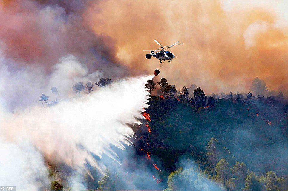
Wildfires are becoming a growing concern worldwide, with devastating consequences for ecosystems, human lives, and economies. The increasing frequency and intensity of these fires are linked to climate change, urban expansion, and mismanaged forests. To mitigate the catastrophic threat posed by wildfires, innovative technologies in prevention, detection, and suppression are critical. This blog explores the evolving wildfire landscape and the cutting-edge solutions being deployed to combat this escalating crisis.

The Growing Threat of Wildfires

In recent years, wildfires have caused unprecedented damage. Countries such as the United States, Australia, and Greece have witnessed some of the most destructive fires in history. The 2019-2020 Australian bushfire season, for instance, burned over 46 million acres, destroyed thousands of homes, and killed or displaced nearly 3 billion animals. In the United States, the 2020 fire season was equally catastrophic, with over 10 million acres burned and billions of dollars in damages.

The Devastating Impact of Wildfires

In August 2020, a catastrophic series of wildfires ravaged California, resulting in the destruction of hundreds of buildings, the scorching of nearly a million acres of land, and the loss of at least six lives. These fires, ignited by nearly 12,000 lightning strikes in a dry, parched terrain, led to the creation of approximately 600 new wildfires. Jeremy Rahn, a public information officer for Cal Fire, termed this event a “lightning siege.” The wildfires forced over 100,000 people to evacuate as they burned an area larger than Rhode Island. The National Guard provided helicopter support, while the Air National Guard and Air Force Reserve used C-130 aircraft equipped with water tanks to combat the flames from above.

Earlier in 2018, wildfires devastated several U.S. states, including California, which experienced its largest wildfire in recorded history. The Mendocino Complex Fire consumed around 459,000 acres, destroyed nearly 300 buildings, and killed one firefighter. That same year, the Camp Fire became California’s deadliest wildfire, destroying nearly 19,000 structures and claiming 85 lives. These wildfires released 68 million tons of carbon dioxide, comparable to the annual carbon emissions for powering the entire state, according to the Interior Department.

Wildfires in Canada and the U.S. burn an average of 54,500 square kilometers (13,000,000 acres) annually. In the U.S., between 60,000 and 80,000 wildfires occur each year, burning an average of 7 million acres. In 2017, the U.S. Forest Service spent a record $2 billion tackling wildfires. Over the past decade, the U.S. Forest Service and Department of the Interior have spent a combined average of $1.5 billion annually on wildfire suppression.

The cost of suppressing, containing, and extinguishing wildfires is escalating as fire seasons grow longer and the frequency, size, and severity of wildfires increase. In Indonesia, between June and October 2015, over 100,000 fires burned millions of hectares of forest land, causing significant human and animal fatalities and economic damage exceeding $15 billion. Worldwide, the annual damage from wildfires is in the billions of euros, with wildfires scorching 330-431 million hectares of global vegetation each year between 1997 and 2008.

Factors Leading to Wildfires

Wildfires are “quasi-natural” hazards, meaning they result from both natural and human causes. Major factors leading to wildfires include the presence of fuels, an ignition source, and conducive weather conditions. Natural causes of wildfire ignitions include lightning, volcanic eruptions, sparks from rockfalls, and spontaneous combustion. In Canada and northwest China, lightning is the primary ignition source, while in the U.S. and Australia, both lightning strikes and human activities such as machinery sparks and discarded cigarette butts play significant roles.

Natural Causes

  1. Lightning: A significant cause in many regions, particularly Canada and northwest China. Lightning, especially “dry” thunderstorms, can ignite fires without accompanying rain.
  2. Volcanic Eruptions: Lava and hot ash from eruptions can ignite surrounding vegetation.
  3. Sparks from Rockfalls: When rocks collide and create sparks, they can start fires in dry conditions.
  4. Spontaneous Combustion: Under specific conditions, organic materials can self-ignite due to internal heat buildup.

Human Causes

Human activities are a major contributor to wildfires globally, with various causes depending on the region:

  1. Machinery Sparks: Sparks from agricultural, construction, or other machinery can ignite dry vegetation.
  2. Discarded Cigarette Butts: Common in many countries, careless disposal of cigarettes can start fires.
  3. Agricultural Practices: In regions like Central and South America, Africa, and Southeast Asia, fires are often used for land-clearing and animal husbandry, which can get out of control.
  4. Power Lines: Trees growing near power lines can catch fire, and arcing electricity from power lines can ignite nearby vegetation.
  5. Campfires and Barbecues: Unattended or poorly managed fires can spread to surrounding areas.

Several factors contribute to the increasing threat of wildfires:

  1. Climate Change: Rising temperatures, prolonged droughts, and shifting weather patterns create ideal conditions for wildfires. Warmer climates lead to drier vegetation, making forests more susceptible to ignition. In places like the US West Coast, fire seasons have become longer and more intense. Human activities such as deforestation, urban expansion, and agricultural practices have changed land use, making ecosystems more vulnerable to fires.
  2. Urban Expansion: The encroachment of urban areas into wildland regions, known as the wildland-urban interface (WUI), increases the risk of fires spreading to populated areas, threatening lives and property.
  3. Forest Management: Inadequate forest management practices, such as fire suppression and lack of controlled burns, can lead to the accumulation of flammable materials, increasing the likelihood of severe fires.

Human involvement is a major contributor to wildfires in many parts of the world. In regions like Mexico, Central America, South America, Africa, Southeast Asia, Fiji, and New Zealand, wildfires often result from activities related to animal husbandry, agriculture, and land-conversion burning. Human carelessness is a major cause of wildfires in China and the Mediterranean Basin. Trees near power lines can also ignite fires, posing electrical hazards and fire risks.

Types and Characteristics of Wildfires

Wildfires occur when an ignition source contacts combustible material in the presence of sufficient heat and oxygen. A wildfire front is the portion sustaining continuous flaming combustion, heating surrounding air and woody material through convection and thermal radiation. As the fire approaches, wood dries, pyrolysis releases flammable gases, and wood can smolder or ignite at high temperatures. Wildfires spread rapidly through dense, uninterrupted fuels, advancing at speeds of up to 10.8 kilometers per hour in forests and 22 kilometers per hour in grasslands.

Wildfires can be categorized into three types:

  1. Ground Fires (GF): These occur in the humus and peaty layers beneath the forest floor, producing intense heat but little flame. They are challenging to detect and often cause significant damage by the time they are noticed.
  2. Surface Fires (SF): These fires occur on or near the ground, burning litter, ground cover, scrub, and regeneration. They spread regularly and depend on wind speed for detection.
  3. Crown Fires (CF): Occurring in the crowns of trees, these fires consume foliage and kill trees. Crown fires are the most dangerous, spreading rapidly and widely.

An external file that holds a picture, illustration, etc. Object name is sensors-07-03084f3.jpg

They can also spread by spotting, where burning embers are carried by the wind over barriers, starting new fires beyond the main front. In summary, wildfires are driven by a combination of natural factors, human activities, and climate change. Effective wildfire management requires understanding these factors and implementing strategies to mitigate risks and control outbreaks.

Wildfire Prevention, Detection, and Suppression

The increasing frequency and intensity of wildfires, along with rising federal suppression costs, have driven the need for improved methods of wildfire prevention, detection, and suppression. International wildfire management experts advocate for the continued development of technology and research to better manage these fires.

Prevention

Wildfires are caused by a combination of natural factors such as topography, fuels, and weather. While it is challenging to control topography and weather, managing fuels and reducing human-caused ignitions can significantly mitigate wildfire risks.

Effective wildfire prevention techniques allow agencies to manage air quality, maintain ecological balances, protect resources, and limit the impact of uncontrolled fires. Wildfire prevention programs employ techniques such as wildland fire use and prescribed burns.

Fuel Management: Fuel management involves controlling the flammability and reducing the resistance to control of wildland fuels through mechanical, chemical, biological, manual means, or fire. This includes:

  • Prescribed Burns: Also known as controlled burns, these are intentionally ignited under controlled conditions to reduce excess vegetation. These burns help lower the risk of uncontrolled wildfires by mimicking natural fire cycles that clear excess vegetation. This method is highly effective in decreasing a fire’s rate of spread, intensity, flame length, and heat per unit area.
  • Mechanical Removal: Involves thinning vegetation using machinery to reduce fuel loads.
  • Chemical Treatments: Use of fire retardants to decrease the flammability of vegetation.
  • Biological Methods: Grazing by livestock to reduce vegetation.

Preventing wildfires from starting is the first line of defense. Modern technology offers several promising solutions:

  1. Remote Sensing: Satellite imagery and aerial drones equipped with advanced sensors can monitor forests for signs of potential fire hazards. These tools can detect areas of dry vegetation, illegal activities, and other risk factors. National Weather Service forecasters assist land managers and firefighters by producing daily fire weather forecasts and issuing red flag warnings when critical conditions for wildfire development are present.
  2. Community Education: Public awareness campaigns and community programs educate residents about fire safety and prevention strategies. Informed communities are better equipped to take proactive measures to reduce fire risks.

Detection

Fast and effective detection is a key factor in wildfire fighting. A small, high risk area that features thick vegetation, a strong human presence, or is close to a critical urban area can be monitored using a local sensor network. Detection systems may include wireless sensor networks that act as automated weather systems: detecting temperature, humidity, and smoke. These may be battery-powered, solar-powered, or tree-rechargeable: able to recharge their battery systems using the small electrical currents in plant material. Advances in technology have improved the ability to detect and monitor wildfires:

Lightning Detection: Lightning strikes are a significant cause of wildfires. Detection systems can identify the location and type (positive or negative) of lightning strikes. Positive strikes are more likely to cause fires due to their higher intensity and longer contact duration with the ground.

Weather Forecasting: The National Weather Service provides daily fire weather forecasts and spot forecasts for specific wildfires or prescribed burns. These forecasts help land managers and firefighters anticipate and respond to fire-prone conditions.

Red Flag Warnings: Issued when the combination of dry vegetation and critical weather conditions (high winds, low humidity) creates a high potential for wildfire development and spread. These warnings inform land managers and the public of increased fire danger.

Cutting-Edge Detection Technologies

Early detection of wildfires is crucial to minimizing their spread and impact. Technological advancements are enhancing our ability to detect fires quickly and accurately. Larger, medium-risk areas can be monitored by scanning towers that incorporate fixed cameras and sensors to detect smoke or additional factors such as the infrared signature of carbon dioxide produced by fires. Additional capabilities such as night vision, brightness detection, and color change detection may also be incorporated into sensor arrays.

Space Technology and Wildfire Prediction

Satellites equipped with thermal imaging sensors can detect heat signatures from wildfires, providing real-time data to emergency responders. Programs like NASA’s Fire Information for Resource Management System (FIRMS) offer near-real-time fire location data.

Advances in space technology have enabled scientists to predict droughts and increased bushfire risk up to five months in advance. By using satellite data to measure water below the Earth’s surface, scientists can relate this information to drought impacts on vegetation and predict changes in fire risk. Satellite and aerial monitoring, including planes, helicopters, and UAVs equipped with infrared or high-resolution cameras, provide wide-area views to identify and target wildfires.

Satellite-mounted sensors measure infrared radiation emitted by fires, identifying hot spots and combining remote-sensing data from various sources for fire and smoke plume detection. These technologies help quantify available water, leading to more accurate vegetation state forecasts and better wildfire prevention strategies.

Scientists at the Australian National University (ANU) have leveraged new space technology to predict droughts and increased bushfire risk up to five months in advance. By utilizing data from multiple satellites, they measure subsurface water levels with unprecedented precision, correlating these measurements with drought impacts on vegetation several months later. This groundbreaking approach allows for early identification of areas at risk of severe bushfires.

Satellite Data Integration: The scientists combined satellite data with the Australian Flammability Monitoring System at ANU to forecast changes in bushfire risk over the coming months. This system uses up-to-date satellite maps to monitor vegetation flammability, providing a comprehensive view of potential fire hazards.

Water Cycle Simulation: Professor Albert van Dijk and his team integrated satellite data with computer models simulating the water cycle and plant growth. This fusion enabled them to create a detailed picture of subsurface water distribution and its likely impacts on vegetation months in advance. By detecting variations in water availability, they could predict the condition of grazing land, dryland crops, and forests, thereby anticipating increased fire risk and farming challenges.

WildFire Management

Detection Systems

Fast and effective detection is crucial for wildfire fighting. Local sensor networks can monitor high-risk areas using wireless sensors to detect temperature, humidity, and smoke. Larger areas can be monitored by scanning towers with fixed cameras and sensors detecting smoke and infrared signatures of fires.

Mobile biological sensors, using animals with temperature and location sensors, can assist in early fire detection by tracking animal behavior and temperature changes. One  paper proposes a mobile biological sensor system that can assist in early detection of forest fires one of the most dreaded natural disasters on the earth. The main idea presented in this paper is to utilize animals with sensors as Mobile Biological Sensors (MBS). The devices used in this system are animals which are native animals living in forests, sensors (thermo and radiation sensors with GPS features) that measure the temperature and transmit the location of the MBS, access points for wireless communication and a central computer system which classifies of animal actions.

The system offers two different methods, firstly: access points continuously receive data about animals’ location using GPS at certain time intervals and the gathered data is then classified and checked to see if there is a sudden movement (panic) of the animal groups: this method is called animal behavior classification (ABC). The second method can be defined as thermal detection (TD): the access points get the temperature values from the MBS devices and send the data to a central computer to check for instant changes in the temperatures. This system may be used for many purposes other than fire detection, namely animal tracking, poaching prevention and detecting instantaneous animal death.

AI and Machine Learning: Artificial intelligence algorithms analyze data from various sources, including weather patterns, vegetation moisture levels, and historical fire data, to predict the likelihood of fires. Machine learning models can also identify new fires from satellite images with high accuracy.

Satellite and Aerial Monitoring

Satellite and aerial monitoring through the use of planes, helicopter, or UAVs can provide a wider view and may be sufficient to monitor very large, low risk areas. These more sophisticated systems employ GPS and aircraft-mounted infrared or high-resolution visible cameras to identify and target wildfires.

The National Oceanic and Atmospheric Administration’s Hazard Mapping System combines remote-sensing data from satellite sources such as Geostationary Operational Environmental Satellite (GOES), Moderate-Resolution Imaging Spectroradiometer (MODIS), and Advanced Very High Resolution Radiometer (AVHRR) for detection of fire and smoke plume locations.

Satellite-mounted sensors such as Envisat’s Advanced Along Track Scanning Radiometer and European Remote-Sensing Satellite’s Along-Track Scanning Radiometer can measure infrared radiation emitted by fires, identifying hot spots greater than 39 °C (102 °F).

One of the most important is described by Harden et al . Their paper outlines a model which can be readily adapted for analysis of any forest, and has actually been used to examine various fire detection strategies for the Footner Forest in Northern Alberta. Some research is based on image processing techniques, capturing camera segments and processing and classifying these images for fire detection. Using image processing methods, Roy and UNEP have used a satellite for capturing images from forests and, have detected whether there is a fire possibility or not.

Another satellite application in forest fires detection is by Lafarge et al. They present a fully automated method of forest fire detection from TIR satellite images based on the random field theory where preprocessing is used to model the image as a realization of a Gaussian field. This study shows some interesting properties because the fire areas considered to be in the minority are considered as anomalies of that field. Nakau et al. developed a fire detection information system from receiving AVHRR satellite to output fire detection map and validated the early detection algorithm using AVHRR satellite imagery. Forest fires were detected using an algorithm; two-dimensional histogram method by Prof. Kudo.

A further study presents a system called Integral Forest Fire Monitoring System (in Croatian IPNAS). Another study is computer-vision based forest fire detection and monitoring system where fixed cameras are used. Furthermore, there is a great many forest fire detection studies and systems.

However, satellite detection is prone to offset errors, anywhere from 2 to 3 kilometers (1 to 2 mi) for MODIS and AVHRR data and up to 12 kilometers (7.5 mi) for GOES data. Satellites in geostationary orbits may become disabled, and satellites in polar orbits are often limited by their short window of observation time. Cloud cover and image resolution and may also limit the effectiveness of satellite imagery.

Ollero et al. have studied a scheme using multi-sensorial integrated systems for early detection of forest fires. Several information and data sources in Olleros’s study were used, including infrared images, visual images, data from sensors, maps and models.

GIS and Big Data in Wildfire Management

GIS technology, used by the Army Corps during the 2017 California wildfires, helps in planning debris removal and assessing environmental impact. Big data and AI are increasingly used to predict wildfire spread and improve resource allocation. Social media can also provide real-time information on wildfire locations and spread.

In October 2017, fast-moving wildfires burned throughout Northern California, including Napa, Lake, Mendocino, Sonoma, Solano, Yuba, and Butte counties. These fires burned over 245,000 acres, resulted in 43 casualties, and destroyed or damaged over 10,000 structures. The Federal Emergency Management Agency (FEMA) tasked the Army Corps with the massive debris removal mission.

GIS Technology: GIS (Geographic Information System) technology was crucial in every stage of the mission, from environmental assessments to debris hauling and final cleanup. The system created debris hauling route maps that provided the most efficient and safest routes for navigating difficult terrain with dumpster trucks and excavators. Todd Thalhamer, Operations Chief at CalRecycle, emphasized that GIS was critical in planning the incident and determining resource allocation.

Wildfire Modeling and Risk Management

Wildfire modeling, using computational science, predicts fire behavior and helps allocate resources. Risk management maps, developed with data on fire ignitions, weather, vegetation, and topography, guide policy and urban planning to minimize damage and improve safety.

Wildfire modeling is concerned with numerical simulation of wildfires in order to comprehend and predict fire behavior. Wildfire modeling can ultimately aid wildfire suppression, increase the safety of firefighters and the public, and minimize damage. Using computational science, wildfire modeling involves the statistical analysis of past fire events to predict spotting risks and front behavior. Modern growth models utilize a combination of past ellipsoidal descriptions and Huygens’ Principle to simulate fire growth as a continuously expanding polygon.

At the Canadian Forest Service’s Northern Forestry Centre headquarters in Edmonton, fire research scientist Kerry Anderson, also monitor fires that are burning and try to predict where they’ll go next using computer models to spread a forest fire into the future. These models provide a snapshot of the fire’s potential, Hutchinson said. “Where it becomes important is when you start having multiple fires in a state, and you’re having to allocate resources,” she added.

Military Technology Adapted for Wildfire Management

High-powered Synthetic Aperture Radar (SAR) sensor technology, long utilized by the military in combat zones, is now being tested by the San Diego Fire-Rescue Department for wildfire management and early evacuation warnings.

Linden Blue, CEO of General Atomics Aeronautical Systems, stated that manned aircraft flying at altitudes of 13,000 to 15,000 feet can collect video and data for four to six hours while staying above air tankers, firefighting helicopters, smoke plumes, and low clouds. SAR technology allows visibility through clouds, smoke, and even treetops to detect flames and hot soil. Following successful tests with manned aircraft, Blue mentioned plans to expand the technology’s use to unmanned aircraft.

“This year we’re adding an element that’s going to make our city safer,” Mayor Kevin Faulconer said, emphasizing how the sensors will revolutionize wildfire management with advanced, real-time data. Fire Chief Brian Fennessy noted that the technology enhances communication between dispatchers and isolated firefighters and can track firefighters for their safety. Accurate mapping of fire movements would enable more timely evacuation warnings.

Drones in Wildfire Management

Unmanned aerial vehicles (UAVs) equipped with infrared cameras can fly over vast areas to detect hotspots and monitor fire progression. Drones can also access remote or dangerous locations that are difficult for ground crews to reach.

Drones offer several advantages for wildfire management, such as accessing areas that manned aircraft cannot and reducing risks by removing human pilots from dangerous situations.

Before a fire ever starts, drones can be used to survey at-risk areas to provide topographical information and details about vegetation encroachment. During a fire, thermal sensors onboard the aircraft can cut through the smoke and provide information about how intense the flames are and which direction the fire is moving.

Firefighters are using information gathered by the drone to guide the allocation of firefighting resources on the ground to where they are most needed. Firefighters use drone-collected information to allocate resources efficiently and identify critical infrastructure like power lines, gas lines, and water systems in a fire’s path. Dirk Giles, UAS program manager at the United States Forestry Service, highlighted how drones have increased safety by replacing airborne pilots and allowing nearly 24-hour operations.

DARPA’s PCAS Technology

DARPA’s Persistent Close Air Support (PCAS) program, initially designed for military use, has been adapted for wildfire management. The Fire Line Advanced Situational Awareness for Handhelds (FLASH) system includes rugged tablets and MANET-capable radios, enabling firefighters to share real-time information and coordinate more effectively.

NASA’s STEReO Project and AI Applications

NASA’s STEReO project aims to improve disaster response with software and communication tools that enhance the use of unmanned aircraft systems (UAS), or drones. These systems capture thermal images to help establish fire-containment lines and make critical decisions on fire management under rapidly changing conditions.

Jon Gaster, CEO of KSI, explained that their “Mission Keeper” platform, currently being demoed by departments in the U.S. and Europe, uses AI to analyze video feeds from drones, making data more accessible and useful for command centers. Integrating satellite data, aerial imagery, and GPS information into a comprehensive system can provide real-time updates to incident command centers.

Predicting Power Failures That Could Lead to Wildfires

Engineers at Texas A&M University have developed Distribution Fault Anticipation (DFA), a diagnostic software that interprets variations in electrical current caused by deteriorating conditions or equipment. DFA alerts utility operators to potential problems before they cause outages and possibly spark fires, helping prevent fires and reduce pre-emptive power outages.

Electrical power outages are commonly caused by falling trees tearing down lines or failures of devices such as clamps, switches, conductors and connectors. The devices often deteriorate over weeks or months, impacting electrical current in small ways before an actual failure – perhaps triggered by high winds. DFA continuously monitors current sensors and applies its algorithms to detect and report abnormalities for investigation and repair.

Not only could the DFA technology prevent fires, it would give utility companies a tool to reduce the number and size of pre-emptive power outages, which now are based on dry conditions and weather forecasts.

Advances in Wildfire Suppression

When a wildfire ignites, the immediate priority is containment. A comprehensive and coordinated response involves the deployment of fire trucks, ground crews, bulldozers, and aircraft. When wildfires do occur, rapid and effective suppression is essential to minimize damage. Wildfire suppression prioritizes containing the blaze using fire trucks, ground crews, bulldozers, and aircraft. Firefighters lay down fire hoses and create firebreaks to remove potential fuel. Aircraft, including helicopters and fixed-wing planes, play a critical role by dropping water, suppressant foam, and fire retardants on hotspots.

Ground Efforts

Creating Firebreaks: On the ground, firefighters lay down fire hoses along the fire’s edge, spacing them every 100 feet (30 meters). Firefighter crews or bulldozers then create firebreaks or fire lines around the blaze’s perimeter. This involves removing potential fuels like dry brush or grass, effectively starving the fire of material to burn. As Julie Hutchinson, battalion chief of the California Department of Forestry and Fire Protection (CAL FIRE), explains, “We don’t want the fire to come out of that area, and the only way to do that is to remove any fuel.”

Firefighting Robots: Ground-based robots equipped with water hoses, cameras, and sensors can operate in hazardous conditions, supporting human firefighters and tackling blazes in challenging environments. Firefighting robots, such as Thermite developed by Howe and Howe Tech, are remote-controlled machines equipped with multi-directional nozzles that can deliver up to 600 gallons of water per minute. These robots assist first responders by reducing flames, allowing firefighters to access otherwise hostile environments, especially during industrial, nuclear, and chemical fires.

High-Tech Fire Shelters: Advances in materials science have led to the development of more effective fire shelters for firefighters. These shelters provide better protection from extreme heat and flames, enhancing the safety of those on the front lines.

Night-Vision Technology: Night-vision systems and augmented reality (AR) technology are being explored to improve nighttime firefighting by addressing visibility issues caused by fire glare.  Night-time conditions are often ideal for firefighting due to reduced temperatures, increased humidity, and lighter winds that cause fires to “stand down,” providing an advantageous window for ground crews. However, night-time firefighting is rare, as the benefits are often outweighed by concerns over poor visibility and the increased risk of collisions. Military-style night-vision systems appear to be a ready-made solution, but they struggle with the contrast between darkness and the glare of a fire. Bob Gann, acting director at the Colorado Center of Excellence for Advanced Technology Aerial Firefighting, notes that his team is exploring the application of augmented reality (AR) technology specifically optimized for firefighting to address this issue.

Fire Line Advanced Situational Awareness for Handhelds (FLASH): This prototype system includes a ruggedized tablet computer and MANET-capable radio that firefighters and other responders can wear, freeing their hands for field tasks. The system overlays multiple streams of information from airborne sensors, firefighters, and fire command posts onto a shared digital map visible via tablet computers. This technology was demonstrated near the site of the tragic Yarnell Hill wildfire, where 19 firefighters from the Prescott Fire Department’s Granite Mountain Hotshots unit lost their lives.

Aerial Support

Helicopters and Fixed-Wing Aircraft: Helicopters and planes play a crucial role in wildfire suppression. Helicopters can dump water or suppressant foam on fire hotspots, with the foam acting as insulation to prevent unburned fuels from igniting. In some cases, silver iodide is used to encourage snowfall, which can help control fires. Unmanned aerial vehicles, planes, and helicopters are also deployed to drop fire retardants and water onto fires.

Air Tankers: A wide variety of fixed-wing aircraft and helicopters are used for firefighting. These range from small, single-engine air tankers, capable of dropping around 3,000 liters (793 US gallons) of retardant, to much larger aircraft. The Global SuperTanker, a modified jumbo jet, is one of the most notable, capable of carrying nearly 73,000 liters (19,200 US gallons) of retardant. This aircraft made headlines when it was used to combat wildfires in southern California.

Fire Retardants

Fixed wing aircraft called air tankers fly over the blaze dumping flame retardant chemicals, such as ammonium phosphate
Fire retardants are used to help slow wildfires, coat fuels, and lessen oxygen availability as required by various firefighting situations.

Chemical Composition and Application: Fire retardants are composed of nitrates, ammonia, phosphates, sulfates, and other chemicals, along with thickening agents. These retardants help slow wildfires by coating fuels and reducing oxygen availability. The decision to use retardants depends on the wildfire’s magnitude, location, and intensity.

Strategic Deployment: Fire retardants are particularly useful in areas inaccessible to ground crews or where human safety and structures are at risk. They may also be applied ahead of wildfires to protect structures and vegetation as a precautionary measure. However, the use of aerial fire retardants can alter soil chemistry and affect plant and animal habitats. Therefore, care is taken to avoid application near waterways and endangered species.

Efficiency and Outcomes

Containment and Extinguishment: While complete fire suppression is not always possible, most wildfires are contained before they grow out of control. More than 99% of the 10,000 new wildfires each year are extinguished before causing extensive damage. However, escaped wildfires can still result in significant destruction, underscoring the importance of swift and effective suppression efforts.

Public Education and Awareness: Informing the public about fire danger and promoting safe practices can reduce human-caused wildfires. This includes guidelines for campfires, smoking, and equipment use. By integrating prevention, detection, and suppression strategies, wildfire management can effectively reduce the occurrence, spread, and impact of wildfires, protecting lives, property, and ecosystems.

The Future of Wildfire Management

As the threat of wildfires continues to grow, the integration of advanced technologies in prevention, detection, and suppression will be crucial. Collaboration between government agencies, private companies, and research institutions is essential to develop and deploy these innovations effectively.

The military is developing autonomous unmanned ground vehicles capable of navigating all kinds of terrains and carrying various payloads, including day-night all-weather surveillance. These vehicles are expected to assist firefighters in preventing and containing wildfires. Canada has used the Hägglund, an all-terrain carrier that stores all the gear firefighters need and can traverse difficult terrain such as toppled trees, thick mud, and streams.

Drone Swarms

The British military, in collaboration with the U.S. Air Force Research Lab, has initiated a hackathon to develop drone swarms to assist emergency services in dealing with wildfires. The challenge focuses on mapping and tracking wildfires using AI and machine-learning algorithms to improve mission planning, minimize damage, and prevent fatalities.

Mission Planning: Participants will explore innovative ways to plan missions using multiple systems to assist in the identification and prediction of wildfire spread. The goal is to develop “robust and resilient” autonomy for drone swarms that can handle unexpected situations and support firefighting missions effectively. The competition utilizes a Java-based multi-UAV mission simulation suite called AMASE provided by the U.S. Air Force.

Big Data and Social Media

Big data is already being used to understand and predict wildfire spread, with AI expected to play a larger role in firefighting on the ground in the future.

Crowdsourced Information: Social media has proven helpful in identifying the spread of wildfires and deploying forces. Monitoring social posts for mentions or pictures of fire or smoke from at-risk locations can serve as an early warning system, especially as more people choose to live near at-risk lands.

Future advancements may include:

  • Smart Forests: Integrated networks of sensors and IoT devices monitoring forest health and fire risks in real time.
  • Enhanced Fire Retardants: Development of more effective and environmentally friendly fire retardants.
  • Automated Response Systems: AI-driven systems coordinating the deployment of resources and personnel for rapid response to detected fires.

Future Technologies

Autonomous unmanned ground vehicles, like the all-terrain Hägglund used in Canada, can assist firefighters by transporting equipment over challenging terrains. Drone swarms, as explored in a British military hackathon, use AI and machine learning to map and track wildfires, enhancing mission planning and firefighting efficiency.

Conclusion

The threat of catastrophic wildfires is increasing due to factors such as climate change, human activities, and extended droughts.  Effective prevention, detection, and suppression technologies are essential in managing this growing threat. By employing advanced space technology, fuels management, and innovative detection systems, we can better predict, prevent, and combat wildfires, ultimately protecting lives, property, and the environment. Integrating advanced military technologies, drones, AI, and GIS into wildfire management significantly enhances firefighters’ ability to predict, track, and combat wildfires, ultimately improving safety and resource efficiency. As climate change and urban expansion continue to exacerbate the wildfire risk, embracing these advanced technologies will be crucial in safeguarding our future.

“Ultimately, if our climate is changing, human systems must also change. Urban areas are expanding at a relentless pace. For communities to be truly sustainable, all of our systems―building codes, insurance policies, market-based incentives, community planning and early warning systems―must change to reduce risks. We need to have better ecosystem services management, and it needs to be integrated into a coordinated suite of policies that sustain human settlements in dangerously shifting conditions. Only then can we “dampen” loss and damage,” write Z. Zommers, United Nations Environment Programme and others.


Reference and Resources also include:

http://earthobservatory.nasa.gov/IOTD/view.php?id=86268http://phys.org/news/2016-05-canada-wildfires-rage-experts-ramifications.html

http://www.nature.com/news/science-can-map-a-solution-to-a-fast-burning-problem-1.20085?

https://en.wikipedia.org/wiki/Wildfirehttp://www.livescience.com/39367-how-to-fight-wildfires.html   Tech’s Role In Fighting Wildfires

http://www.sandiegouniontribune.com/news/public-safety/sd-me-fire-tech-20170810-story.html

https://www.dvidshub.net/news/284580/california-wildfires-army-corps-rebuilds-lives-with-gis-technology

http://www.anu.edu.au/news/all-news/space-technology-predicts-droughts-several-months-in-advance

https://scienceblog.com/512858/predicting-power-failures-that-could-lead-to-wildfires/?utm_source=feedburner&utm_medium=email&utm_campaign=Feed%3A+scienceblogrssfeed+%28ScienceBlog.com%29

https://www.ncbi.nlm.nih.gov/pmc/articles/PMC3841882/


About Rajesh Uppal

Check Also

Bolstering National Security: Addressing Vulnerabilities in the U.S. Defense Industrial Base

As global tensions rise, the U.S. Defense Industrial Base (DIB) finds itself grappling with a …

error: Content is protected !!