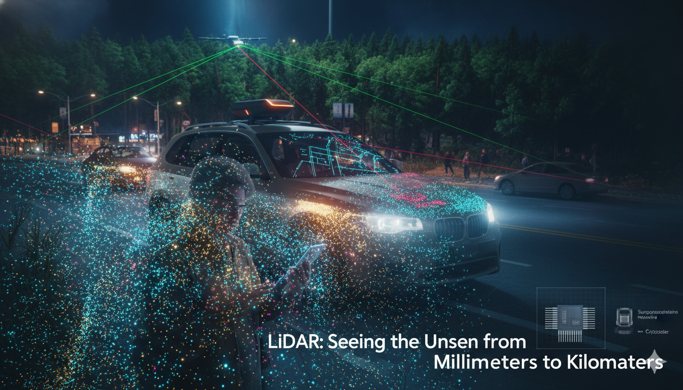
Home / Industry & Market Dynamics / The Future of Remote Sensing: Novel LIDAR Technologies for Diverse Applications

The Future of Remote Sensing: Novel LIDAR Technologies for Diverse Applications

Remote sensing allows us to capture and analyze information about landscapes without physical contact. One of the most powerful tools in this domain is LIDAR (Light Detection and Ranging), an optical remote sensing technology that uses light pulses to measure distances and map structures. LIDAR has evolved significantly, offering breakthroughs in 3D mapping, driverless vehicles, battlefield visualization, mine detection, and imaging through forests. This article explores the latest innovations in LIDAR technology and their applications.

LiDAR (Light Detection and Ranging) systems operate by emitting amplitude and/or phase-modulated light from a laser source. This light travels through illumination optics to the target, reflects off the target, and is collected by imaging optics. The receiver then records the light’s amplitude or phase and correlates it with the modulation signal to determine the time-of-flight (TOF) of the light. This TOF measurement is used to calculate the distance to the target.

1. Transforming 3D Mapping with Advanced LIDAR Systems

LIDAR technology excels in creating detailed 3D maps by sending out light pulses and measuring the time it takes for them to return. Unlike radar, which uses radio waves, LIDAR uses light pulses with wavelengths about 100,000 times smaller, allowing for much higher resolution. Modern lidar systems are pushing the boundaries of 3D mapping with high-resolution and long-range capabilities.  Traditional lidar systems faced limitations in accuracy and range, but recent advancements have introduced new technologies that overcome these barriers.

Lidars (Light Detection and Ranging) are similar to radars in that they operate by sending light pulses to the targets and calculate distances by measuring the received time. Since they use light pulses that have about 100,000 times smaller wavelength than radio waves used by radar, they have much higher resolution. Distance traveled is then converted to elevation. When LIDAR is mounted on Aircraft, these measurements are made using the key components of a lidar system including a GPS that identifies the X,Y,Z location of the light energy and an Internal Measurement Unit (IMU) that provides the orientation of the plane in the sky.

2. Driverless Vehicles: The Future of Autonomous Driving

In the realm of autonomous vehicles, lidar plays a pivotal role in ensuring safety and navigation. LIDAR is a cornerstone of autonomous vehicle technology, providing precise depth perception and real-time navigation capabilities. Moreover, advanced lidar systems provide real-time, high-resolution data that enables driverless vehicles to make split-second decisions, improving safety and reliability.

LiDAR excels in sensing objects within a medium range, typically from a few feet to a few hundred feet. While radar is more effective at longer distances and ultrasonic sensors are better for close-range detection, LiDAR provides precise, detailed information in its effective range.

LiDAR is an optical sensor technology that enables robots to perceive, make decisions, and navigate their surroundings. While basic LiDAR systems measure space in one or two dimensions, advanced 3D LiDAR systems are essential for robots that aim to replicate human-like perception. In self-driving cars, 3D LiDAR scans beams of light in three dimensions to create a detailed virtual model of the environment. The reflected light signals are processed by the vehicle to detect and identify objects, and to determine how to interact with or avoid them.

LiDAR systems generate a millimeter-accurate 3D map of the environment, known as a point cloud, by steering transmitted light. These point clouds are compared with pre-stored 3D road maps using advanced algorithms to precisely determine the vehicle’s location on the road. This process, part of SLAM (Simultaneous Localization and Mapping), involves creating or updating a map of an unknown environment while tracking the vehicle’s position within it.

These systems allow autonomous vehicles to detect and respond to their surroundings with remarkable accuracy, often within a few centimeters at distances up to 60 meters. As LIDAR costs decrease—thanks to innovations that reduced prices by 90% since 2012—this technology is becoming more accessible, even appearing in consumer devices like the latest iPhones.

With the automotive lidar market expected to double in the coming years, these technologies are set to revolutionize transportation by making autonomous driving more accessible and effective.

3. Battlefield Visualization: Gaining the Tactical Edge

On the battlefield, accurate visualization and threat detection are crucial. LIDAR data is both high-resolution and high-accuracy, enabling improved battlefield visualization, mission planning and force protection. LIDAR provides a way to see urban areas in rich 3-D views that give tactical forces unprecedented awareness in urban environments.

Novel lidar technologies offer enhanced capabilities for military applications, such as battlefield visualization and target tracking. Lidar systems with simultaneous frequency and angle-of-arrival (AOA) measurement capabilities provide precise data on signal frequencies and directions, allowing for effective threat identification and localization.

These advanced lidar systems enable better situational awareness by mapping the battlefield in 3D, identifying potential threats, and improving tactical decision-making. By integrating lidar with other sensors and real-time data processing, military forces can gain a significant tactical advantage, enhancing operational effectiveness.

4. Mine Hunting: Uncovering Hidden Dangers

Mine hunting is a complex and hazardous task that benefits greatly from advanced lidar technologies. New lidar systems capable of high-resolution imaging and depth measurement are revolutionizing the way mines are detected and mapped. These systems can penetrate soil and vegetation to identify buried mines with greater accuracy, reducing the risks associated with traditional mine detection methods.

Lidar’s ability to provide detailed 3D maps of the terrain allows for precise location of mines, improving safety for personnel and increasing the efficiency of demining operations. As lidar technology continues to evolve, its role in mine hunting will become increasingly critical in ensuring safe and effective operations.

5. Imaging Through Forests: Penetrating Dense Vegetation

Imaging through dense vegetation, such as forests, presents significant challenges due to the obstructive nature of foliage. However, advancements in lidar technology are making it possible to see through these obstacles. New lidar systems with enhanced penetration capabilities use advanced optical filters and laser sources to achieve high-resolution imaging even through thick canopies.

For example, lidar systems equipped with specialized filters can reduce interference from ambient light and reflections, providing clearer images of the underlying terrain. This capability is invaluable for applications such as forestry management, wildlife monitoring, and environmental research, where understanding the forest floor is essential.

Emerging Trends in LIDAR Technology

Spinning LiDAR systems, characterized by their rotating domes, have been a standard in the industry. Velodyne, a pioneer in this space, introduced a LiDAR unit in 2007 with 64 lasers stacked vertically and spinning rapidly. This setup provides a wide field of view and long-range capability but is heavy, expensive, and requires regular maintenance. Google’s self-driving cars, for example, used Velodyne’s HDL-64E module to detect vehicles, pedestrians, and small ground-level hazards.

Quanergy, based in Sunnyvale, Calif., produces spinning LiDAR suited for security applications with its M8 sensor. It features a 360-degree horizontal field of view and generates 1.3 million pulses per second. Combined with Qortex machine learning software, it can classify and track people and vehicles effectively, even in challenging conditions like high winds.

For effective performance, LiDAR systems must achieve both high spatial resolution and precise range measurements, often requiring high-resolution 3D imaging in short periods. Two common methods for obtaining 3D images are scanning and flash LiDAR.

Scanning LiDAR uses a laser and one or a few detector pixels to capture 3D images. The laser pulses are directed to different points on the target via a scanner, with TOF measured for each point using a single detector pixel. This method can be time-consuming, as the system must scan each point to build a high-resolution 3D image.

In contrast, flash LiDAR illuminates the entire scene with a single laser pulse and uses a 2D array detector to capture 3D images instantly. This approach is advantageous for real-time imaging of moving targets and allows for 3D image acquisition even when the LiDAR system or the target is in motion.

While spinning LiDAR remains a benchmark, there is a notable shift towards solid-state technologies. Ouster, for instance, is focusing on integrating LiDAR components into silicon chips, enhancing resolution and reducing reliance on moving parts. Their recent development includes a 128-beam LiDAR, providing the highest resolution available.

RedTail LiDAR Systems, leveraging technology from the US Army Research Laboratory, introduced the RTL-400, a new mapping system featuring a MEMS mirror-based laser scanner. This system, operating at a pulse rate of 400,000 pulses per second, offers exceptional resolution and is designed for high-altitude mapping applications, including agriculture and construction site monitoring.

Source considerations

Most modern LiDAR systems utilize the time-of-flight (ToF) principle and operate in the near-infrared (NIR) range (e.g., 850nm or 905nm) due to the availability of high-sensitivity silicon-based avalanche photodiodes (APDs) and single-photon avalanche photodiodes (SPADs). However, this wavelength limits the maximum permissible energy (MPE) of the laser, which can restrict range and necessitate high-power short nanosecond pulses.

Alternatively, some systems operate in the short-wave infrared (SWIR) range (e.g., 1550nm), where the MPE level is significantly higher. SWIR wavelengths are often used in frequency-modulated continuous-wave (FMCW) LiDAR, which offers advantages such as velocity information per frame, higher signal-to-noise ratio (SNR), lower power consumption, and reduced susceptibility to interference. However, FMCW LiDAR is more complex, requiring a stable tunable laser and coherent optical components.

Laser sources for lidar are a rapidly evolving component technology. Swiss startup DeepLight, for instance, is developing hybrid integrated lasers leveraging silicon nitride and MEMS actuators for automotive FMCW lidar systems based on coherent detection. The approach enables the system to measure object velocity with high sensitivity, as well as with minimal interference at long ranges of >200 meters.

However, the technology requires narrow linewidth lasers and high chirp linearity — which presents a major disadvantage. In response, DeepLight is developing more easily controlled high-performing lasers based on ultralow-loss silicon nitride platforms.

Advanced LIDAR systems, like Marelli’s Smart Corner, integrate sensors into vehicle components to improve field of view and reduce blind spots. The integration of lidar sensors into vehicle components, as demonstrated by Marelli’s Smart Corner solution, addresses the challenges of size, weight, and power consumption. By embedding lidar systems into headlamps, grilles, and other vehicle parts, this technology improves field of view and reduces blind spots, enhancing the vehicle’s ability to detect and respond to its environment.

AEye, based in Dublin, Calif., offers “agile LiDAR” with a range exceeding 300 meters. This technology can dynamically adjust its scanning patterns to focus on specific regions of interest, improving object detection significantly compared to traditional LiDAR systems.

For instance, lidar sensors with bio-inspired designs, such as those developed by Ommatidia, utilize arrays of ommatidia-like photoreceptor cells. This design enhances photon detection, allowing for high-resolution and long-range 3D mapping even in challenging conditions.

Additionally, innovations like hybrid integrated lasers, as seen in DeepLight’s technology, offer improved spectral purity and reduced noise. These advancements enable more precise and accurate 3D mapping, crucial for applications ranging from urban planning to environmental monitoring.

Flash LIDAR: Capturing Rapid, Real-Time Images

This approach enables real-time imaging of moving targets and is less prone to image vibration.

Flash LiDAR systems offer a unique approach to 3D imaging by using a 2D array detector and a single laser pulse to illuminate an entire scene. This method allows for real-time capture of 3D images, even of moving targets, as it acquires the complete image with just one pulse. This capability is particularly advantageous for dynamic environments where both the LiDAR system and the objects being scanned may be in motion.

Flash LiDAR systems excel in reducing image vibration and achieving faster data capture rates compared to traditional scanning LiDAR systems.  However, challenges include the need for significant power and the potential for reflected light to blind sensors. Reflected light from the scene can sometimes cause sensor blindness, and substantial power is required to illuminate the scene, especially over longer distances. Despite these challenges, flash LIDAR is increasingly used in autonomous vehicles and industrial applications for its speed and efficiency.

Despite these challenges, flash LiDAR is widely used in autonomous vehicles, with manufacturers like Continental Automotive and LeddarTech leading the field. An exception is Sense Photonics from Durham, N.C., which provides the Sense One system for industrial applications. This system boasts up to 40 meters of range for outdoor use, offers 7.5 times higher vertical resolution compared to other sensors, and features a 2.5 times wider vertical field of view (75 degrees versus 30 degrees), making it well-suited for imaging large workspaces and perimeters.

3D LIDAR and Beyond: From Scanning to Flash

Traditional scanning LIDAR systems use mechanical scanners to capture 3D images, but newer technologies like flash LIDAR and silicon photonics offer faster and more compact solutions. Flash LIDAR can acquire images with a single laser pulse, making it suitable for dynamic environments. Meanwhile, silicon photonics enables miniaturization and cost reduction by integrating beam steering technology into chip-scale solutions.

High-Performance LIDAR for Advanced Applications

Innovations in LIDAR technology continue to push the boundaries. For instance, Draper’s Hemera LIDAR system can detect billions of photons per second, improving performance in challenging conditions like fog and rain. Blackmore Sensors’ Doppler LIDARs provide both position and velocity data, enhancing navigation and obstacle detection. Miniaturization efforts, such as those by RedTail LiDAR Systems and Sense Photonics, aim to make LIDAR more accessible and practical for various applications.

Volvo and Luminar’s Lidar Technology

Volvo and Luminar have developed advanced lidar technology that utilizes a 1550 nm laser source, which offers enhanced range and resolution compared to conventional lidar systems. This technology is designed to predict pedestrian actions based on their poses and body language, a capability referred to as “pose estimation.” By using lidar, which provides 3D information with camera-like resolution, Volvo aims to improve the safety and reliability of autonomous driving systems. The technology surpasses traditional 2D camera data by offering more detailed and reliable information over various distances, helping to solve complex perception and prediction challenges in autonomous vehicles.

AEye’s iDAR System
AEye, a lidar startup, has developed the iDAR system, which uses a 1550 nm laser emitter to detect and track objects at a distance of up to 1000 meters, far exceeding the typical 200-300 meters range required for commercial effectiveness. This system benefits from the ability to use more powerful laser sources due to different eye safety regulations at the 1550 nm wavelength, allowing for a greater “photon budget.” AEye’s iDAR technology also incorporates AI and intelligent data collection, dynamically tracking and analyzing objects of interest while reducing unnecessary data processing. This results in higher accuracy and improved performance for autonomous vehicle applications, with the potential to increase detection ranges even further in the future.

Draper’s Hemera LiDAR Detector represents a significant advancement in sensor technology for self-driving cars. Unlike traditional LiDAR systems, which detect millions of photons, Hemera captures billions of photons per second, providing enhanced data accuracy and reliability. This increased sensitivity allows the system to perform effectively in challenging conditions such as bright sunlight, fog, snow, and rain, where conventional LiDAR sensors often struggle. By improving obstacle detection and reducing false positives caused by scattered photons, Hemera contributes to the overall safety and performance of autonomous vehicles.

Designed to be compatible with existing LiDAR systems, Hemera enables car manufacturers and suppliers to upgrade their technology without needing to replace their entire infrastructure. Draper plans to license this innovative technology to other industry players, facilitating the integration of advanced LiDAR capabilities across a broad range of autonomous driving systems. This approach not only enhances the functionality of current systems but also supports the progression towards full vehicle automation.

Silicon photonics is making strides in LiDAR technology, particularly in FMCW systems. It enables coherent receivers and beam steering via optical phase array (OPA) technology, which can replace bulky rotating mechanisms with miniaturized, solid-state solutions. This advancement can lead to smaller, more durable LiDAR modules and reduce costs, paralleling other solid-state technologies.

Recent breakthroughs in LiDAR technology include longer ranges, software configurability, and AI integration for advanced capabilities like range and velocity measurement using Doppler radar. For instance, Blackmore Sensors and Analytics has developed high-performance LiDARs with multi-beam Doppler sensors, earning a Prism Award at SPIE Photonics West in 2019. Major automotive companies such as BMW and Toyota have tested this technology.

LiDAR systems are also becoming more compact. While most current solutions are still about the size of a hand, efforts are underway to further miniaturize them. Key areas for improvement include solid-state sensors to reduce costs significantly, increased sensor range, and 4D LiDAR, which measures both the position and velocity of objects in 3D space.

These advancements reflect ongoing efforts to enhance LiDAR technology, making it more versatile, cost-effective, and applicable across various fields.

Conclusion

The rapid advancements in lidar technology are transforming a range of fields by providing enhanced 3D mapping, improving autonomous vehicle safety, offering better battlefield visualization, revolutionizing mine hunting, and enabling imaging through dense vegetation. As these novel lidar technologies continue to evolve, they promise to deliver even greater precision, efficiency, and functionality across various applications. From making autonomous driving a reality to ensuring safety in challenging environments, the future of lidar is bright and full of potential.


References and Resources also include:

https://www.photonics.com/Articles/Lidar_Evolution_Pioneering_Integrated/a69705


References and Resources also include:

Check Also

Strengthening Domestic Rare Earth Supply Chains: A Defense Priority

In an era where technological dominance and national security are tightly intertwined, the United States …

error: Content is protected !!