Controlled Flight into Terrain (CFIT) is the #2 leading cause of General Aviation fatal accidents involving the loss of life. There have been over 9,000 deaths due to CFIT since the introduction of commercial jets. Between 2000 and 2009 approximately 961 people died worldwide as a result of CFIT, the second largest cause of aircraft accident fatalities.
CFIT occurs when the aircraft is under the control of the pilot(s), there is an in-flight collision with terrain, water, or obstacles and the pilot(s) have little or no awareness of the impending collision. CFIT normally occurs at cruise or maneuvering speeds.
For CFIT, the greatest concern is a loss of ‘place information’. Once a pilot’s mental picture of where they are at present, and where they will be in the future diminishes, safety becomes compromised. This is particularly crucial during those phases of flight when terrain clearance is unavoidably reduced (e.g. initial climb and approach). Reportedly, more than two-thirds of all CFIT accidents result from a loss of vertical situational awareness or an altitude error”.
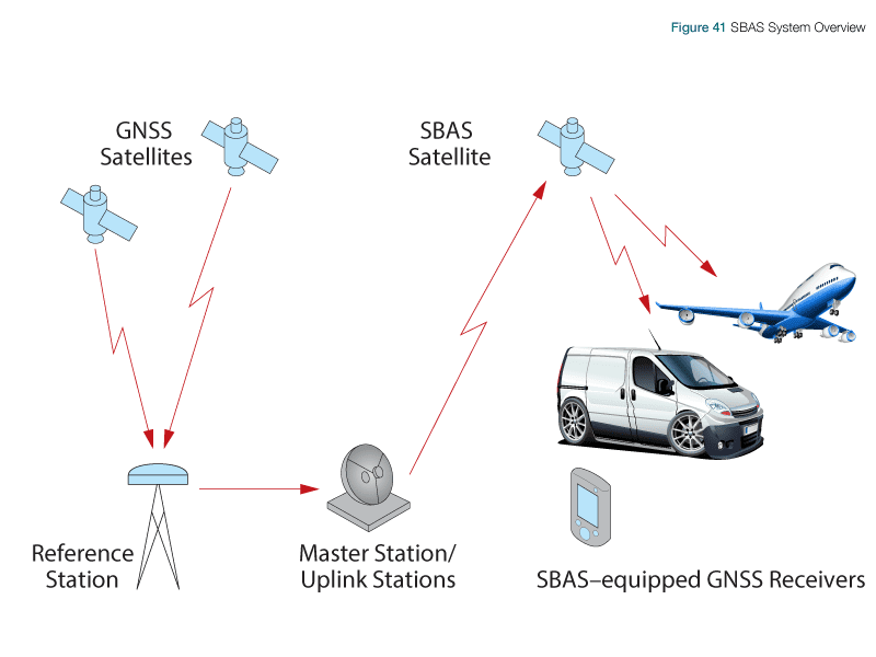
Satellite Based Augmentation Systems (SBAS) deliver error corrections, extra ranging signals (from the geostationary satellite) and integrity information for each GPS satellite being monitored. Like GBAS it also augments GPS signals to provide aircraft with very precise positioning guidance, both horizontal and vertical.
However SBAS differs from GBAS in that it provides GPS integrity monitoring via satellites, rather than from the ground and potentially provides coverage for a wider geographical area.
Currently SBAS systems in operation that are certified for APV approaches – the US WAAS, and European EGNOS which covers the majority of the European Union (EU), along with some neighbouring countries and regions.
Several countries have implemented their own Satellite-based Augmentation System. Japan: Multi-functional Satellite Augmentation System (MSAS) and India: GPS and GEO Augmented Navigation (GAGAN). SBAS systems in development are China: Satellite Navigation Augmentation System (SNAS); South Korea: Wide Area Differential Global Positioning System (WADGPS) and Russia: System for Differential Corrections and Monitoring (SDCM)