

The Stratosphere Becomes a New Strategic Domain
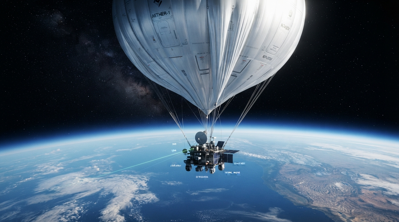
The boundary between air and space is becoming strategically important. At roughly 20–50 kilometres above Earth, the stratosphere sits above most conventional aircraft operations but below conventional satellite orbits. This unusual position gives high-altitude balloons and High-Altitude Platform Systems (HAPS) the potential to provide persistent surveillance, communications, electronic sensing and environmental monitoring at substantially lower cost than orbital systems.
What was once primarily a scientific domain is now becoming part of the military competition for persistent sensing and communications. The attraction is straightforward: a platform can remain over a region for days, weeks or potentially months, avoiding the orbital revisit constraints of satellites while operating above most conventional air traffic and many terrestrial threats.
The technology is also becoming more diverse. Traditional zero-pressure and super-pressure balloons are being joined by solar-powered HAPS aircraft, autonomous navigation systems, hydrogen-lift platforms, advanced wind sensing and increasingly sophisticated payloads. At the same time, researchers are attempting to push persistent flight even higher, into the mesosphere, using radically different propulsion mechanisms.
This convergence is transforming the stratosphere from a passive atmospheric layer into a potential persistent infrastructure layer between aircraft and satellites. The significance extends beyond surveillance: the same platforms could support resilient communications, disaster response, climate observation, navigation augmentation and space-domain awareness.
From Balloons to Persistent High-Altitude Platforms
Stratospheric flight is technically difficult because atmospheric density falls dramatically with altitude, temperatures can become extremely low, winds vary significantly with altitude, and solar-powered systems must balance energy generation with overnight storage.
Conventional zero-pressure balloons remain attractive for scientific missions because they are comparatively simple and can carry substantial payloads. Super-pressure balloons take a different approach by sealing the envelope and maintaining internal pressure, allowing much longer endurance. The fundamental engineering challenge is maintaining buoyancy, structural integrity and thermal stability while carrying useful payloads in an environment with very little atmospheric support.
The next generation increasingly combines balloon technology with autonomous navigation. Rather than attempting to fight the stratospheric wind continuously, systems such as DARPA’s Adaptable Lighter Than Air concept demonstrated the principle of changing altitude to exploit different wind layers. Its objective was extended-range wind-borne navigation above 75,000 feet, supported by real-time wind measurements. (DARPA)
This concept changes the definition of a “balloon.” Instead of a passive object drifting with the atmosphere, the platform becomes an autonomous aerial infrastructure node capable of selecting atmospheric layers to influence its ground track.
Solar-powered HAPS aircraft represent another evolutionary path. Platforms such as Airbus Zephyr combine extremely lightweight structures, photovoltaic power and electric propulsion to remain aloft for extended periods. Earlier Zephyr demonstrations established the feasibility of long-duration stratospheric flight, high-altitude manoeuvrability and persistent Earth observation. (Airbus)
The resulting ecosystem is therefore moving toward three complementary architectures: buoyant balloons, autonomous airships and fixed-wing solar HAPS.
Military Surveillance Moves Above the Traditional Battlespace
The military attraction of these systems is increasingly demonstrated through operational experimentation rather than theoretical studies.
In 2026, U.S. Army Multi-Domain Command–Europe conducted micro high-altitude balloon experimentation with NATO and Swedish partners in the Baltic region. Operating around 60,000–70,000 feet, the platforms carried experimental sensing and communications payloads intended to support multi-domain operations. (Army)
The significance is not simply that a balloon can carry a camera. A stratospheric platform can become a persistent node connecting sensors, tactical units and command networks. It can provide communications relay, monitor movements over wide areas, support targeting networks and potentially cue other systems without requiring a satellite pass.
Similar concepts are being explored for expeditionary operations. During African Lion 26, U.S. forces experimented with micro high-altitude balloons carrying communications equipment, satellite communications and drone-related payloads. The concept points toward a more distributed architecture in which relatively inexpensive airborne nodes can extend communications and sensing closer to tactical formations. (Naval News)
For naval forces, the value is particularly significant. A high-altitude platform can extend the sensor horizon of ships and unmanned systems, potentially helping forces detect and track activity beyond the conventional radar horizon. This creates opportunities for persistent intelligence, surveillance, reconnaissance and targeting in contested maritime environments.
The military role is consequently evolving from observation platform to networked multi-domain node.
The Next Breakthrough: Flying in the Mesosphere
The most technically disruptive development may not be another large balloon but an entirely new type of lightweight flyer.
NASA’s 2025 NIAC program selected Igor Bargatin and the University of Pennsylvania’s Photophoretic Propulsion Enabling Mesosphere Exploration concept for Phase II development. The objective is to create flying structures with no conventional moving parts that can operate between approximately 50 and 80 kilometres altitude. (NASA)
This altitude regime presents a major aerospace problem. The atmosphere is too thin for conventional aircraft to fly efficiently but too dense for conventional satellites to operate as orbital vehicles. Research rockets can sample it, but only for minutes. The mesosphere therefore remains one of the least persistently observed regions of Earth’s atmosphere.
Photophoretic propulsion attempts to exploit this gap. When one side of a lightweight structure is heated by illumination while the opposite side remains cooler, gas molecules interacting with the surface generate a net force. Researchers have engineered microperforated structures to amplify this phenomenon through Knudsen-pump effects. NASA reports that the useful pressure range of the technology overlaps strongly with the mesosphere, while Phase II work aims at scalable structures and kilogram-class payloads. (NASA)
A 2025 Nature study demonstrated photophoretic flight of perforated structures under near-space conditions, strengthening the scientific foundation for the concept. (NASA)
If this technology scales, it could eventually create a new class of solar-powered atmospheric flyers operating above conventional balloons. Potential missions include persistent atmospheric sensing, wind measurements, space-weather research and eventually high-altitude surveillance.
The strategic significance is substantial because it would open a previously difficult-to-access layer of the atmosphere without conventional propulsion.
Sensors, AI and Communications Turn Platforms into Infrastructure
The real value of a stratospheric platform depends less on the envelope or aircraft itself than on its payload and network architecture.
Modern HAPS can carry electro-optical and infrared cameras, synthetic-aperture or other radar sensors, signals-intelligence payloads, communications relays and atmospheric instruments. Their altitude provides a wide field of view, while persistent stationing can compensate for lower sensor performance compared with large orbital systems.
Artificial intelligence is increasingly important because these platforms can generate large volumes of continuous data. Edge processing can identify objects, classify activities, detect anomalies and prioritize information before transmitting it to ground stations. This reduces communications requirements and makes the platform more autonomous.
Wind sensing is equally important. DARPA’s ALTA program demonstrated the importance of measuring atmospheric conditions in real time so that a lighter-than-air vehicle can select favourable wind layers. Future systems are likely to combine atmospheric models, onboard sensors and machine-learning algorithms to predict wind fields and optimize position autonomously. (DARPA)
Communications represent another major opportunity. A high-altitude platform can function as a “tower in the sky,” extending terrestrial networks across remote or infrastructure-poor regions. It can also provide resilient military communications when terrestrial infrastructure is disrupted or satellite communications are degraded.
NASA is already studying high-altitude traffic management because the expansion of commercial and scientific operations above conventional aviation altitudes will require new approaches to managing this emerging airspace. (NASA)
The result is a shift from individual balloon missions toward persistent, software-defined atmospheric infrastructure.
Industrial Competition and the Geopolitics of Near-Space
The emerging HAPS ecosystem is becoming strategically important because it offers a relatively inexpensive pathway into persistent near-space operations. Satellites remain indispensable for global coverage, but HAPS can provide localized persistence and rapid deployment without the cost and complexity of orbital insertion.
This creates opportunities for aerospace primes, telecommunications companies, defence contractors, balloon manufacturers, sensor developers and AI companies. The industrial competition is therefore likely to extend beyond traditional balloon manufacturers into the broader aerospace and digital-infrastructure sectors.
India is particularly well positioned to participate because of its expanding commercial space sector, indigenous launch capability and growing defence demand for persistent ISR and communications. More broadly, the democratization of high-altitude platforms could allow middle powers to acquire capabilities previously associated primarily with major space powers.
The United States and NATO are already experimenting with HAPS and micro-HABs in operational environments, while Europe has continued to explore high-altitude platforms for defence and connectivity. China’s large aerospace and unmanned-systems ecosystem also gives it significant potential to develop persistent high-altitude surveillance architectures.
The strategic competition is consequently not only about who owns satellites. It is increasingly about who controls persistent sensing and communications across every layer from the surface to orbit.
At the same time, the stratosphere presents difficult legal and regulatory questions. High-altitude platforms occupy a region that does not fit neatly into existing concepts of conventional aviation or outer space. As commercial and military deployments increase, questions surrounding airspace sovereignty, spectrum allocation, collision avoidance, international notification and dual-use surveillance will become increasingly important.
Intelligence and Strategic Assessment: The Vertical Battlespace Expands
The strategic importance of stratospheric platforms lies in their ability to complement rather than replace satellites and aircraft.
Satellites provide global persistence at the system level but follow predictable orbital trajectories. Aircraft provide flexibility and sophisticated sensing but consume fuel and are vulnerable to air-defence systems. Stratospheric platforms occupy the middle ground: they can remain in a geographic area for extended periods, carry substantial sensors and potentially reposition by exploiting atmospheric dynamics.
This creates a new layer of persistent intelligence infrastructure.
For military planners, the most important development is likely to be network integration. A future architecture could combine satellites providing global detection, HAPS providing persistent regional surveillance, aircraft delivering high-resolution sensing, unmanned systems performing tactical reconnaissance and terrestrial sensors providing local confirmation. AI could fuse these streams into a continuously updated operational picture.
This architecture could be particularly valuable in A2/AD environments. A HAPS platform operating outside the immediate reach of many tactical air-defence systems could provide persistent surveillance and communications while reducing the need to expose expensive aircraft.
But vulnerability remains. Large balloons and HAPS are observable, potentially vulnerable to fighter aircraft, surface-to-air missiles, electronic warfare and directed-energy systems. Their enormous endurance advantage therefore depends on survivability through altitude, manoeuvrability, low observability, redundancy and distributed deployment rather than assuming they are inherently invulnerable.
The strategic race is consequently moving toward resilient networks of relatively inexpensive platforms rather than a small number of exquisite assets.
Future Outlook: From Stratospheric Platforms to a New Atmospheric Layer
The next decade could transform the region between conventional aviation and orbit into a distinct operational domain.
Solar HAPS are likely to become more autonomous, while super-pressure balloons and airships may provide increasingly persistent communications and sensing. AI-based atmospheric navigation could allow platforms to exploit wind layers more efficiently, while advanced batteries, solar cells and lightweight materials extend endurance.
The more radical possibility is the emergence of photophoretic flyers. NASA’s research indicates that lightweight, microperforated structures could eventually operate in the mesosphere, where today’s conventional aircraft and balloons struggle to remain aloft. The technology remains developmental rather than operational, but its potential significance is considerable. (NASA)
There is also an emerging opportunity for distributed atmospheric sensing. NASA is investigating photophoretic tracers that could create persistent sensing layers at very high altitudes, illustrating how future systems may move beyond individual vehicles toward distributed atmospheric sensor architectures. (NASA)
The unanswered question is whether the stratosphere will become merely another niche aerospace market—or a permanent layer of military and commercial infrastructure.
If endurance, autonomy, navigation and survivability continue improving, the distinction between aircraft and satellite will become increasingly blurred. The strategic battlefield will extend vertically, and the countries capable of operating persistent systems across that vertical spectrum could gain a significant advantage in surveillance, communications and situational awareness.
IDST Internal Classification
Primary Category: Aerospace & Defence Technology
Secondary Categories: High-Altitude Platforms • Stratospheric Balloons • HAPS • Intelligence, Surveillance & Reconnaissance • Autonomous Systems • Near-Space Technologies • Advanced Propulsion • Military Communications
Most Used:
Technology & Capability Intelligence • Strategic Impact • Operational Impact • Technology Watch • Strategic Competition • Capability Intelligence • Mid-Term (3–7 Years) • Long-Term (8–15 Years)
IDST Assessment: Strategic Impact — High | Technology Maturity — Emerging to Demonstration | Defence Relevance — High | Disruption Potential — High
The central IDST judgement is that stratospheric platforms are evolving from experimental balloon systems into a potentially important persistent layer of the global aerospace and defence architecture. The convergence of HAPS, autonomous navigation, AI-enabled sensing, resilient communications and emerging photophoretic propulsion could ultimately extend persistent operations from the lower atmosphere through the stratosphere and toward the mesosphere.
References
- NASA, “Photophoretic Propulsion Enabling Mesosphere Exploration,” NASA Innovative Advanced Concepts (NIAC), 2025. The primary source for the photophoretic propulsion concept, its operating pressure range, mesosphere applications and Phase II development objectives. NASA — Photophoretic Propulsion Enabling Mesosphere Exploration
- NASA, “NIAC 2025 Phase I and Phase II Selections,” 2025. Confirms the selection of Igor Bargatin’s Photophoretic Propulsion concept for NIAC Phase II. NASA — NIAC 2025 Selections
- DARPA, “Adaptable Lighter Than Air (ALTA).” Provides the technical basis for wind-borne navigation, high-altitude lighter-than-air vehicles and real-time stratospheric wind sensing. DARPA — Adaptable Lighter Than Air (ALTA)
- Airbus, “Zephyr High Altitude Platform Station (HAPS).” Covers the current capabilities of solar-powered Zephyr HAPS, including persistent stratospheric flight, Earth observation and communications applications. Airbus — Zephyr HAPS
- Airbus, “Solar Flight.” Provides technical background on solar-powered stratospheric flight, photovoltaic systems, electric propulsion and energy storage for extended-duration HAPS operations. Airbus — Solar Flight
- Airbus, “Zephyr Solar High Altitude Platform System Reaches New Heights,” 2021. Documents Zephyr’s extended-duration stratospheric demonstrations, altitude performance, manoeuvrability and payload integration. Airbus — Zephyr Flight Demonstrations
- Airbus, “NTT DOCOMO and Space Compass Partners with Airbus on HAPS,” 2024. Documents Japan’s strategic investment in AALTO and the development of HAPS-based non-terrestrial connectivity in Asia. Airbus — HAPS Strategic Investment and Japan Partnership
- NASA, “NASA Advances High-Altitude Traffic Management,” 2026. Provides current evidence of the emerging need for dedicated high-altitude traffic-management systems as commercial, scientific and other stratospheric operations expand. NASA — High-Altitude Traffic Management
- NASA Technical Reports Server, “Initial Development of an Upper Class E Traffic Management System for Stratospheric Flight Operations.” Provides technical background on Upper Class E/stratospheric traffic management and the emerging operational framework for long-duration high-altitude vehicles. NASA Technical Reports Server — Upper Class E Traffic Management
- Airbus, “Strat-Observer HAPS: Advanced Stratospheric Earth Imaging.” Provides current information on persistent high-resolution imaging, live video and integration of HAPS with satellite-based Earth-observation architectures. Airbus — Strat-Observer HAPS